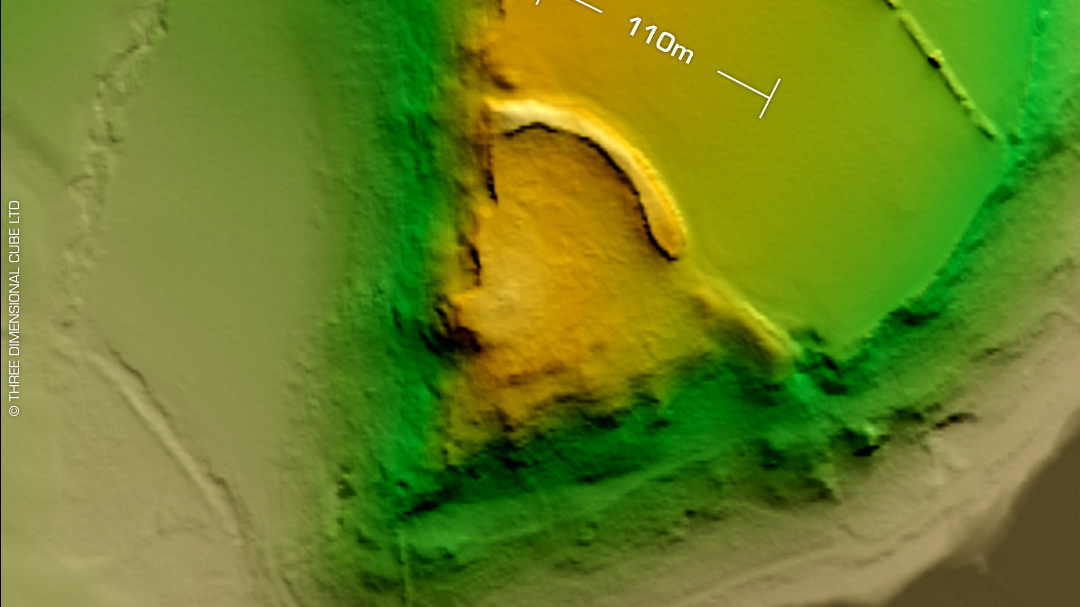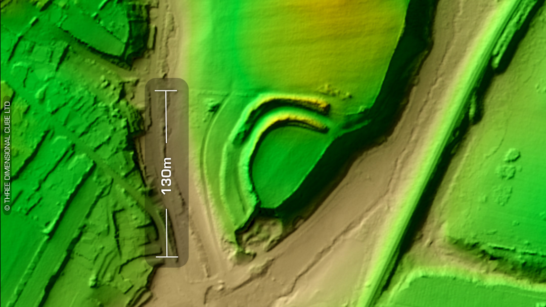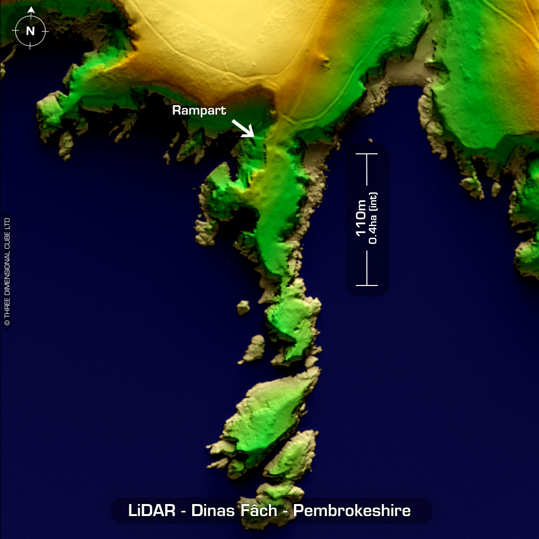
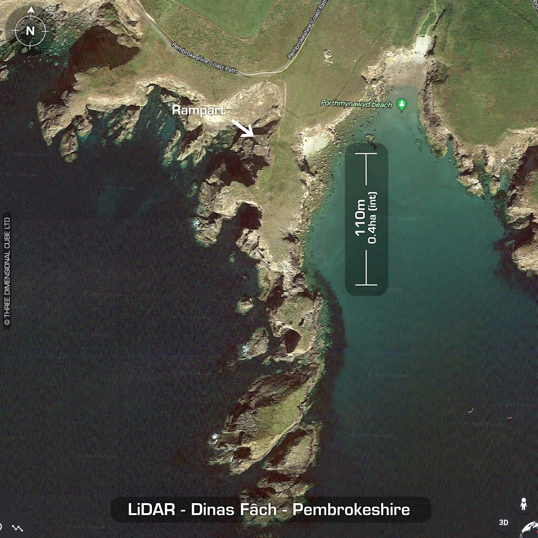
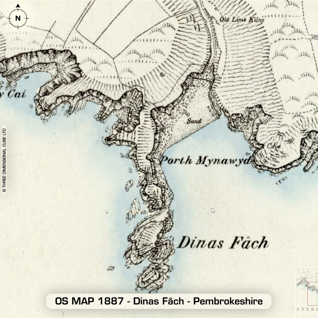
DTM- (Digital Terrain Model, i.e. No buildings or foliage) Lying at the entrance to the second promontory east of the coastal village of Solva is the much eroded coastal promontory fort, Dinas Fâch. As we don’t really know the erosion rates for this geology over the last 2ka we’ll never know how much of this site has been lost to sea. Behind the 5m wide rampart is a cluster of depressions denoting circa 14 hut circle platforms. First investigation by W.F. Grimes in 1939. Additional finds include Roman Samian ware and occupation debris. Last site visit in 2007. No recorded finds or excavations, hence undated. (Scheduled monument) Iron Age tribal association (conjecture based on location): Demetae Descriptions from hillforts.arch.ox.ac.uk & Dyfed Archaeological Trust HER. Contains public sector information licensed under the Open Government Licence v3.0.