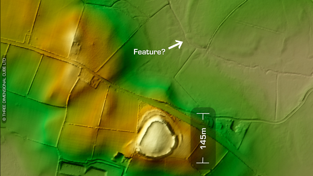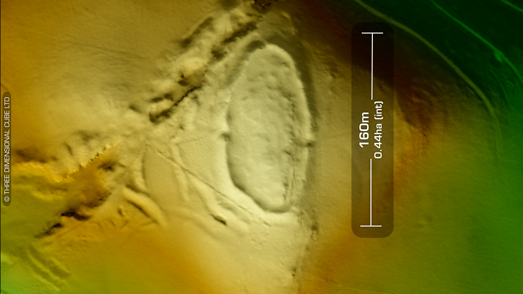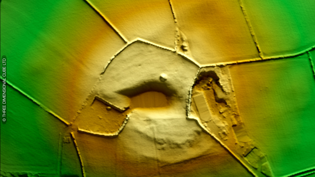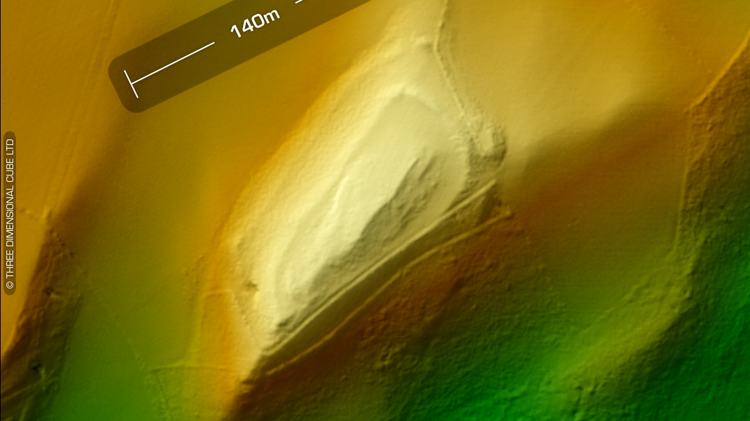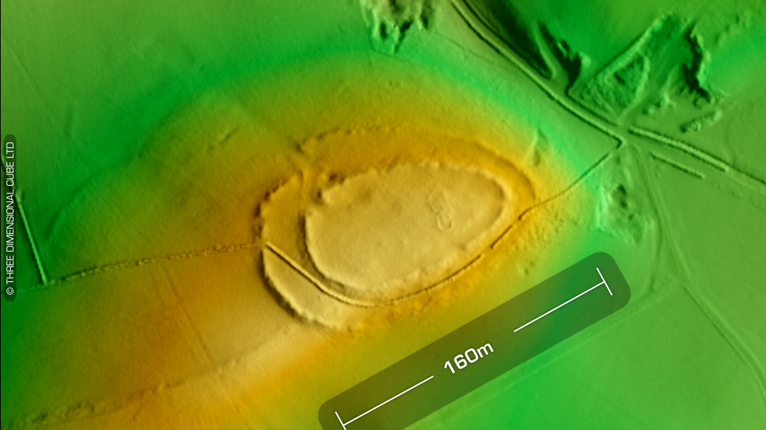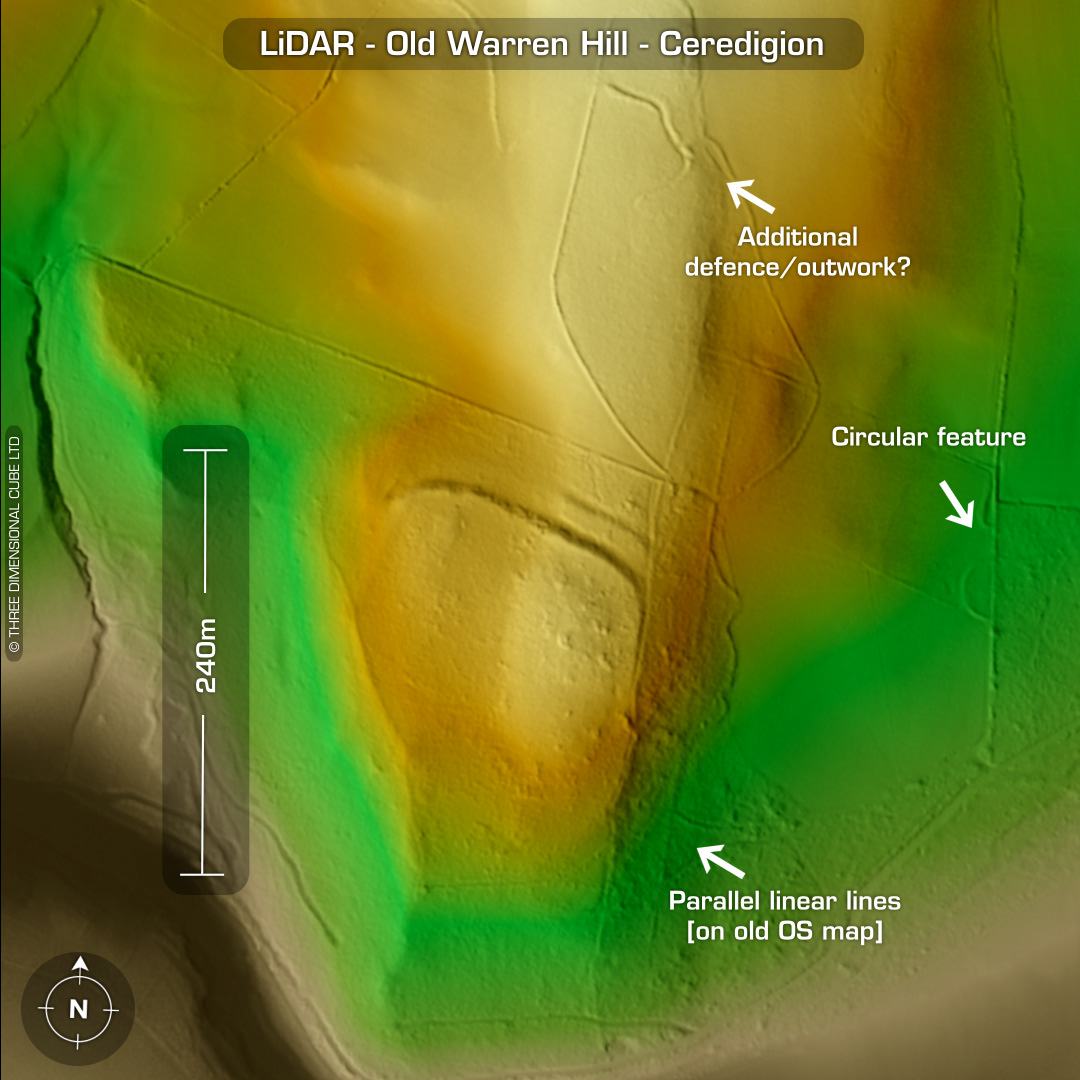
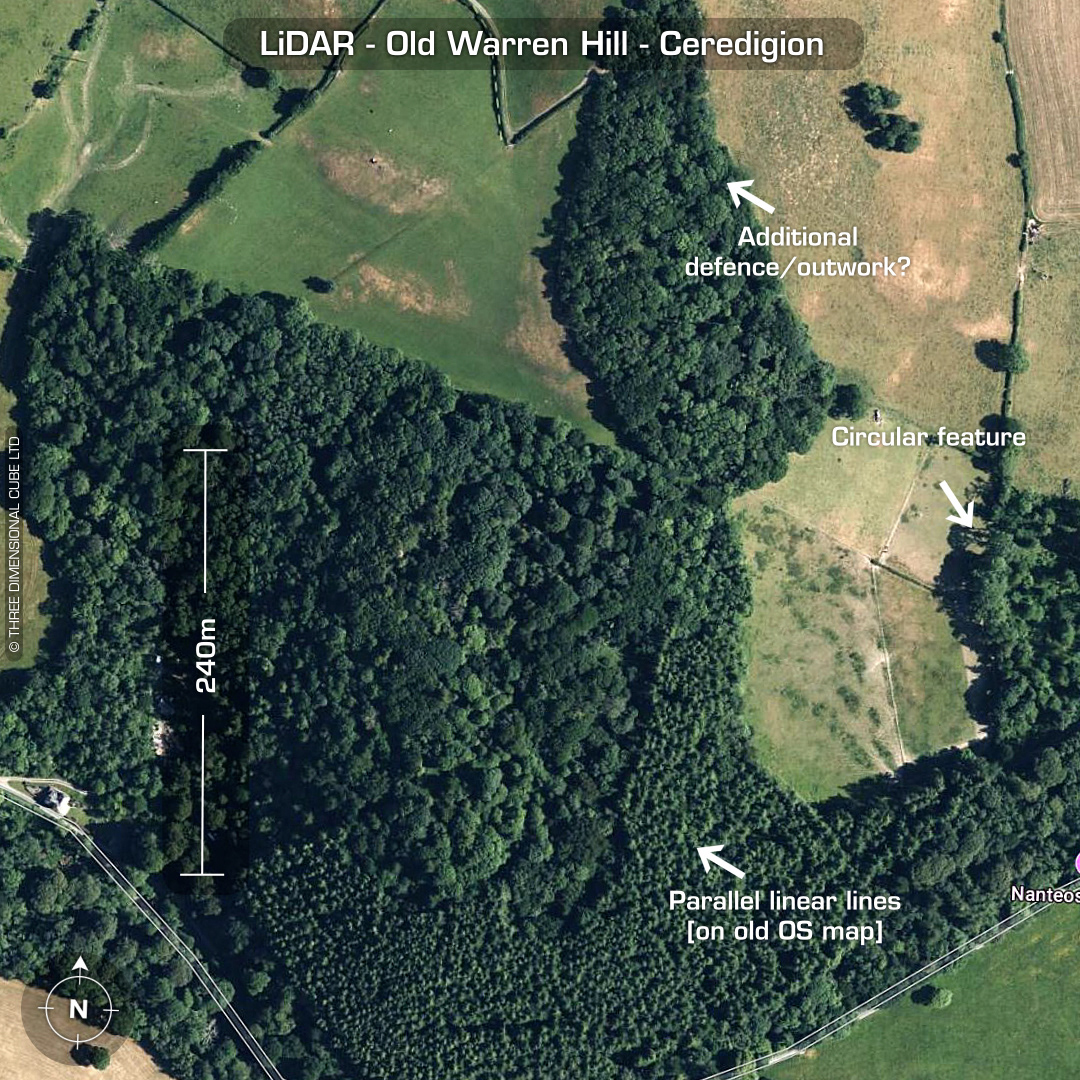
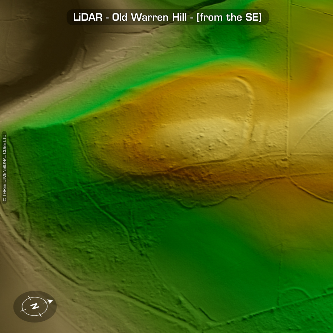
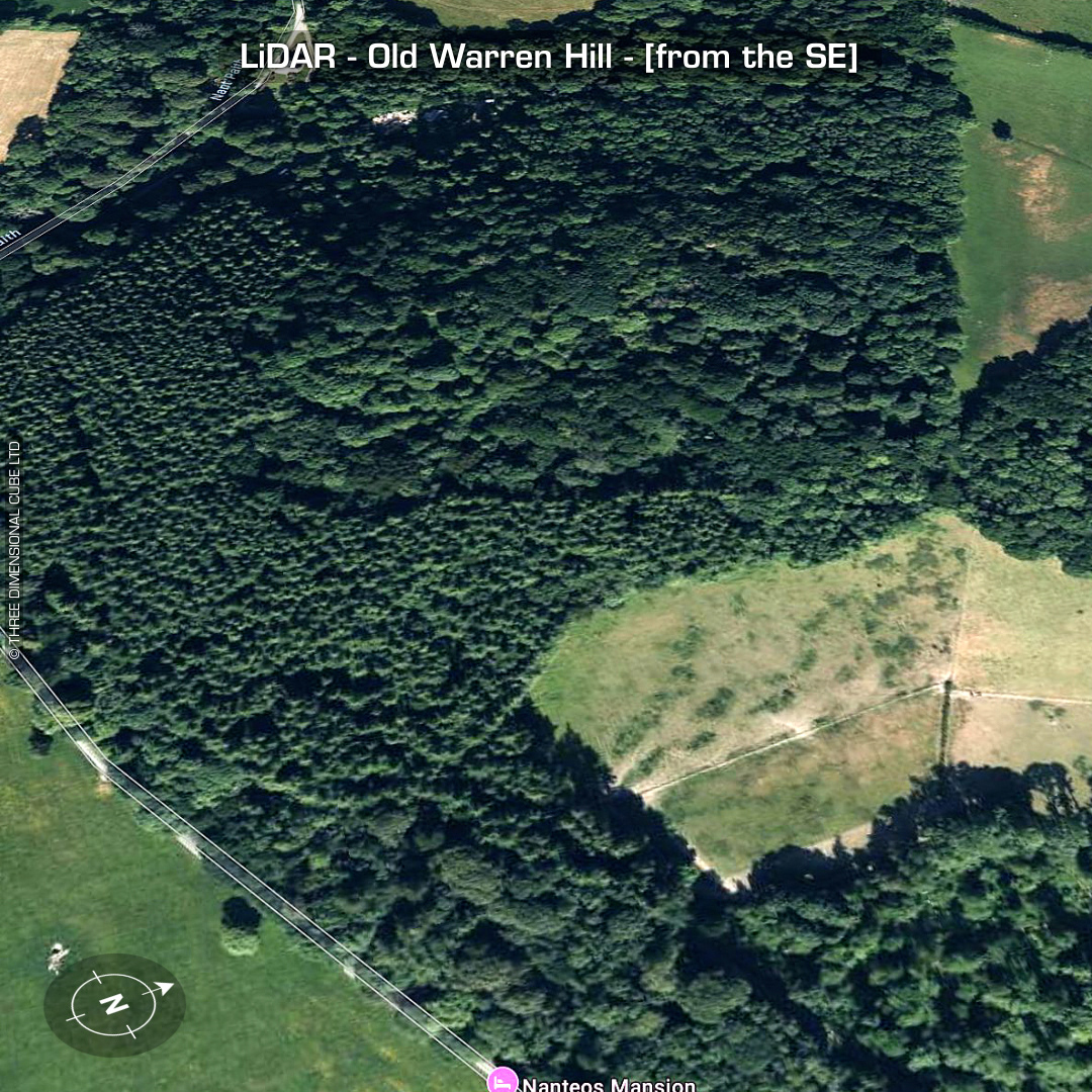
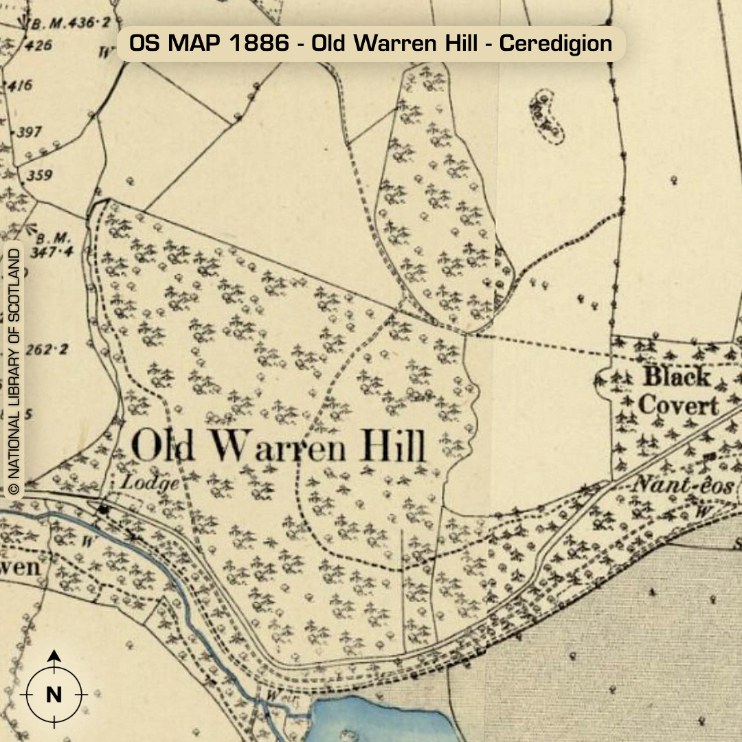
DTM- (Digital Terrain Model, i.e. No buildings or foliage) Southeast of Aberystwyth and in between the A4120 to the north and overlooking the river, Nant Paith to the south sits the complex bivallate hillfort, Old Warren Hill, which is now hidden in woodland. Lots of (possible) ancient linear features. Part degraded main rampart. Possible additional earthwork guarding the approach from the north (now hidden in woodland). First written reference by I.T. Hughes in 1926. Circular feature on the bottom right is on Old OS maps as part of the woods but you can just make out a complete circuit. It is on the grounds of the now called, Plas Nanteos Mansion (Hotel) so is probably a garden feature. Originally called Neuadd LLawdden (built circa 11th century & rebuilt in 1739). On the hotel’s website there is an old photo looking out of the window up the hill to the hillfort. When it was built they didn’t even know it was there as its not on old OS Maps. No recorded finds or excavations, hence undated*. (Scheduled monument) Iron Age tribal association (conjecture based on location): Demetae *Possible age range 2000-2700BP (Before present) Descriptions from hillforts.arch.ox.ac.uk & Dyfed Archaeological Trust HER. 1st ED OS Mapping via National Library of Scotland. Contains public sector information licensed under the Open Government Licence v3.0.