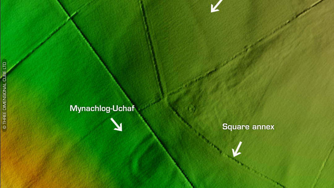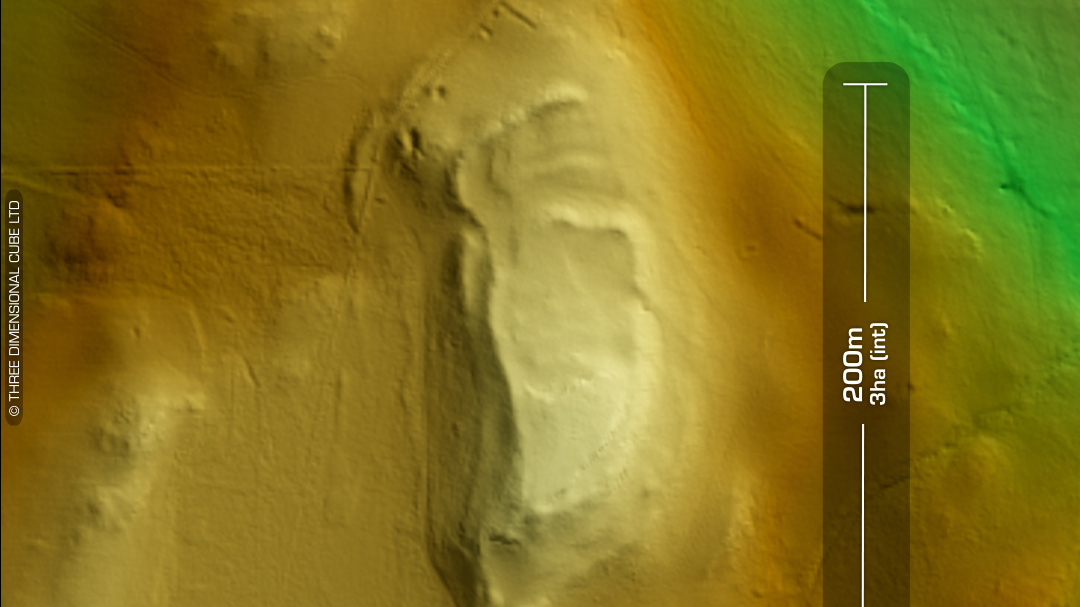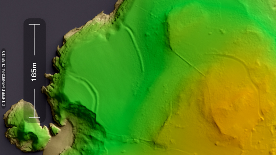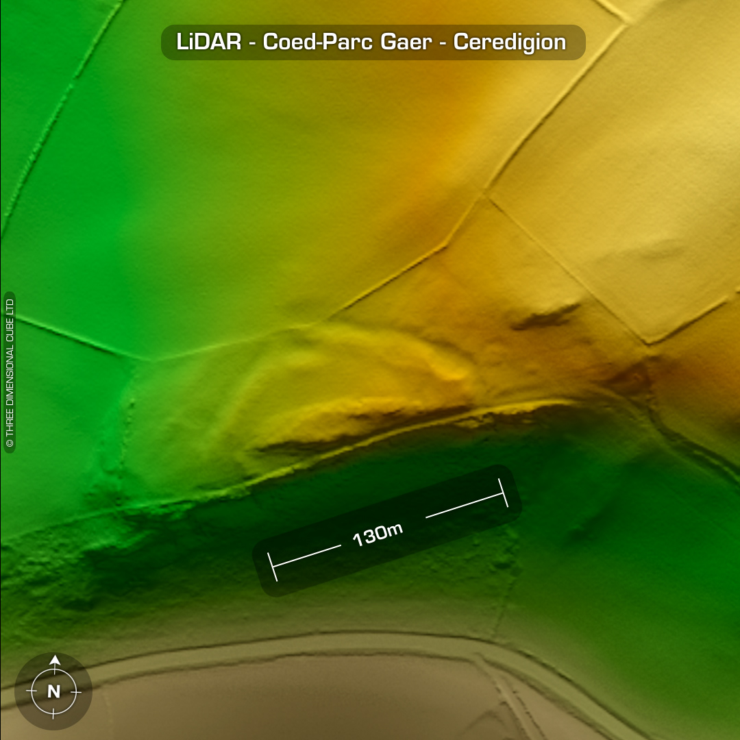
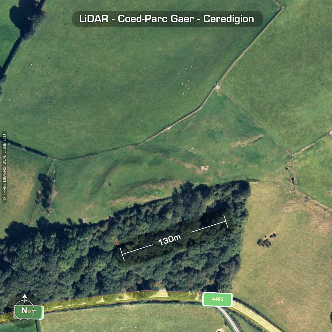
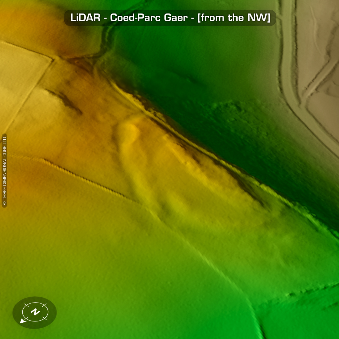
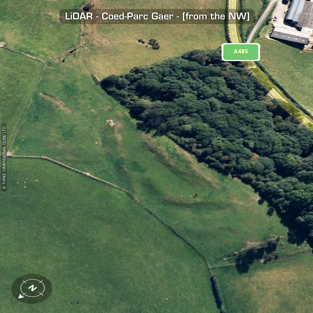
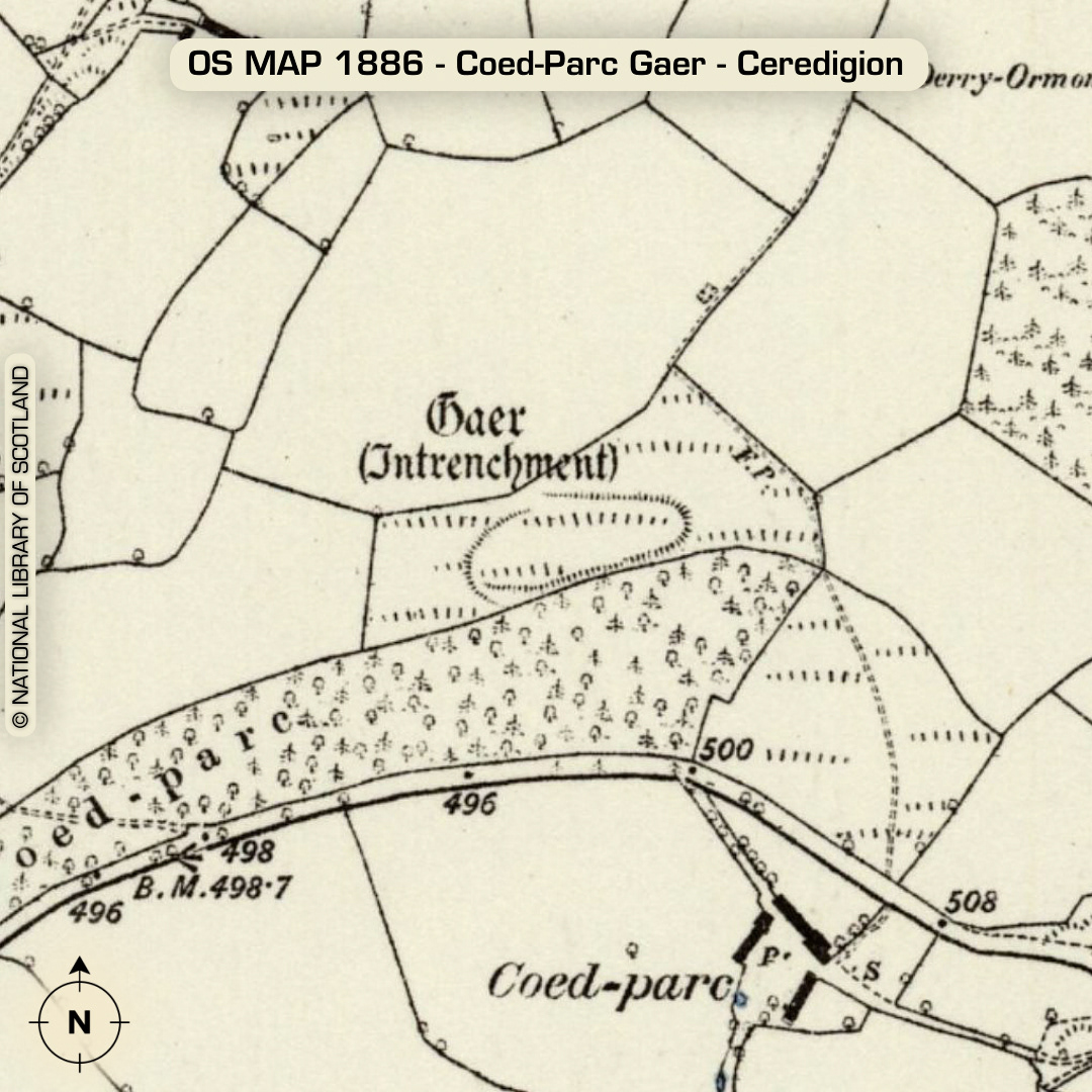
DTM- (Digital Terrain Model, i.e. No buildings or foliage) On a ridgeline above the A485 in between the villages of Glan-Denys and Betws Bledrws sits the heavily degraded multivallate hillfort, Coed-Parc Gaer, Simple east entrance. Circular features may be hut foundations. No recorded finds or excavations, hence undated*. (Scheduled monument) Iron Age tribal association (conjecture based on location): Demetae *Possible age range 2000-2700BP (Before present) Descriptions from hillforts.arch.ox.ac.uk & Dyfed Archaeological Trust HER. 1st ED OS Mapping via National Library of Scotland. Contains public sector information licensed under the Open Government Licence v3.0.