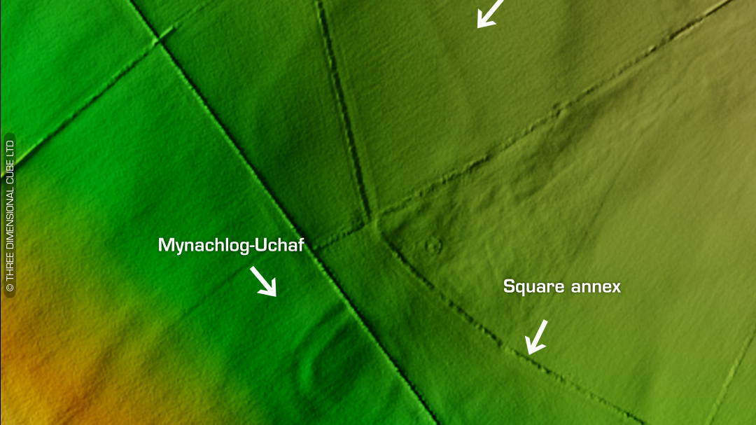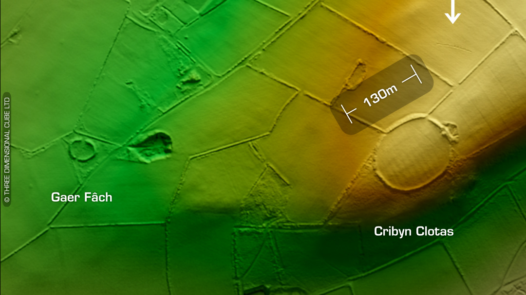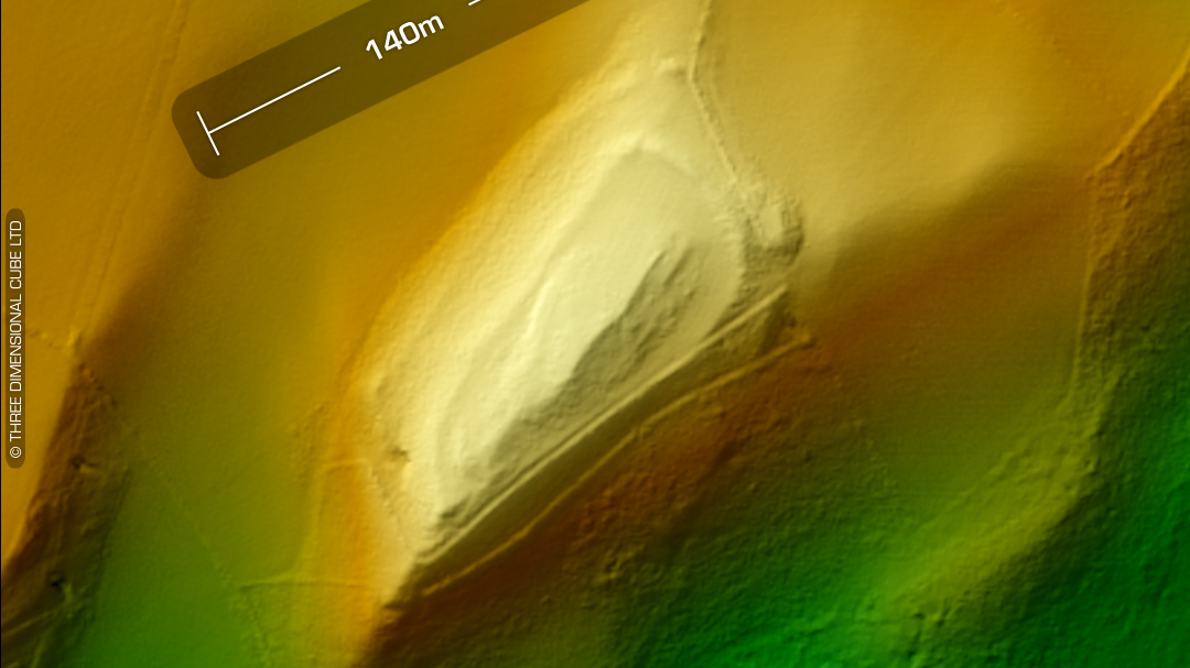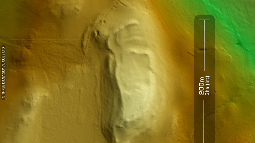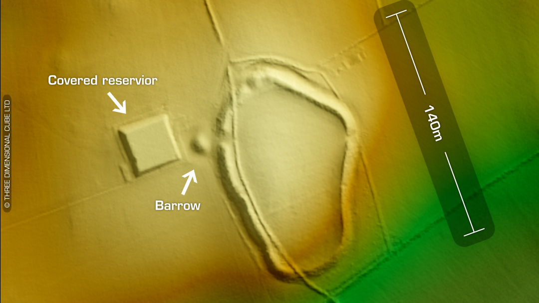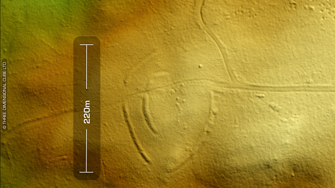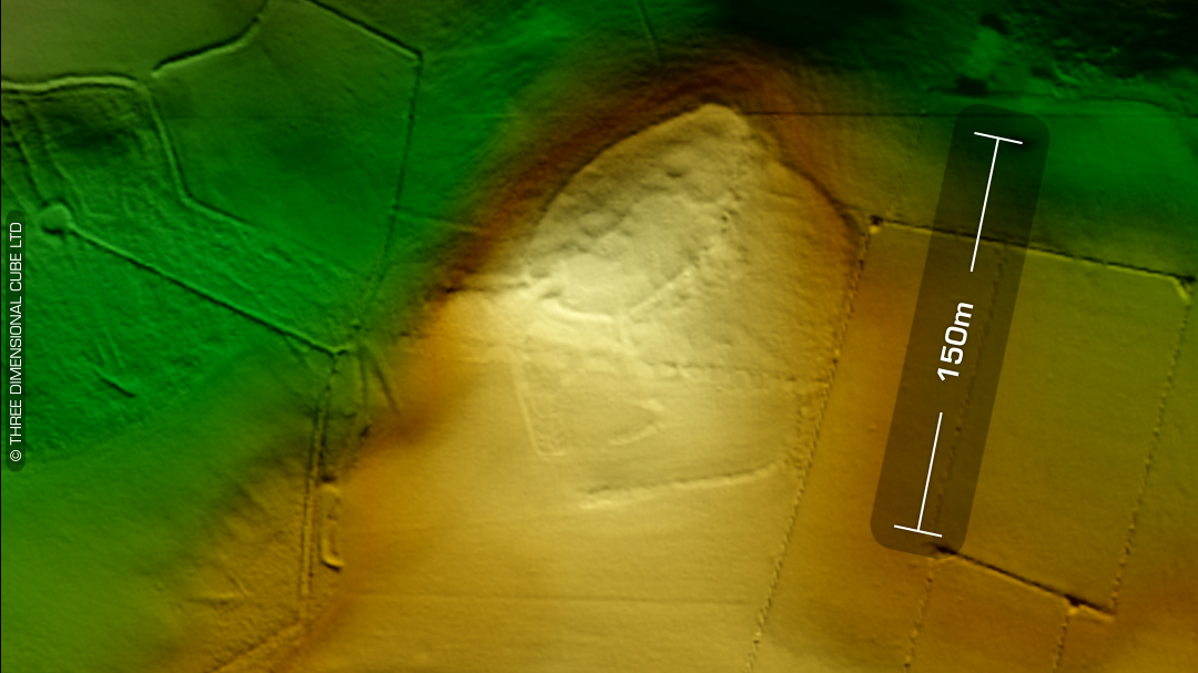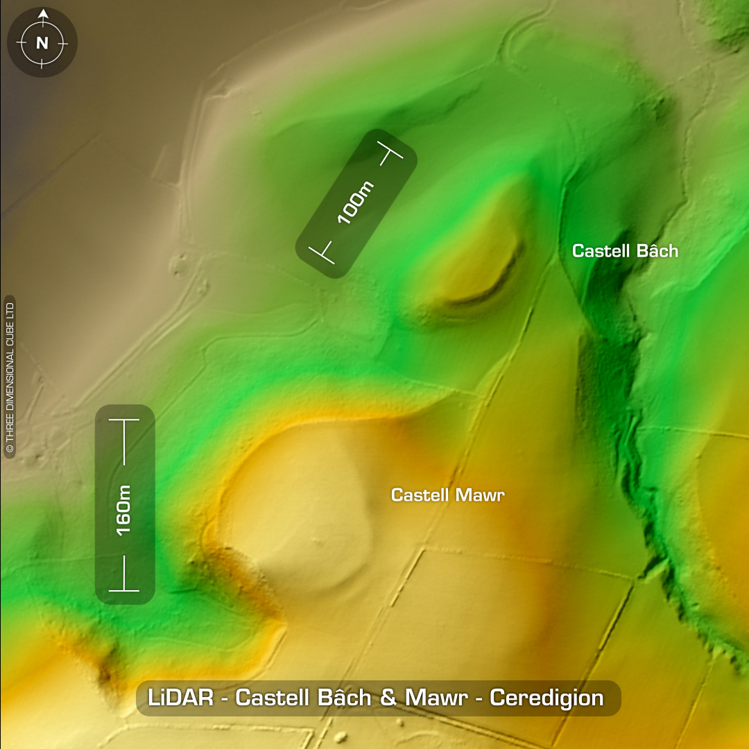
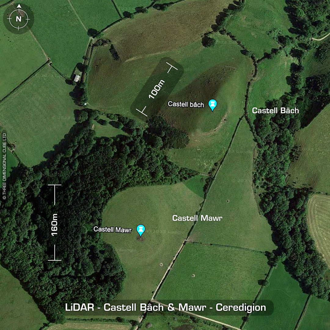


DTM- (Digital Terrain Model, i.e. No buildings or foliage) Overlooking LLanrhystud from the south atop a ridgeline lie two hillforts, Castell Bâch & Castell Mawr. Castell Bâch is a bivallate hillfort with steep slopes on all sides. Entrance on east-side. Possible round house site within. Hogg in 1994 noted that the long-cultivated site had been robbed of its stone from its ramparts. The lane which approaches from the coastal plain, up between Castell Mawr and Castell Bach, is known locally as `the lane of the wounded’ or `the dell of slaughter’ (local knowledge appears to vary), a notable placename said to relate to a battle between the two forts. Castell Mawr is a heavily degraded bivallate circular fort. Cropmarks suggest a complex site with buried structures. Morphology suggests a multi-phase construction. An additional record on DYFED HER indicates a Medieval motte/castle on the site in the 14th century. No recorded finds or excavations, hence undated*. (Scheduled monument) Iron Age tribal association (conjecture based on location): Demetae *Possible age range 2000-2700BP (Before present) Descriptions from hillforts.arch.ox.ac.uk & Dyfed Archaeological Trust HER. 1st ED OS Mapping via National Library of Scotland. Contains public sector information licensed under the Open Government Licence v3.0.