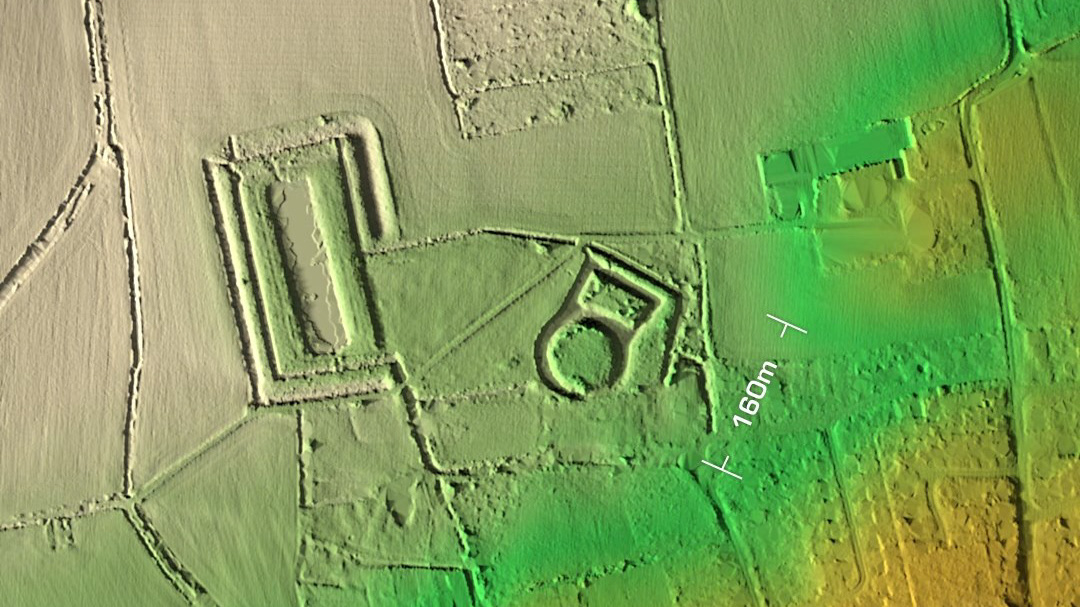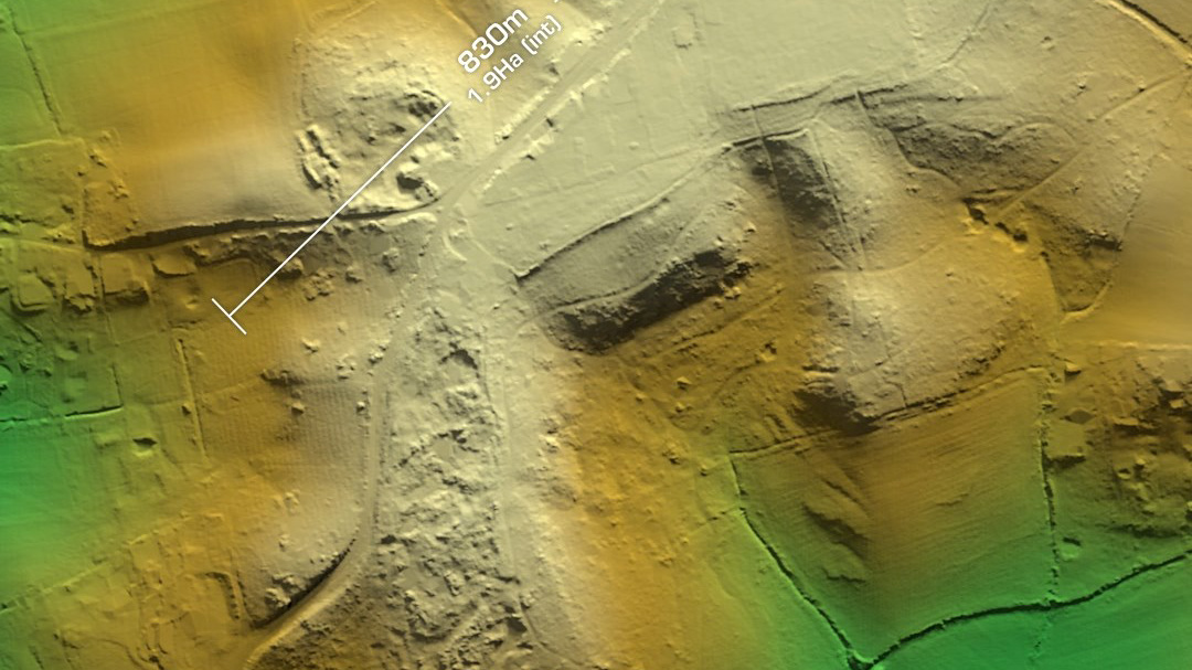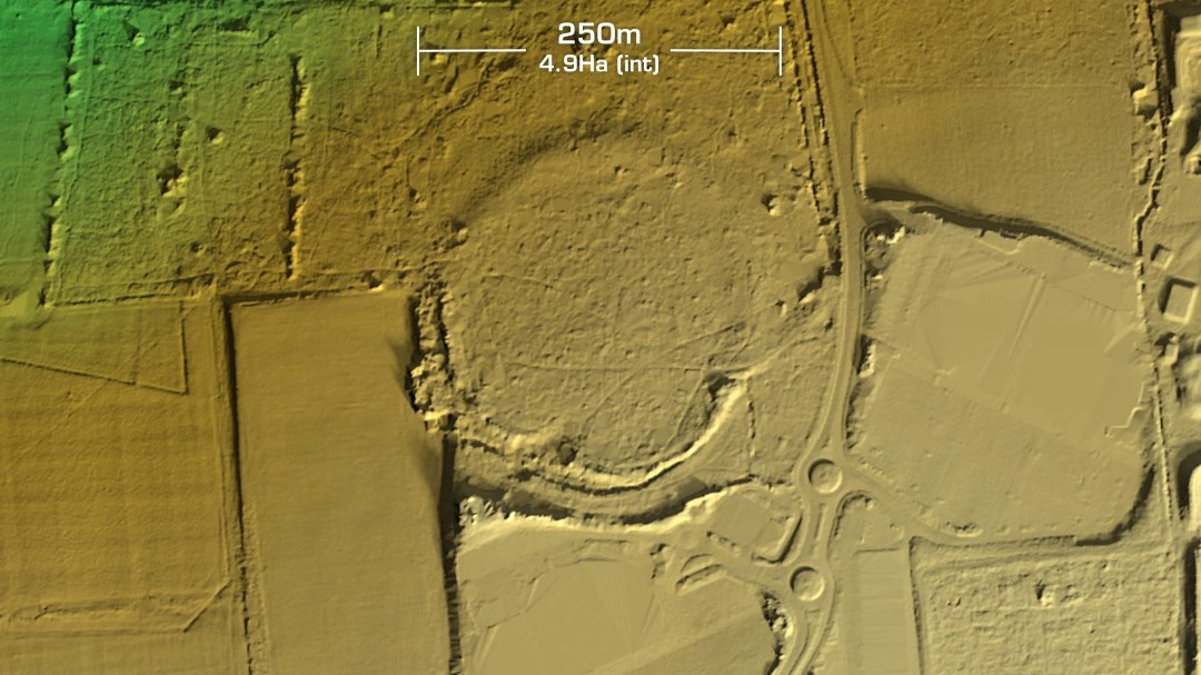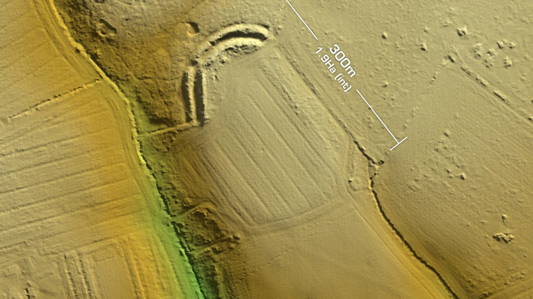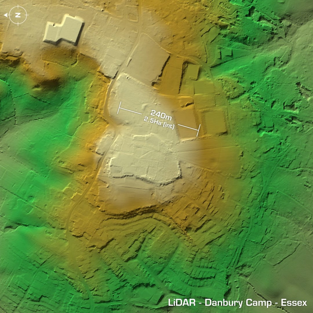
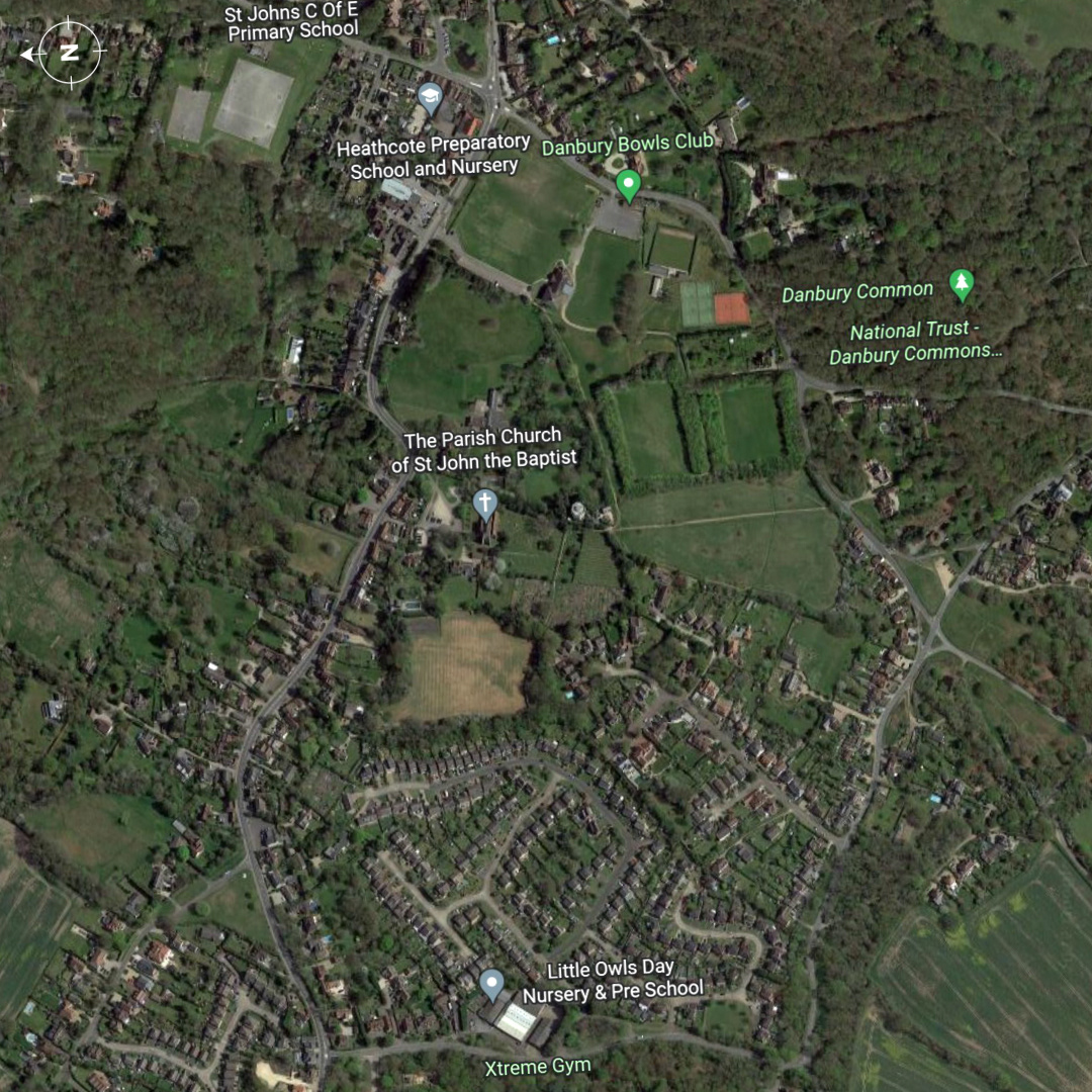
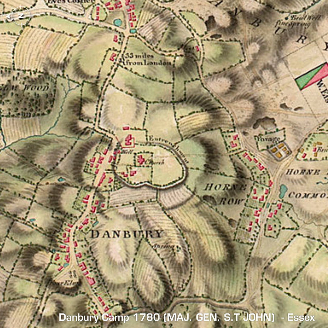
DTM- (Digital Terrain Model, i.e. No buildings or foliage) Even though this fort has been mostly destroyed it’s still quite interesting. Within the boundaries of The Parish Church of St John the Baptist (12th Cent) in Danbury, lies the remains of the univallate hillfort, Danbury Camp. Excavations in 1978 found postholes, tile fragments and Iron Age or Roman sherds. Sporadic finds have been recorded from gardeners digging in the allotments on the south edge of the camp. A rubbish pit containing Oyster shells was found by the church grave diggers in 1949. We know the Romans loved Oysters so this is another indication they ‘made camp’ here. Referred to in Domesady (1086AD) as Danengeberiam or ‘The stronghold (burh) of the Daenningas’. I tried to find a reference from an older map of the area and came up with an online book from 1784. It was on militarymaps.rct.uk and the page was ‘Plan of the encampment on Danbury Common under the command of Maj. Gen. S.T John 1780’. (American War of Independence dispositions of the Army in Great Britain). This is why the overhead 3D renders and Google Map are rotated 90 anticlockwise, so as to match the 1780 Map where the original Iron Age rampart is plainly visible surrounding the church. Iron Age tribal association (conjecture based on location): Trinovantes (Scheduled Monument)