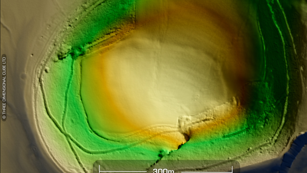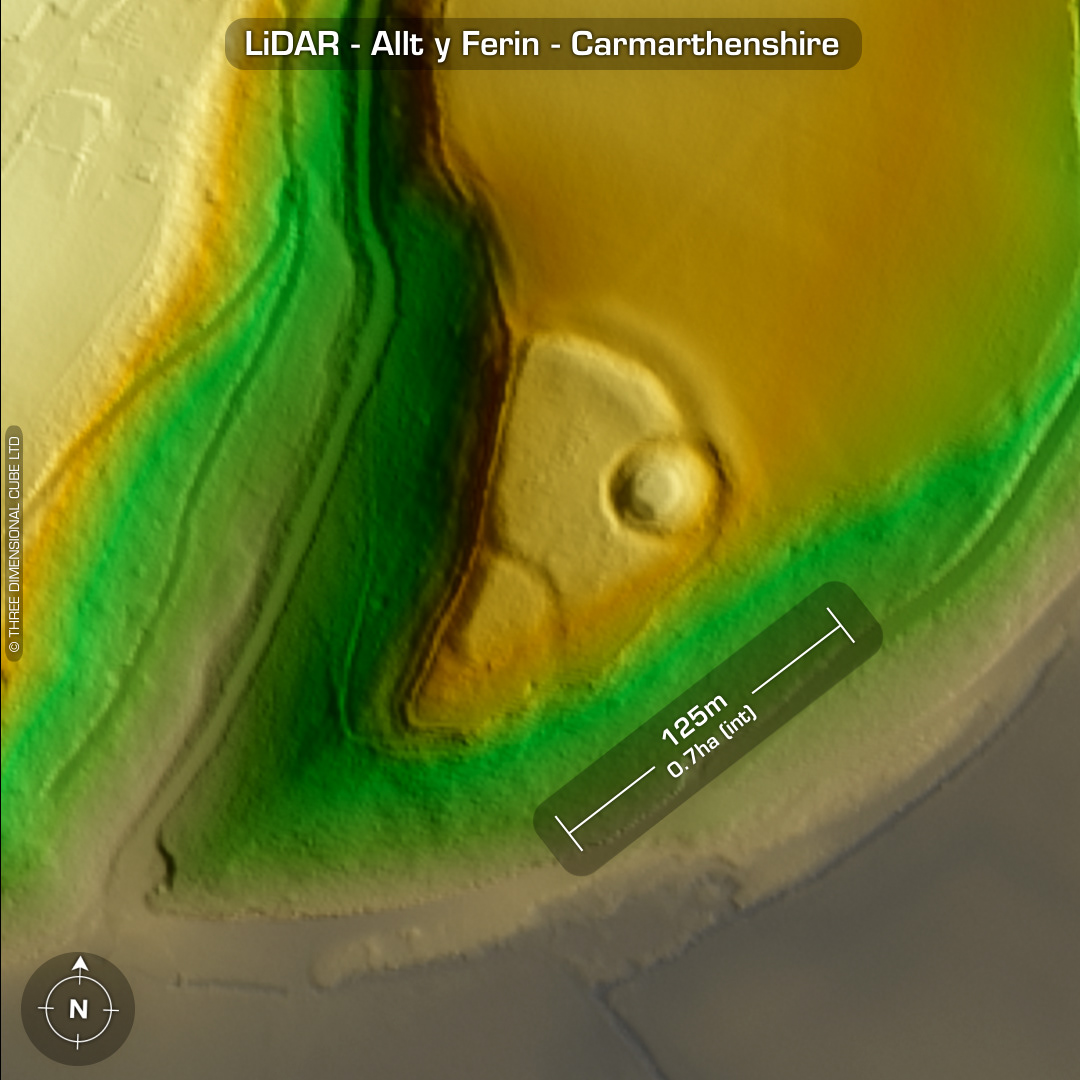
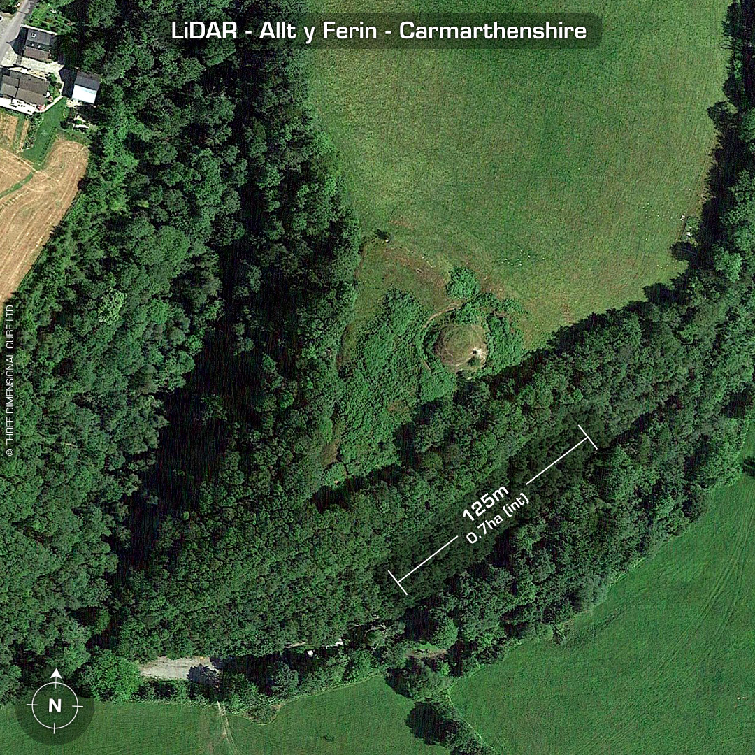
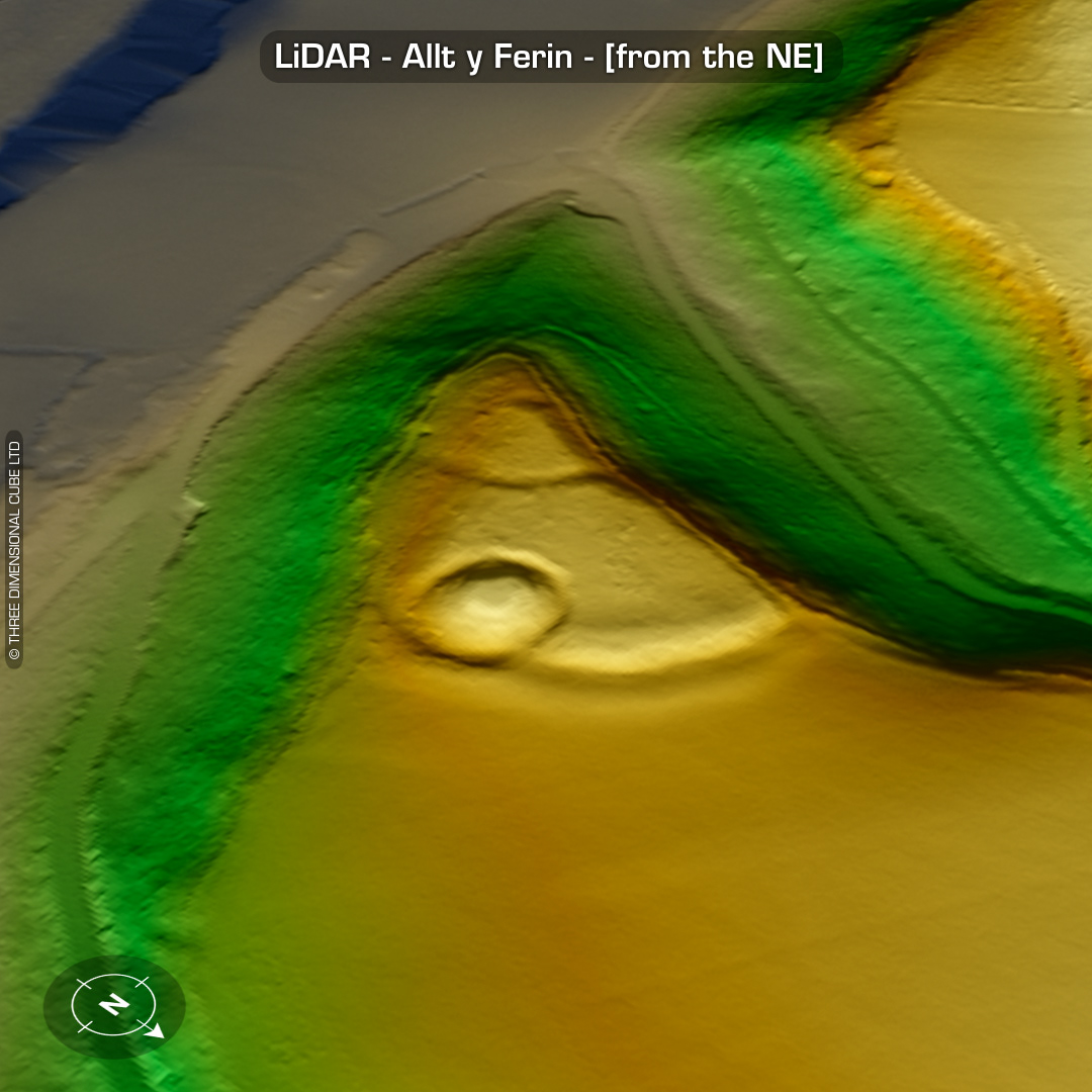
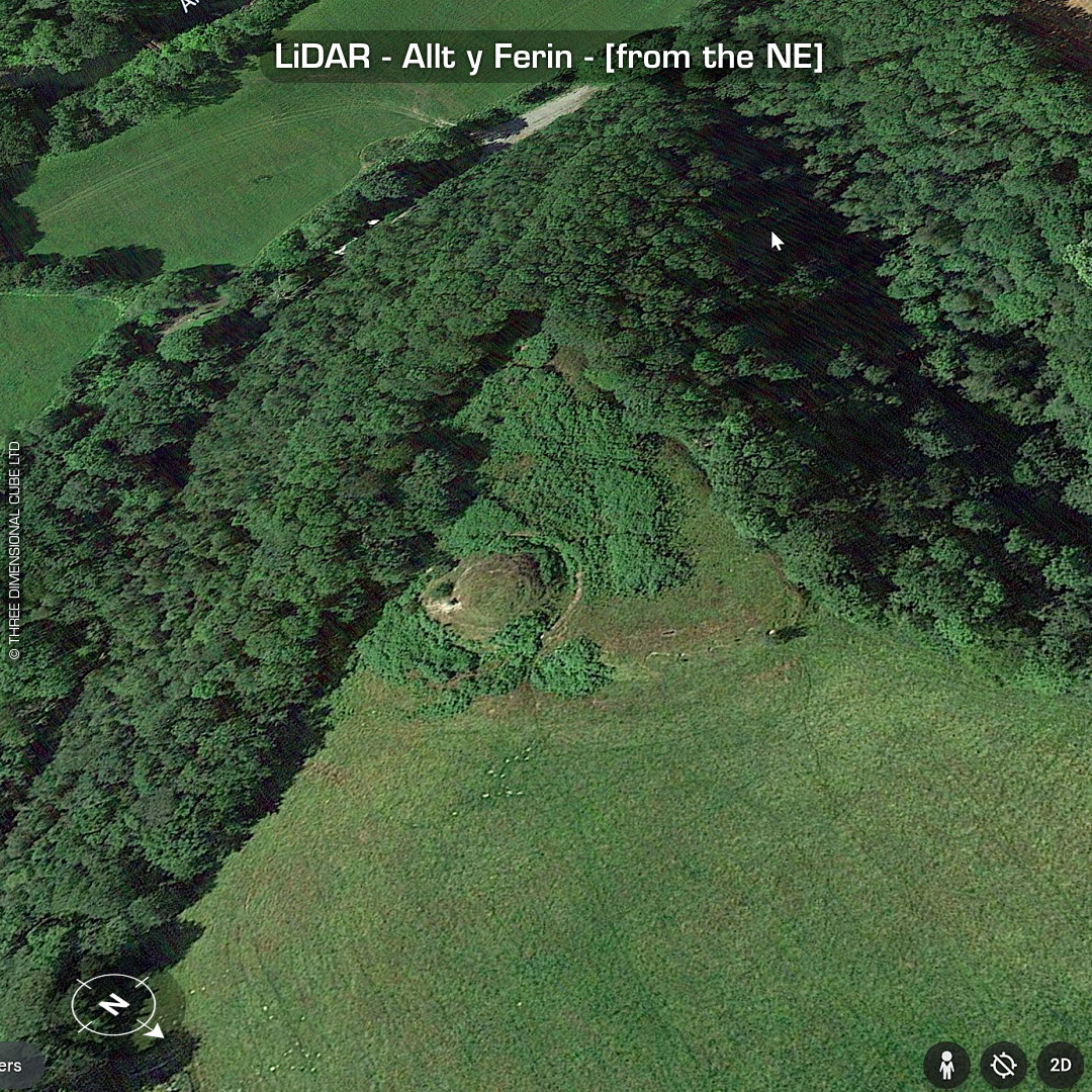
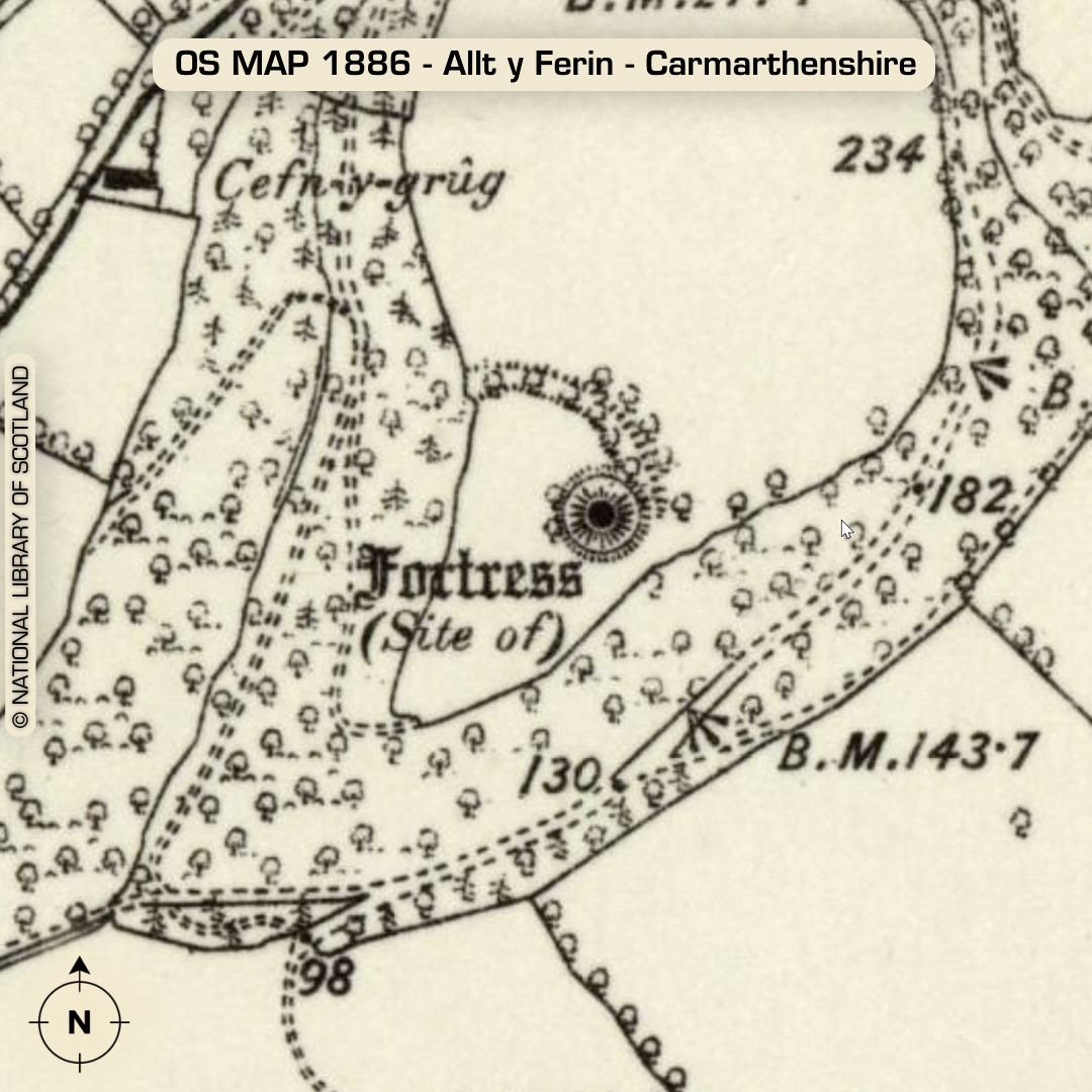
LiDAR – Allt y Ferin - Carmarthenshire DTM- (Digital Terrain Model, i.e. No buildings or foliage) Overlooking the (river) Afon Cothi from the north and lying east of the village of Felingwmisaf sits the inland promontory fort and later medieval motte & bailey, Allt y Ferin. Interesting interior ditch & bank bisecting the promontory. Dating uncertain. The motte is 8m high & 12m diameter across the top. Bailey constructed with hillfort earthwork material. A thatched octagonal building used to sit atop the motte circa 19-20th century. The site owners have an old photograph but it hasn’t been posted online unfortunately. No recorded excavations or finds, hence undated*. (Scheduled monument) Iron Age tribal association (conjecture based on location): Demetae *Possible age range 2000-2700BP (Before present) Descriptions from hillforts.arch.ox.ac.uk & Dyfed Archaeological Trust HER. 1st ED OS Mapping via National Library of Scotland. Contains public sector information licensed under the Open Government Licence v3.0.