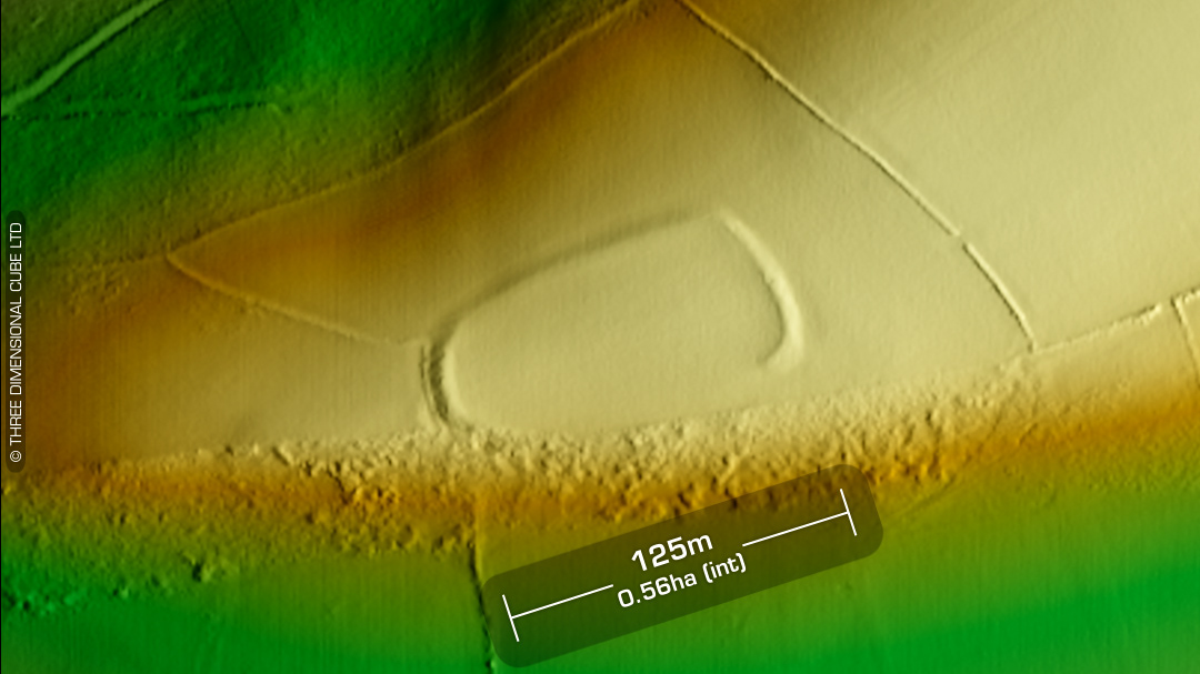
LiDAR – Caer Castell – Llanarthney - Carmarthenshire DTM- (Digital Terrain Model, i.e. No buildings or foliage) Overlooking the (river) Afon Ffinnat and 2.1km W of the village of Llanarthney sits the inland promontory fort, Caer Castell- (Llanarthney). Not recorded on 1st Ed OS Map. Regarded as a ‘natural feature’ in the 1950s, even though it was previously recorded as a ‘defended promontory’ in 1917. The field system containing the fort has always been called ‘Caer Castell’, or ‘Castle fortress’. Simple entrance on east-side. Survey in 1968 by Ordnance Survey and site visit in 1983 by DFED Archaeological Trust. A sculptured and inscribed stone of 11th-12th century date is said to have stood slightly within the western end of the bank before being removed in the 1800’s and placed in the parish church of Llanarthney, where it remains. (Scheduled monument) Iron Age tribal association (conjecture based on location): Demetae Descriptions from Dyfed Archaeological Trust HER. Contains public sector information licensed under the Open Government Licence v3.0.