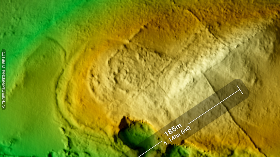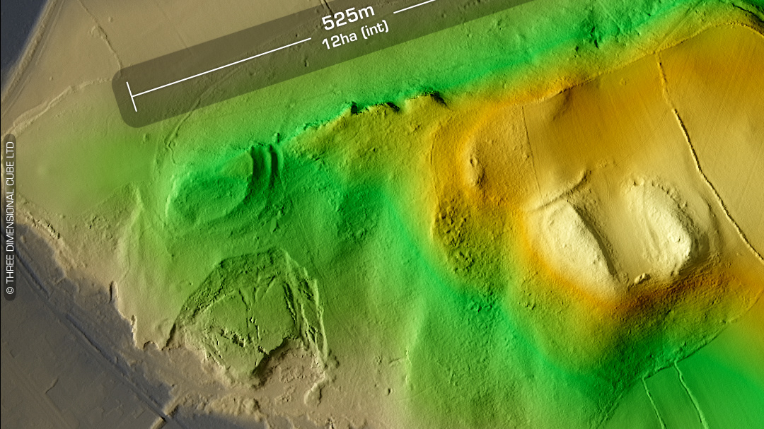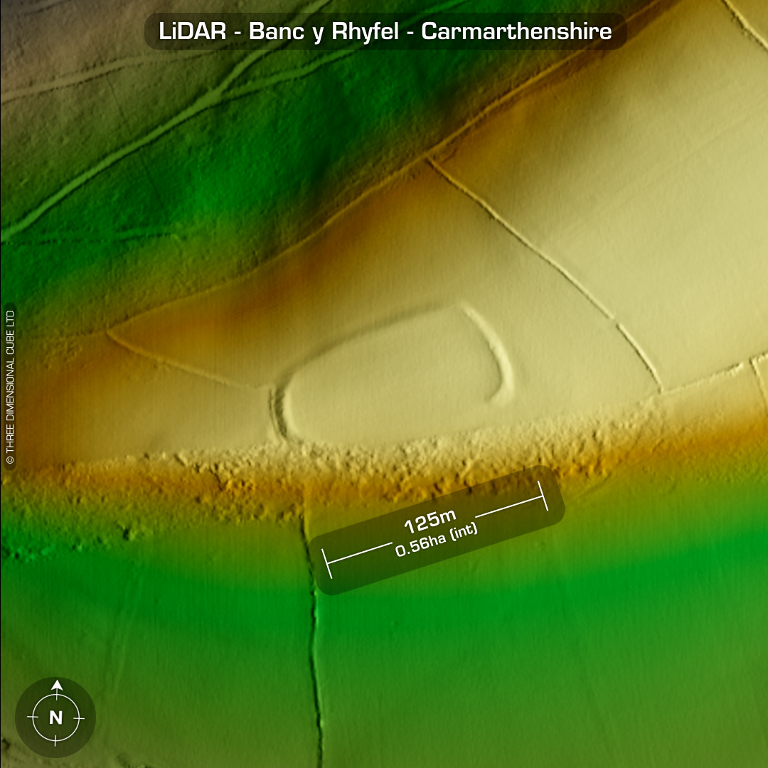
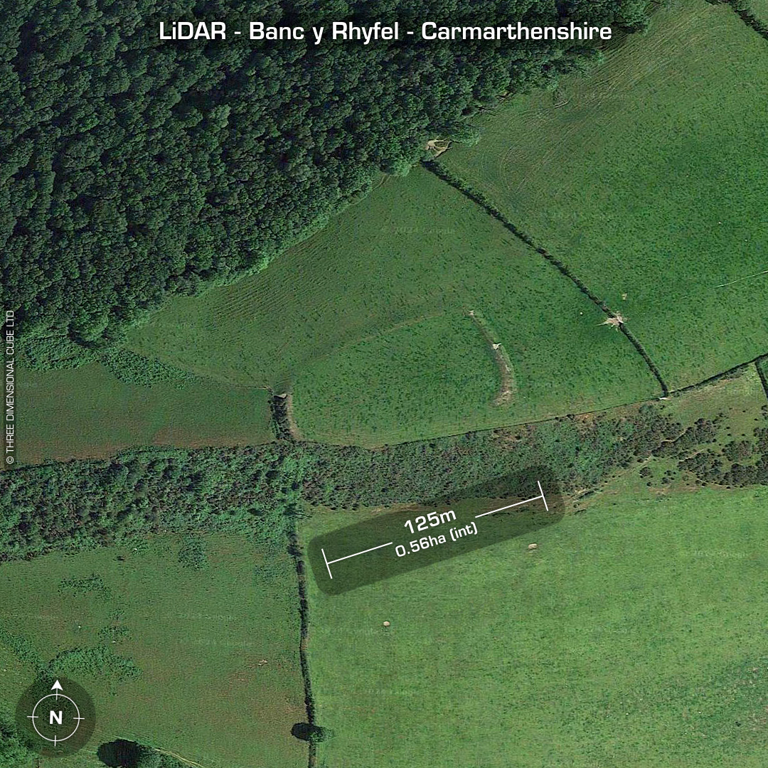
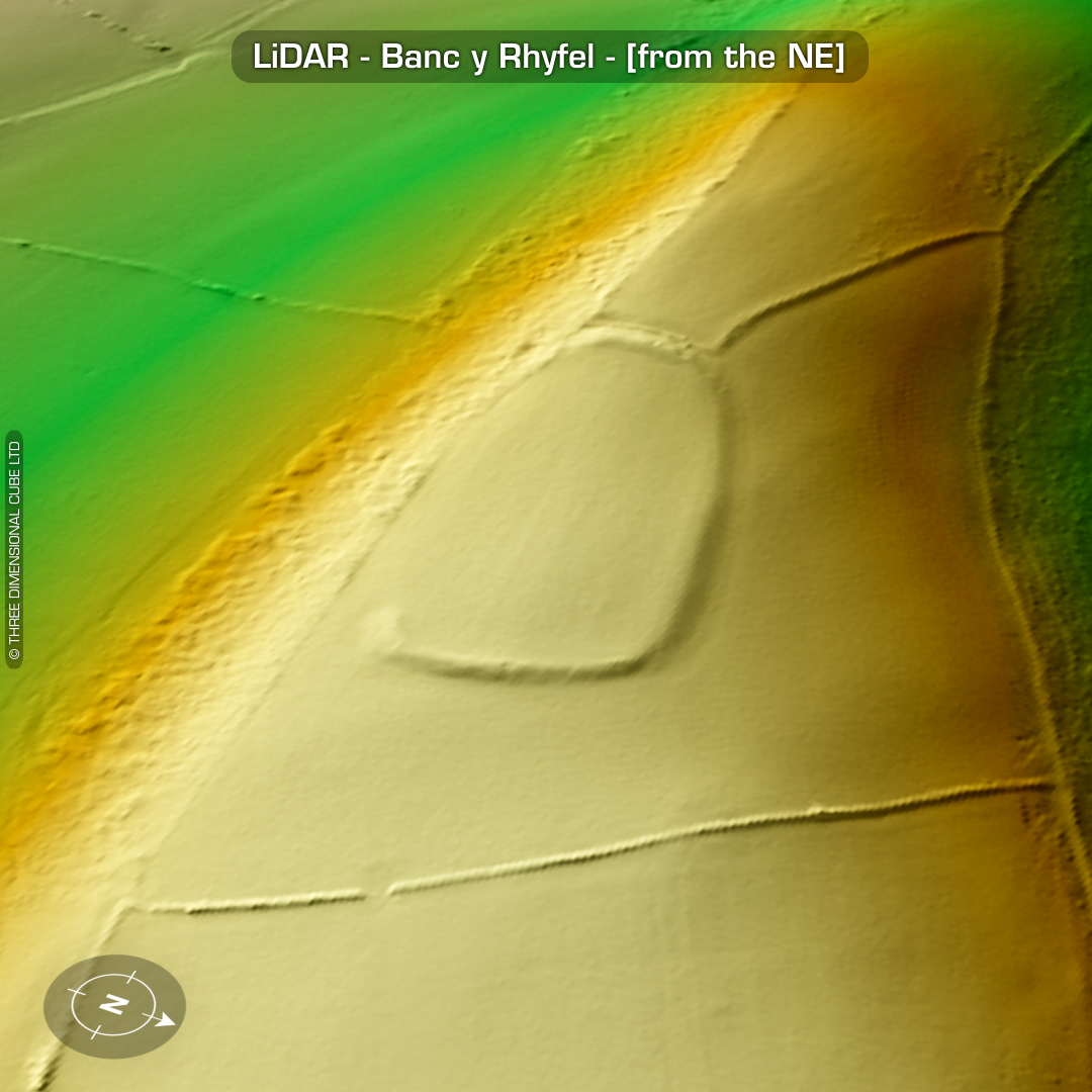
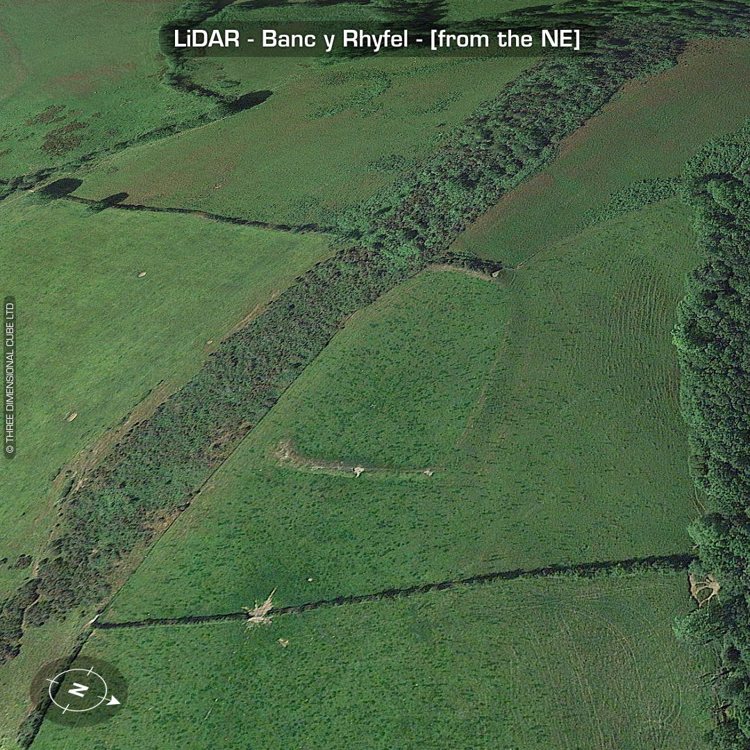
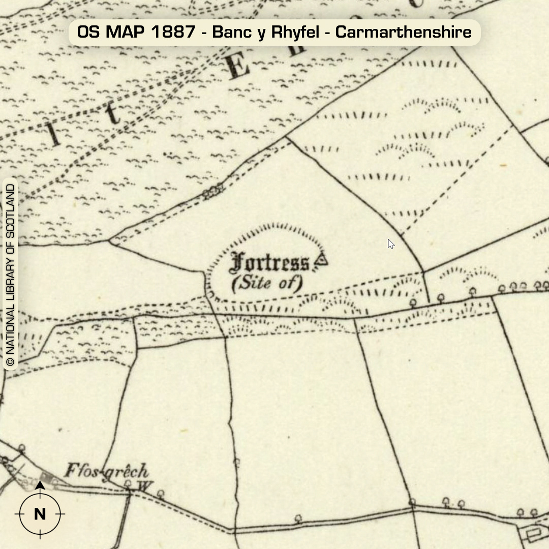
LiDAR – Banc y Rhyfel - Carmarthenshire DTM- (Digital Terrain Model, i.e. No buildings or foliage) 1.7km SW of the village of Llanfynydd atop a ridgeline sits the univallate hillfort, Banc y Rhyfel. Simple entrance on the SE corner. Whole site ploughed-out and degraded by livestock trampling. No recorded excavations or finds, hence undated*. (Scheduled monument) Iron Age tribal association (conjecture based on location): Demetae *Possible age range 2000-2700BP (Before present) Descriptions from hillforts.arch.ox.ac.uk & Dyfed Archaeological Trust HER. 1st ED OS Mapping via National Library of Scotland. Contains public sector information licensed under the Open Government Licence v3.0.