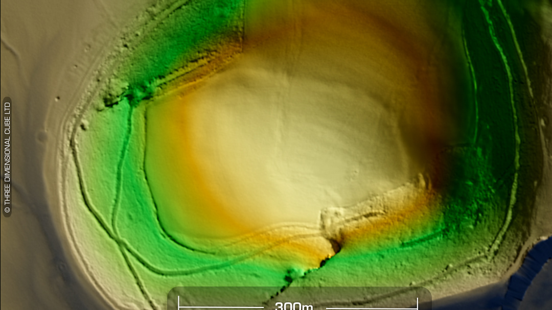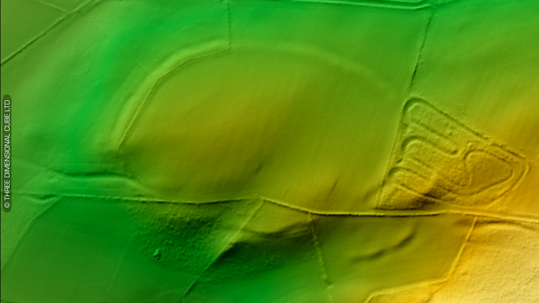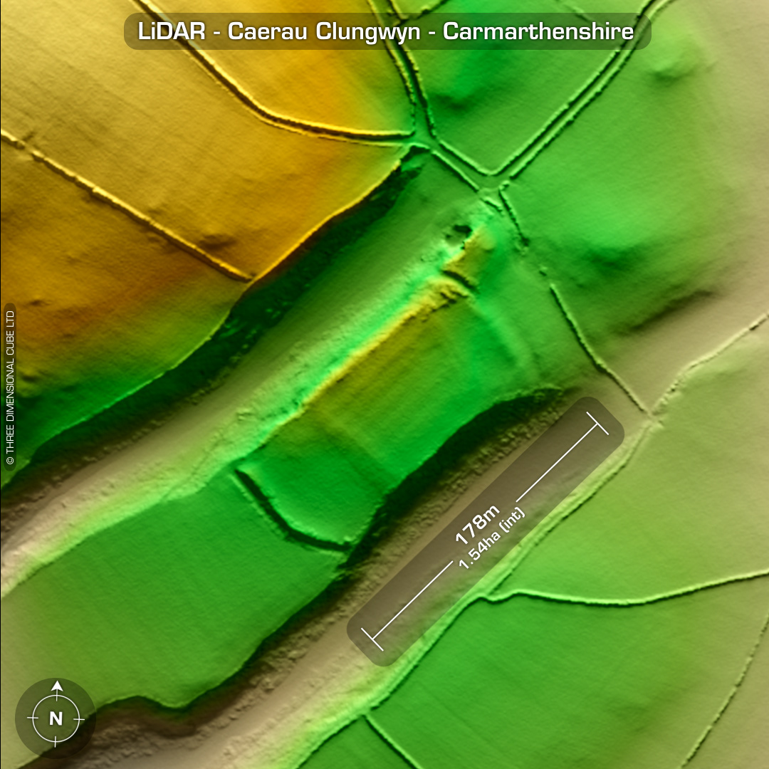
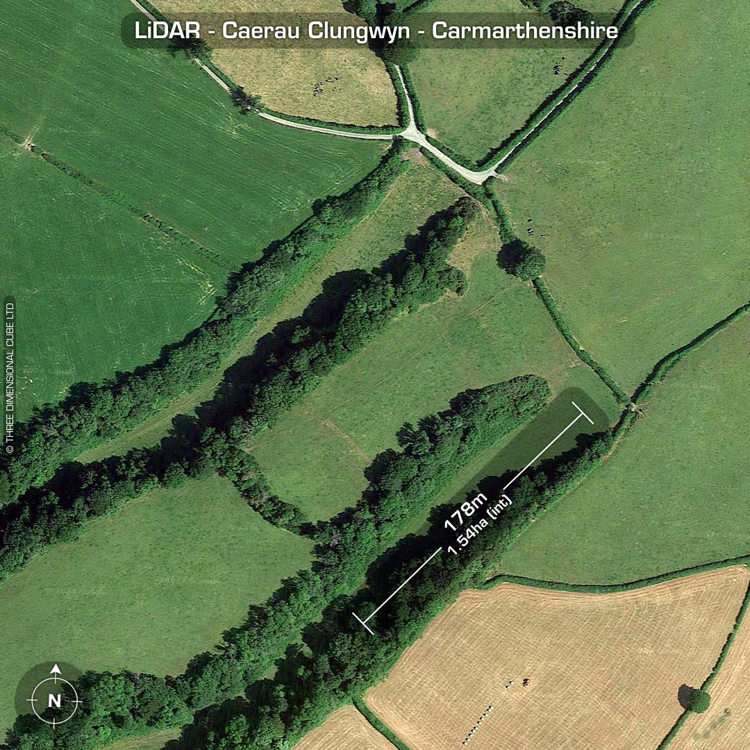
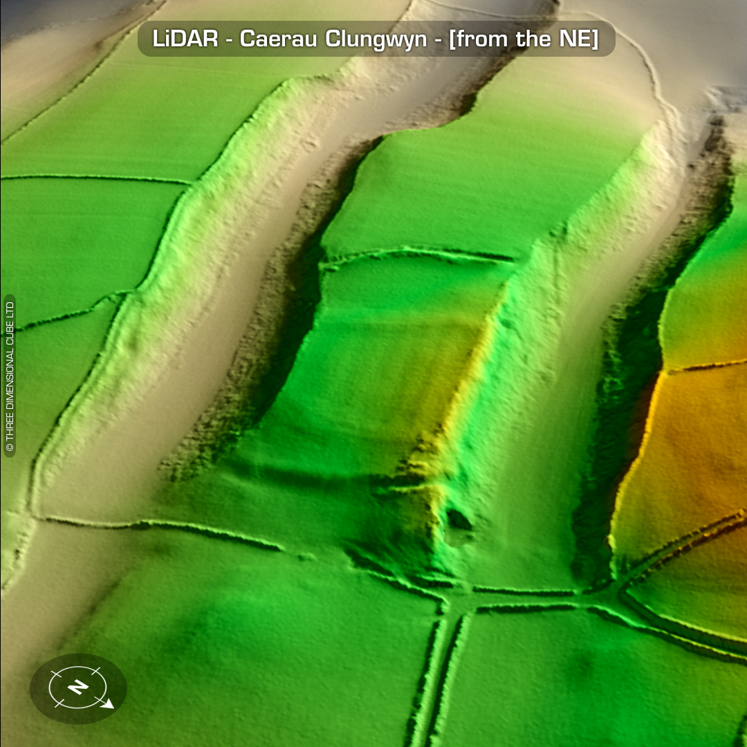
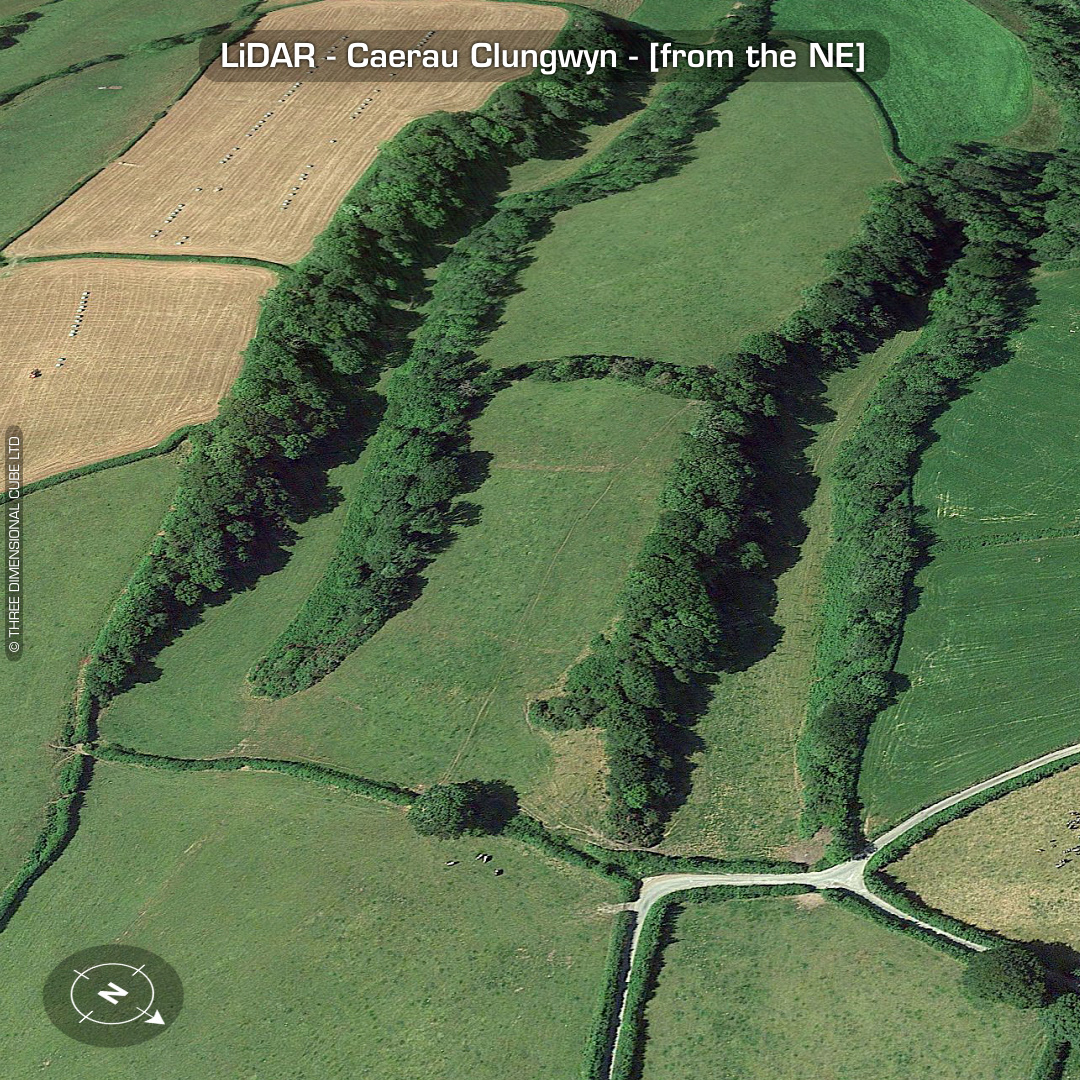
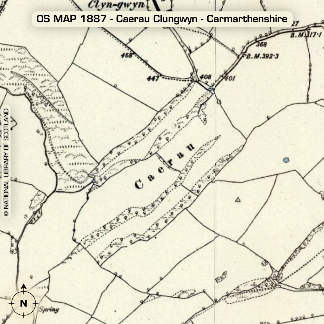
LiDAR – Caerau Clungwyn - Carmarthenshire DTM- (Digital Terrain Model, i.e. No buildings or foliage) Overlooking the village of Bronwydd Arms from the west sits the part-degraded hillfort, Caerau Clungwyn. Probably named after the farm, Clyn-gwyn to the north. Extant ramparts to the SW but degraded to the NE. Interior sub-division banks visible on LiDAR. Farming has widened (probable) eastern entrance for access. Trees cleared from site in 1982. Laid to pasture since the 1980s. (Scheduled monument) Iron Age tribal association (conjecture based on location): Demetae Descriptions from Dyfed Archaeological Trust HER. Contains public sector information licensed under the Open Government Licence v3.0.