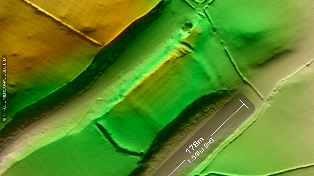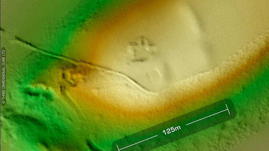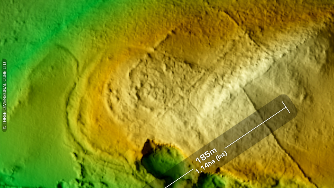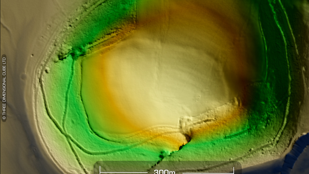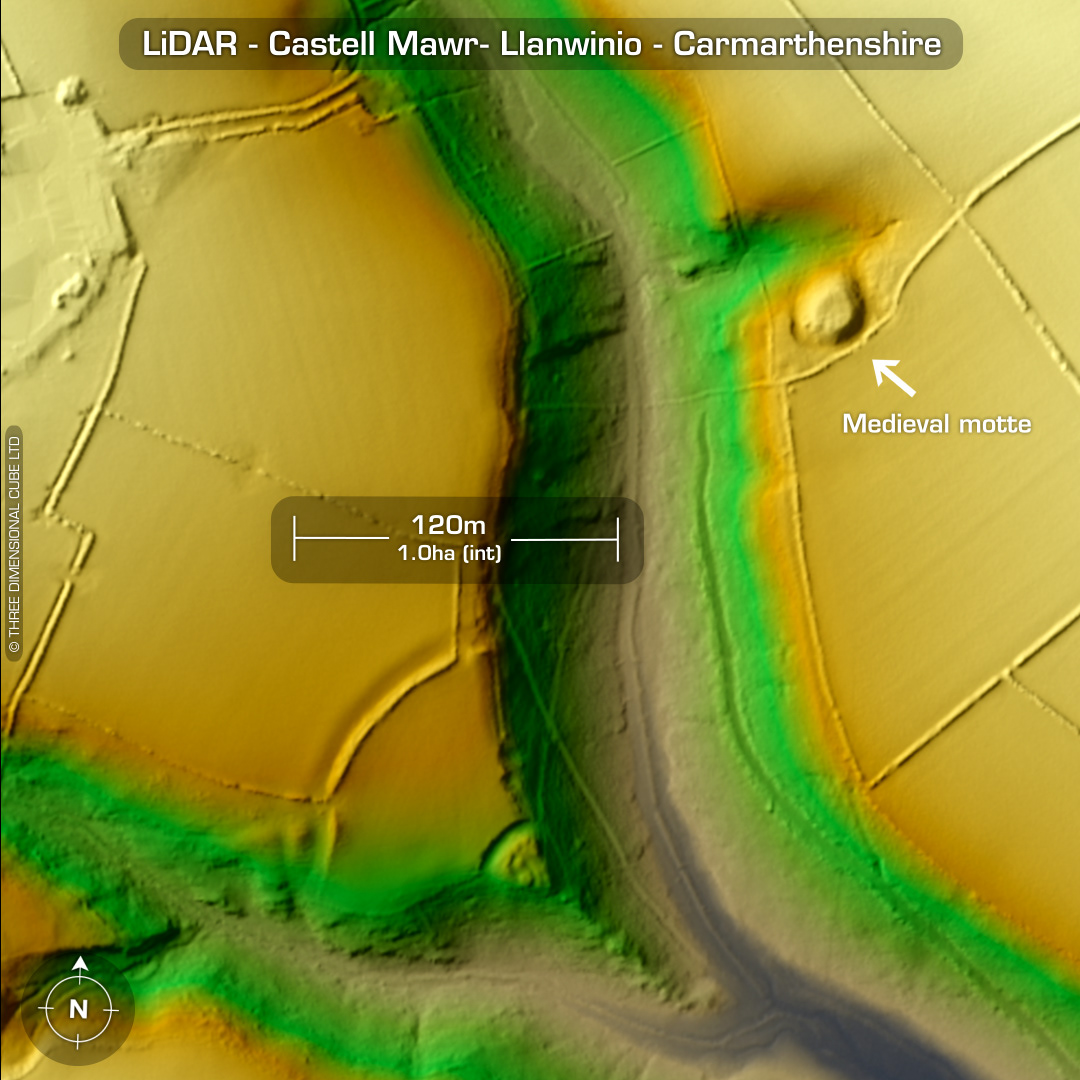
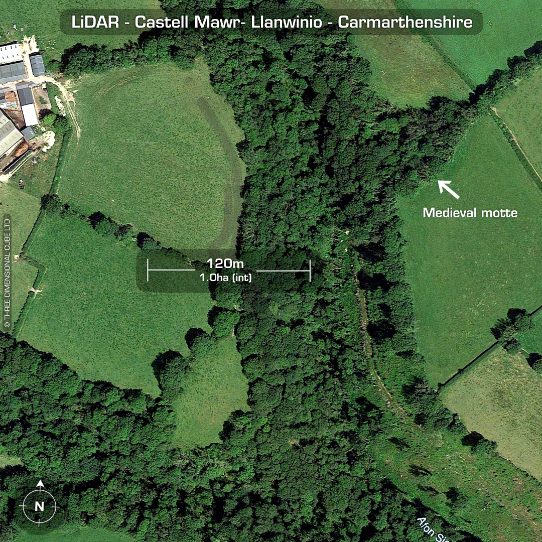
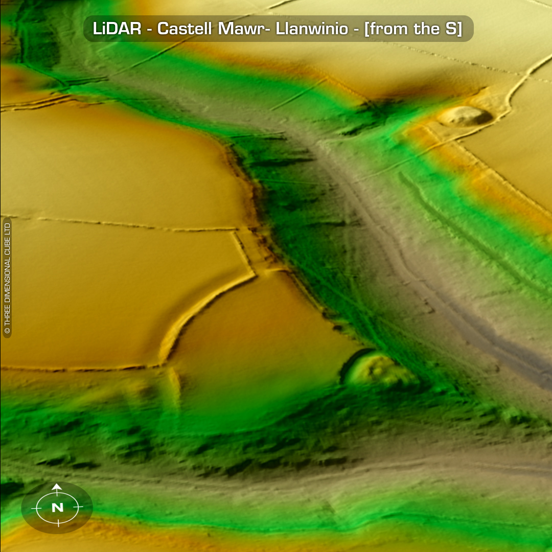

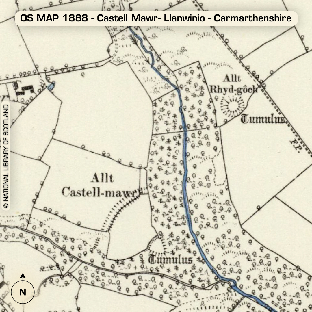
LiDAR – Castell Mawr- Llanwinio - Carmarthenshire DTM- (Digital Terrain Model, i.e. No buildings or foliage) 850m east of the village of Blaenwaun sits the inland promontory fort of Castell Mawr. Old name, Allt Castell-mawr. Just over the (river) Afon Sien to its northeast lies the medieval motte, Castell Bach whose old name was, Allt Rhyd-gôch on old OS Maps. The complex SW corner of Castel Mawr probably indicates the entrance. The gap at the north end of the rampart is probably modern. The rock-cut bisection at the tip of the promontory isolates a small mound which consists of material excavated from the aforementioned cut. Proposals indicate a medieval re-use of the site, especially due to its proximity to the motte. Two Bronze age round barrows did lie just outside the site but have now been ploughed-out. Castell Bach motte has a 1.6m ditch and a natural spring just to its NE corner. No recorded excavations or finds, hence undated. (Scheduled monument) Iron Age tribal association (conjecture based on location): Demetae Descriptions from Dyfed Archaeological Trust HER. Contains public sector information licensed under the Open Government Licence v3.0.