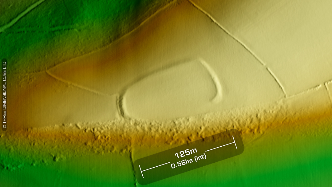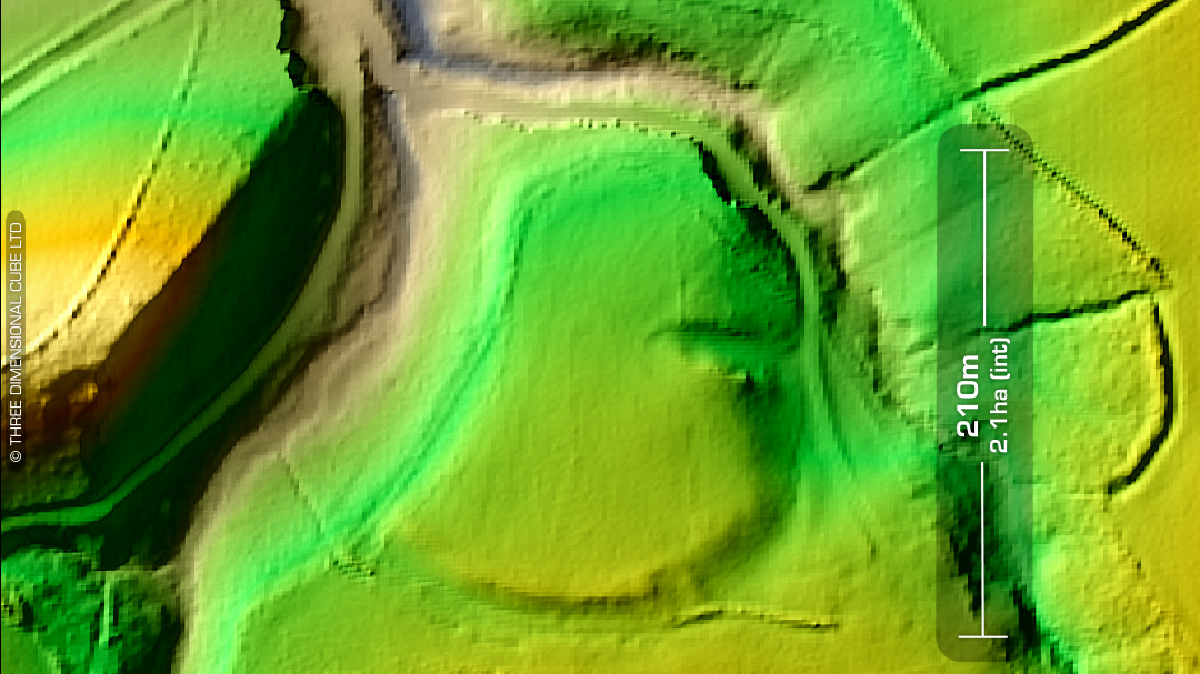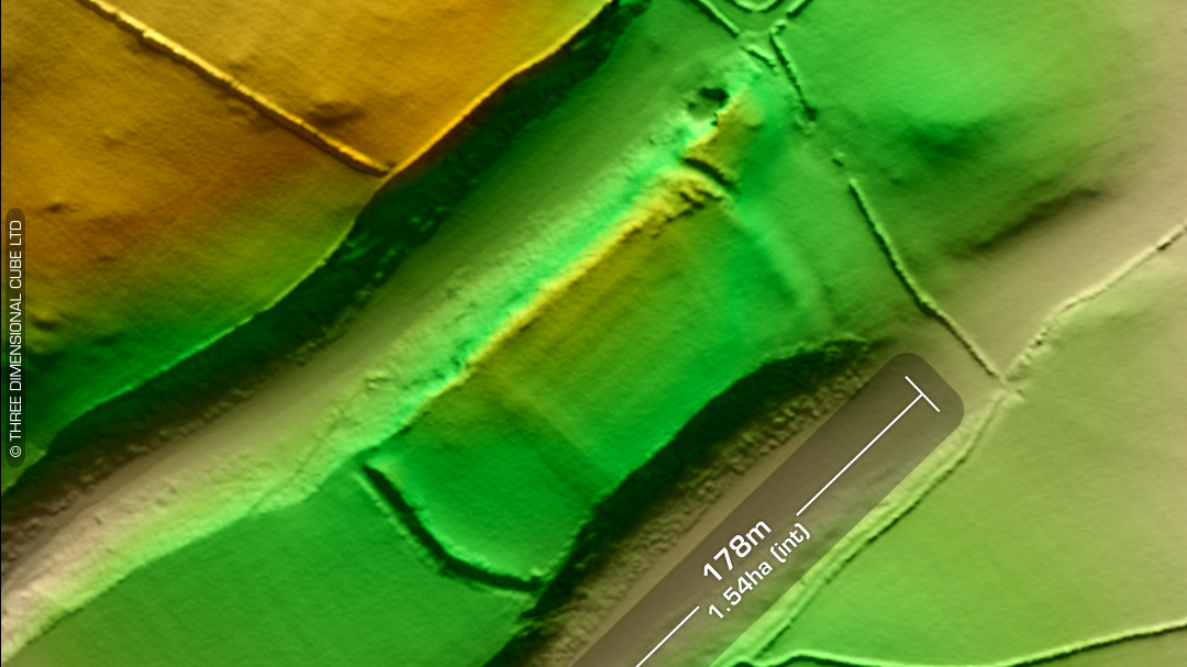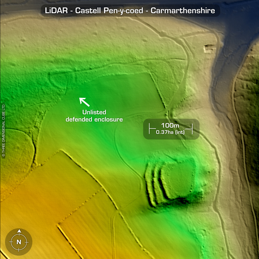
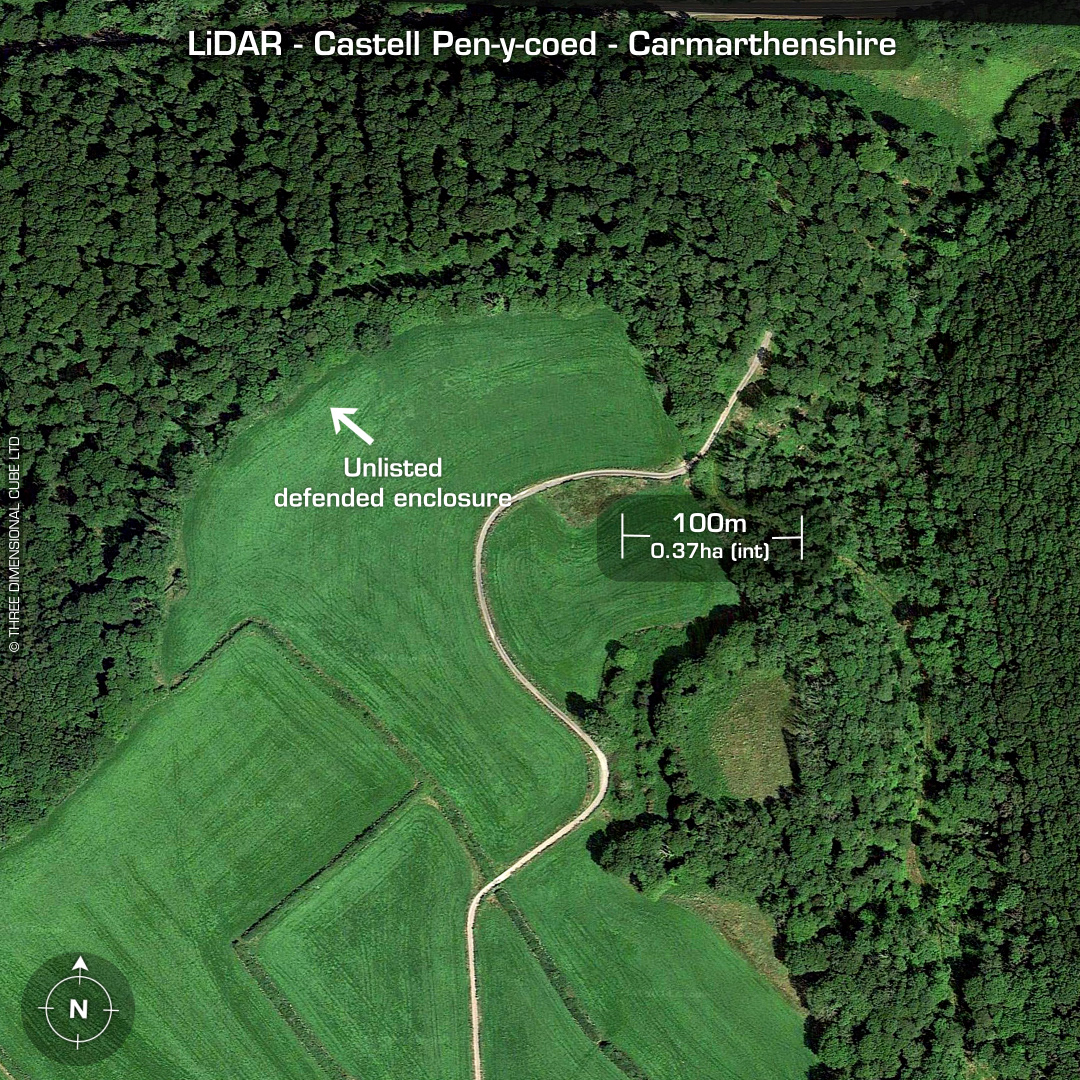
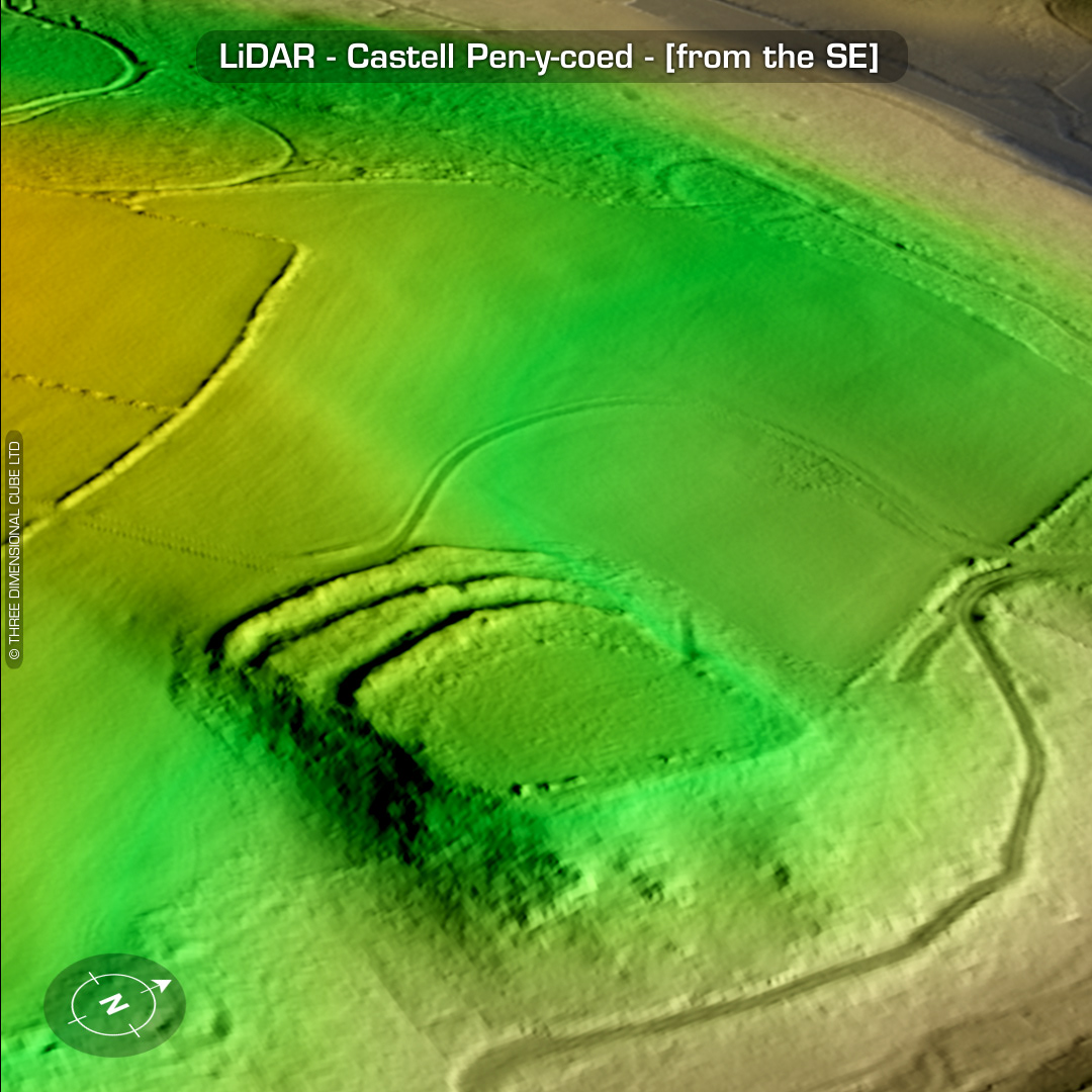
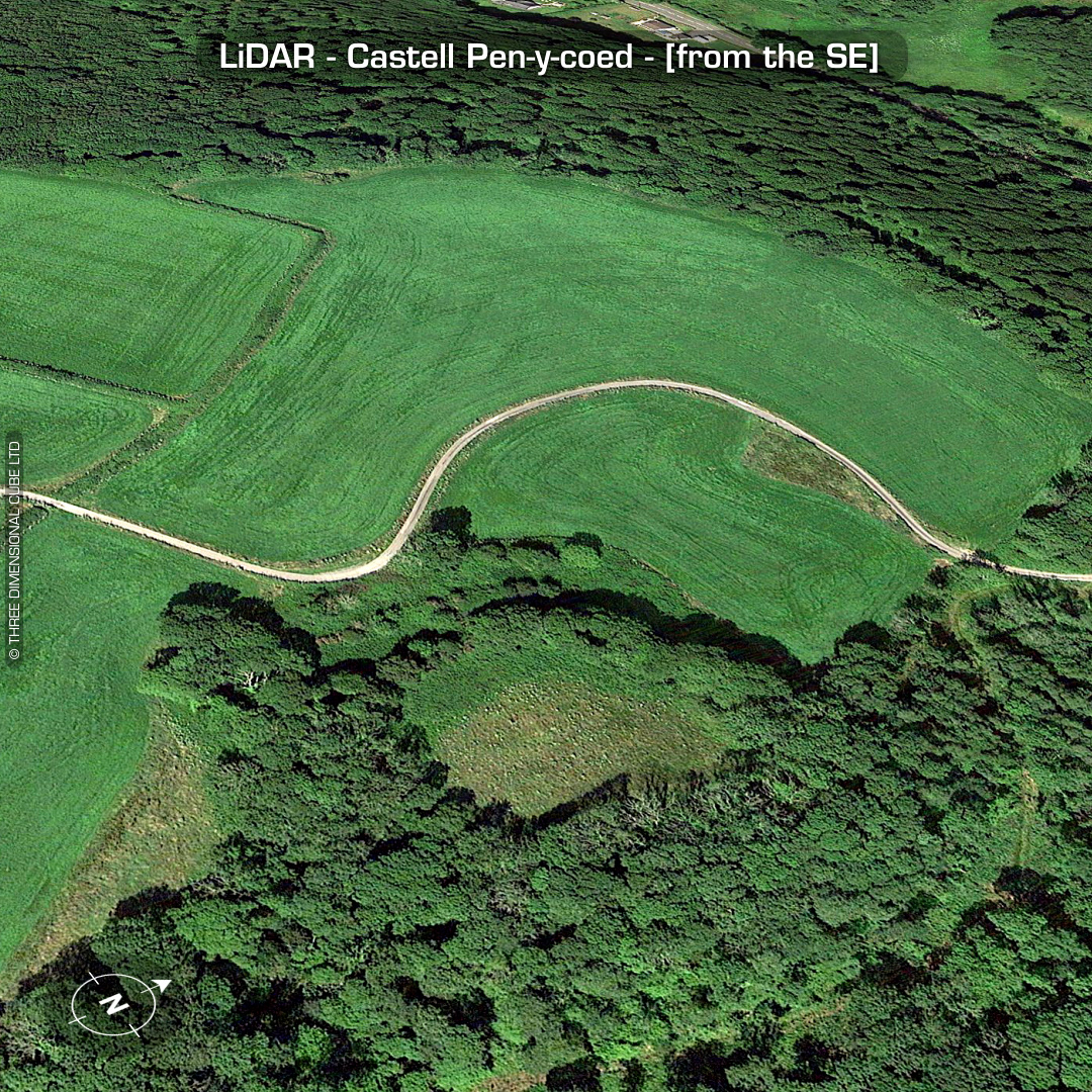

LiDAR – Castell Pen-y-coed - Carmarthenshire DTM- (Digital Terrain Model, i.e. No buildings or foliage) Overlooking a valley below the A477, just to the SW of the village of Llanddowror sits the inland promontory fort, Castell Pen-y-coed. The OS suggested a north-side entrance although there is no evidence for this (sic). (Apart from the north-side track picked-out on LiDAR) Possible site of the great battle of Pencon or Pencoed in the 6th century according to the Royal Commission of Ancient Monuments in Wales and Monmouthshire in 1912. Just to the NW of the site I noticed a defended enclosure hidden in the woods and sent that off to DYFED HER but someone else had just pipped me to the post: Jenna Smith (DYFED HER): ‘The site you sent yesterday near Castell Pen-y-coed (PRN 3887). By bizarre coincidence, as Ken and I were sat together looking through several sites that have been sent to us and we were actually looking at this one (sent in by someone else) when you emailed it! But we have made a record for it – PRN 130614. We have recorded it as a possible IA Defended Enclosure.’ Ah well! No recorded excavations or finds, hence undated. (Scheduled monument) Iron Age tribal association (conjecture based on location): Demetae Descriptions from Dyfed Archaeological Trust HER. Contains public sector information licensed under the Open Government Licence v3.0.