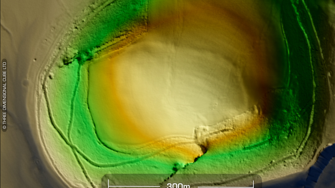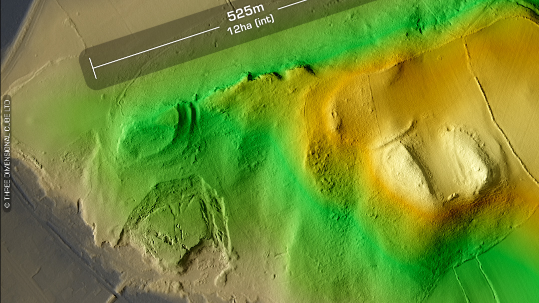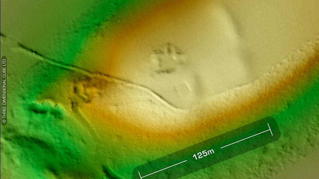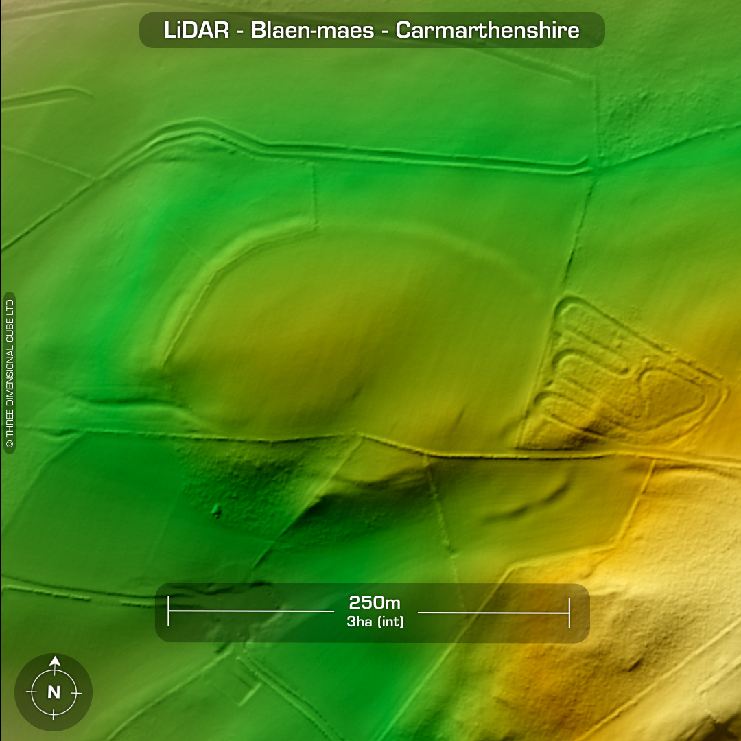
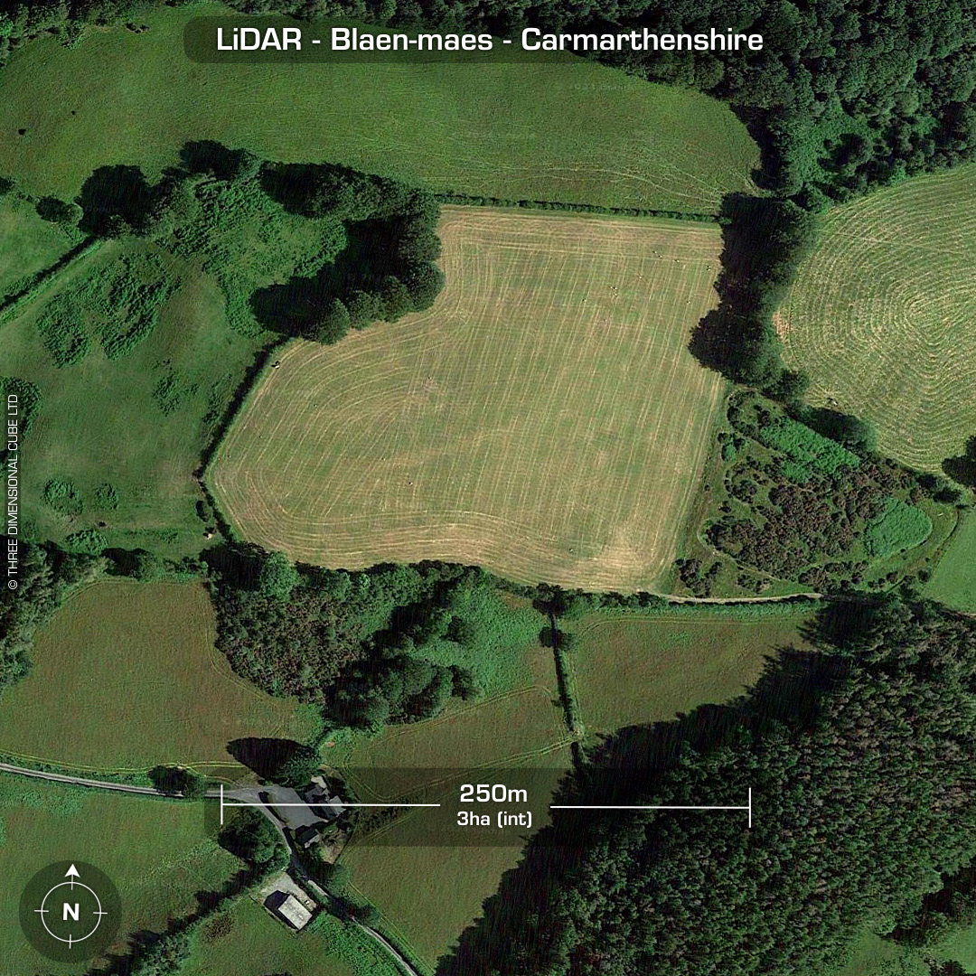
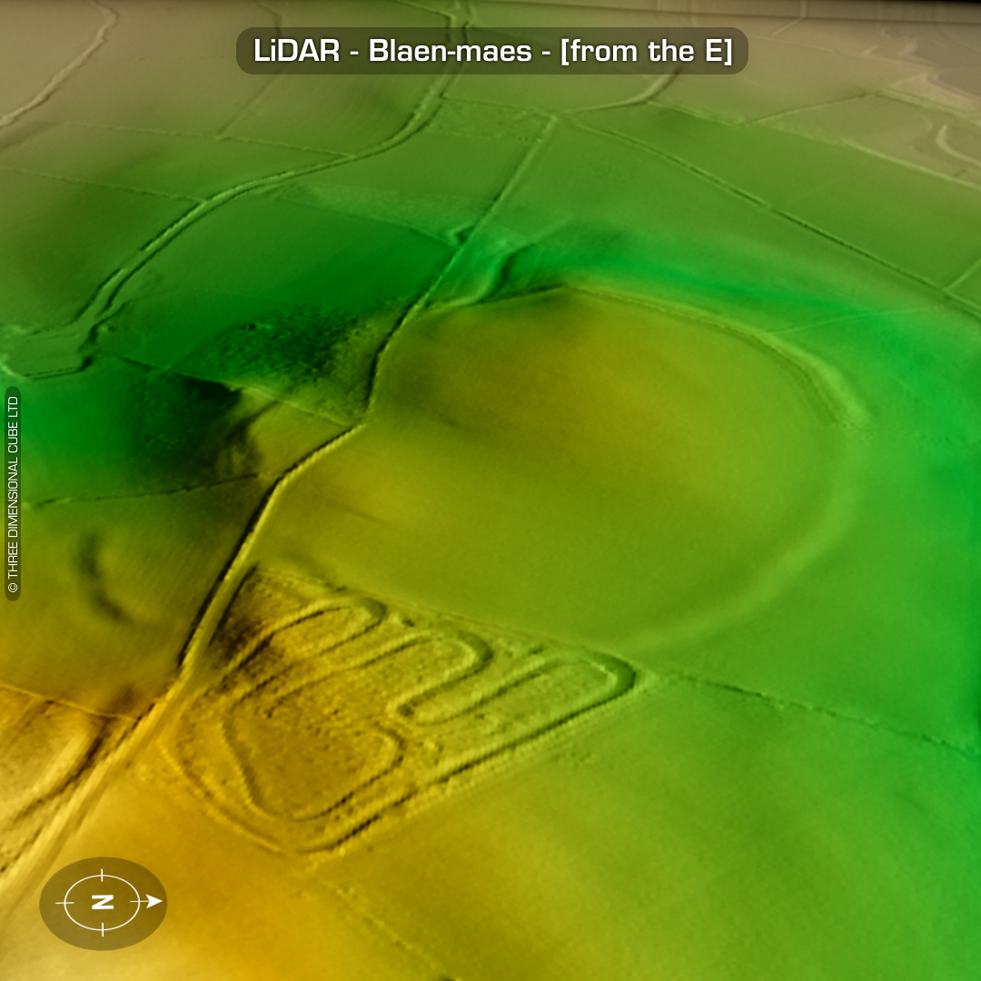
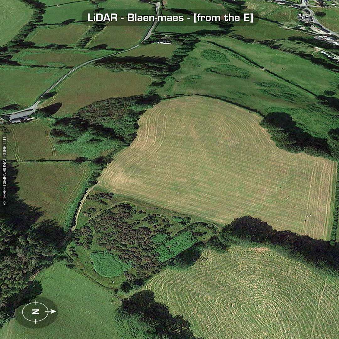
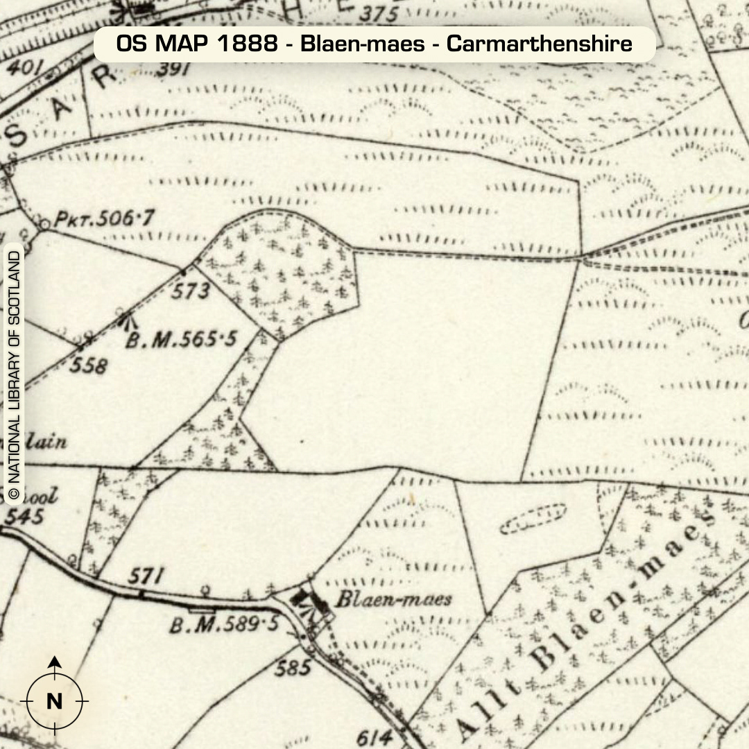
LiDAR – Blaen-maes - Carmarthenshire DTM- (Digital Terrain Model, i.e. No buildings or foliage) Overlooking the village of Pencarreg from the NE sits the ploughed-out univallate contour hillfort, Blaen-maes. An additional internal enclosure noticed in aerial photos in 1946 when the site was first identified has now been ploughed-out, although cropmarks at certain times of the year indicate buried features. To the SE of the site a possible annex/entrance is indicated on the LiDAR. The curved tracks in the eastern adjacent field are probably an old quad bike/motorcross course that’s been there since circa 2006 when it looked new on Google Maps Pro (back in time). Last site visit in 2008. No recorded excavations or finds, hence undated*. (Scheduled monument) Iron Age tribal association (conjecture based on location): Demetae *Possible age range 2000-2700BP (Before present) Descriptions from hillforts.arch.ox.ac.uk & Dyfed Archaeological Trust HER. 1st ED OS Mapping via National Library of Scotland. Contains public sector information licensed under the Open Government Licence v3.0.