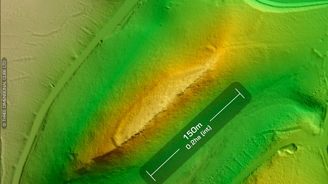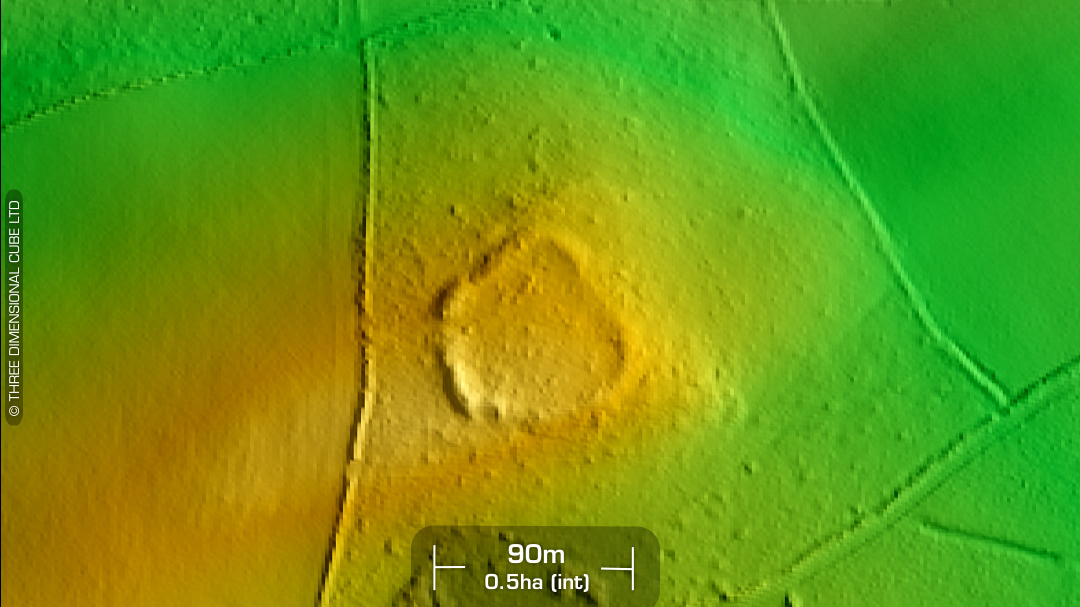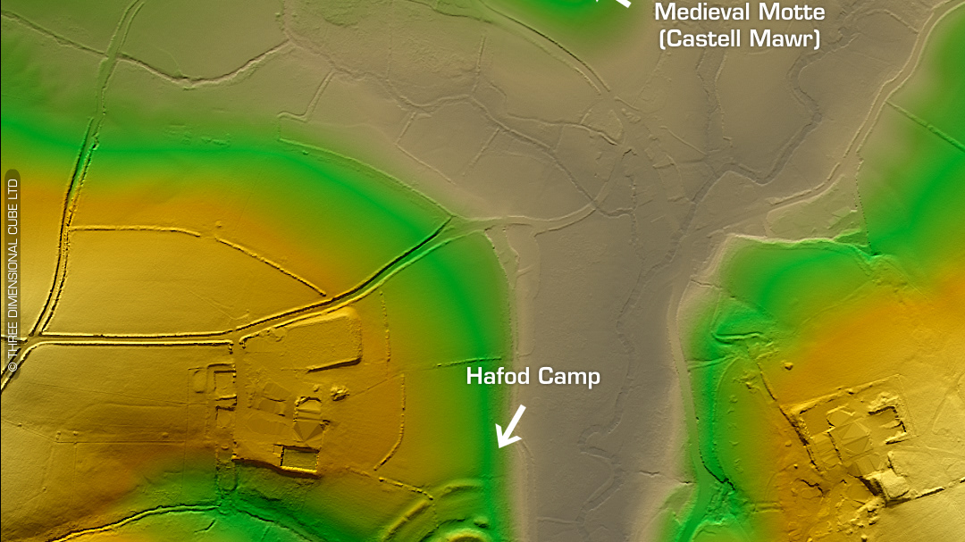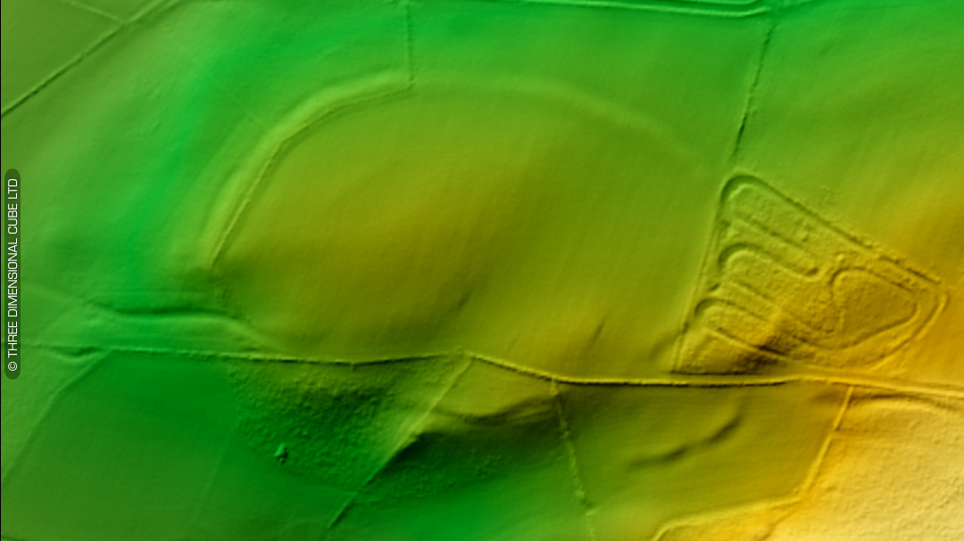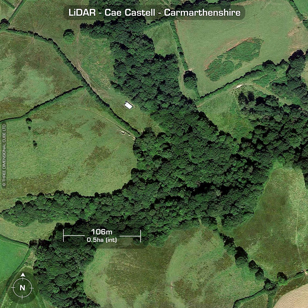


LiDAR – Cae Castell - Carmarthenshire DTM- (Digital Terrain Model, i.e. No buildings or foliage) Overlooking the (river) Afon Myddyfi and 1.3km northwest of the A40 at Pentrefelin sits the heavily degraded inland promontory fort, Cae Castell. Ramparts only visible at low lighting angles or on LiDAR. Boundaries obscured by woodland. Not on old OS Maps. First recorded in 1917 via its (field) name which was suggestive but a site visit could not find any explanation of its Castell moniker until in 2008 when the earthworks were discovered & recorded. A past farm owner found a Bronze Age socketed axe inside the promontory while ploughing. No recorded excavations hence, undated*. (Scheduled monument) Iron Age tribal association (conjecture based on location): Demetae *Possible age range 2000-2700BP (Before present) Descriptions from hillforts.arch.ox.ac.uk & Dyfed Archaeological Trust HER. 1st ED OS Mapping via National Library of Scotland. Contains public sector information licensed under the Open Government Licence v3.0.