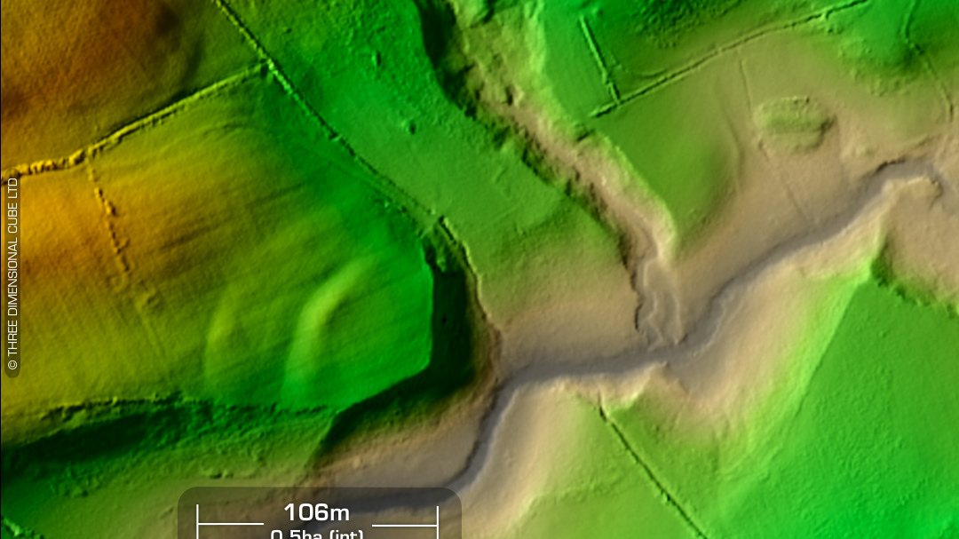
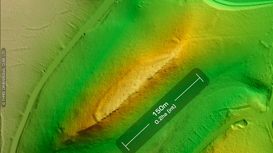
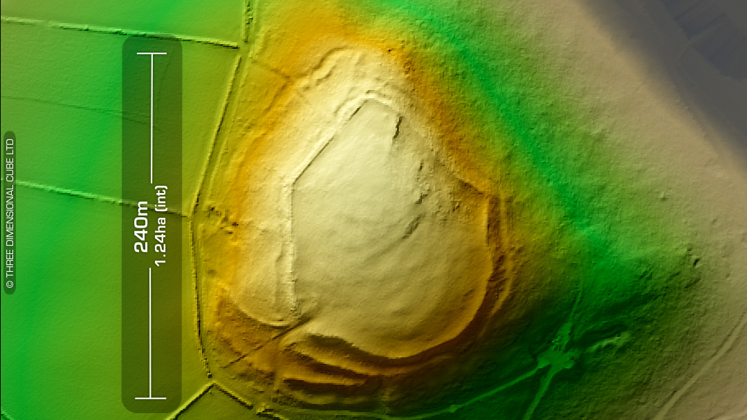
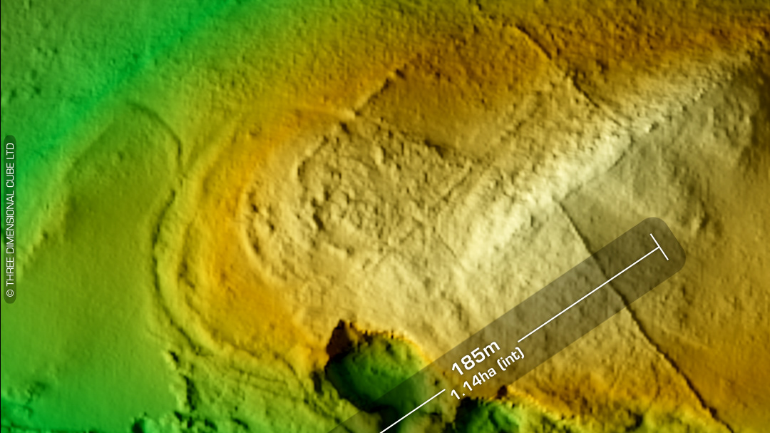
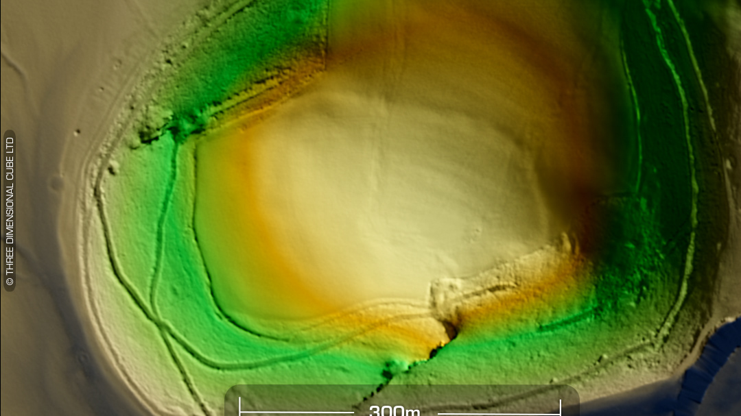
LiDAR – Caer Blaen Minog - Carmarthenshire DTM- (Digital Terrain Model, i.e. No buildings or foliage) Overlooking the (river) Nant Bargod and 1.6km west of the village of Rhos sits the inland promontory fort, Caer Blaen Minog. Site boundaries & defences obscured by forest. Not on 1st Ed OS Map. Owned by Blaenminog Farm Innermost bank is 7m high. East-side entrance. Site survey inc, geophys in 2020 which yielded lots of data (DYFED HER PRN 2280). Various roundhouse platforms, a ring ditch and lots of ‘burnt mounds’ discovered inside & outside the fort. Radiocarbon dating of these external mounds gave a result of circa 2500-1800BC (Bronze Age) which makes them 1500 years older than the fort they are adjacent to. Regarded as one of the finest promontory forts in Wales. (Scheduled monument) Iron Age tribal association (conjecture based on location): Demetae Descriptions from hillforts.arch.ox.ac.uk & Dyfed Archaeological Trust HER. 1st ED OS Mapping via National Library of Scotland. Contains public sector information licensed under the Open Government Licence v3.0.