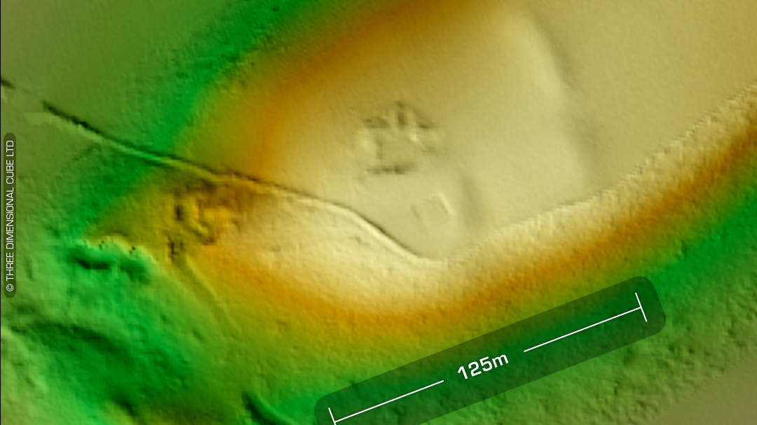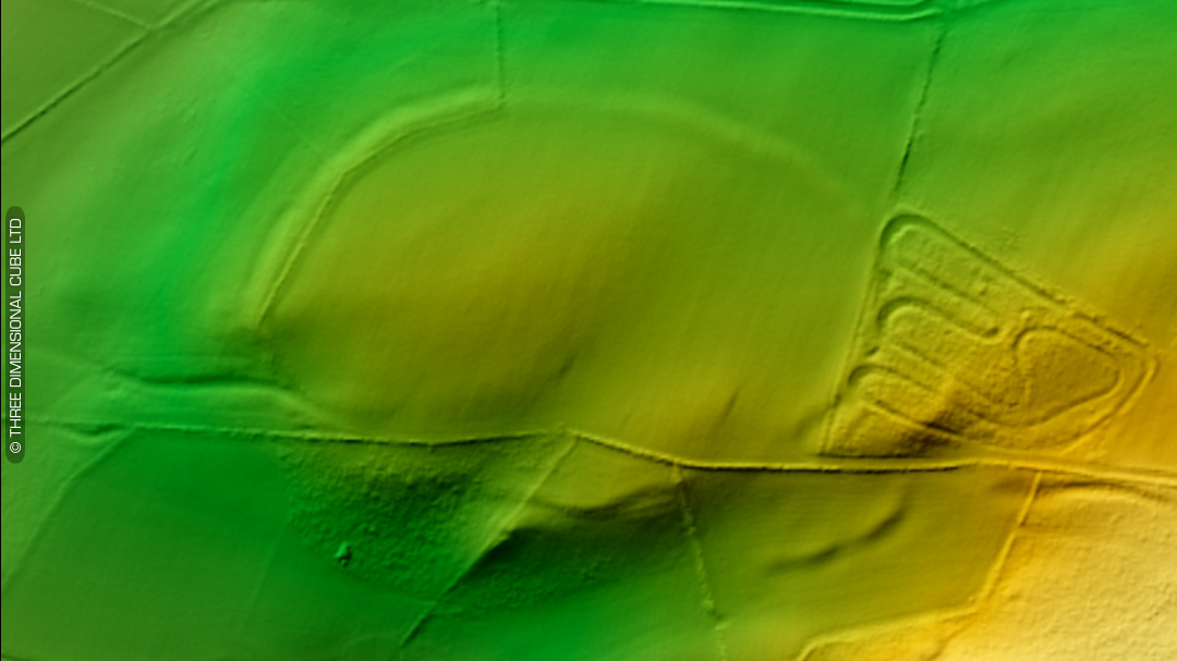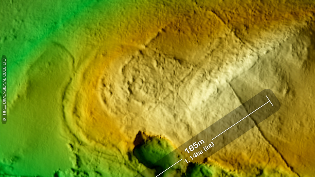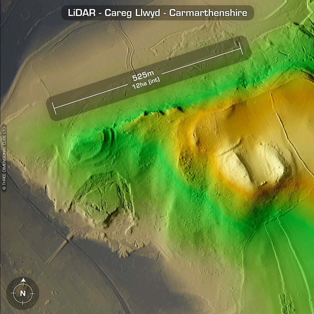
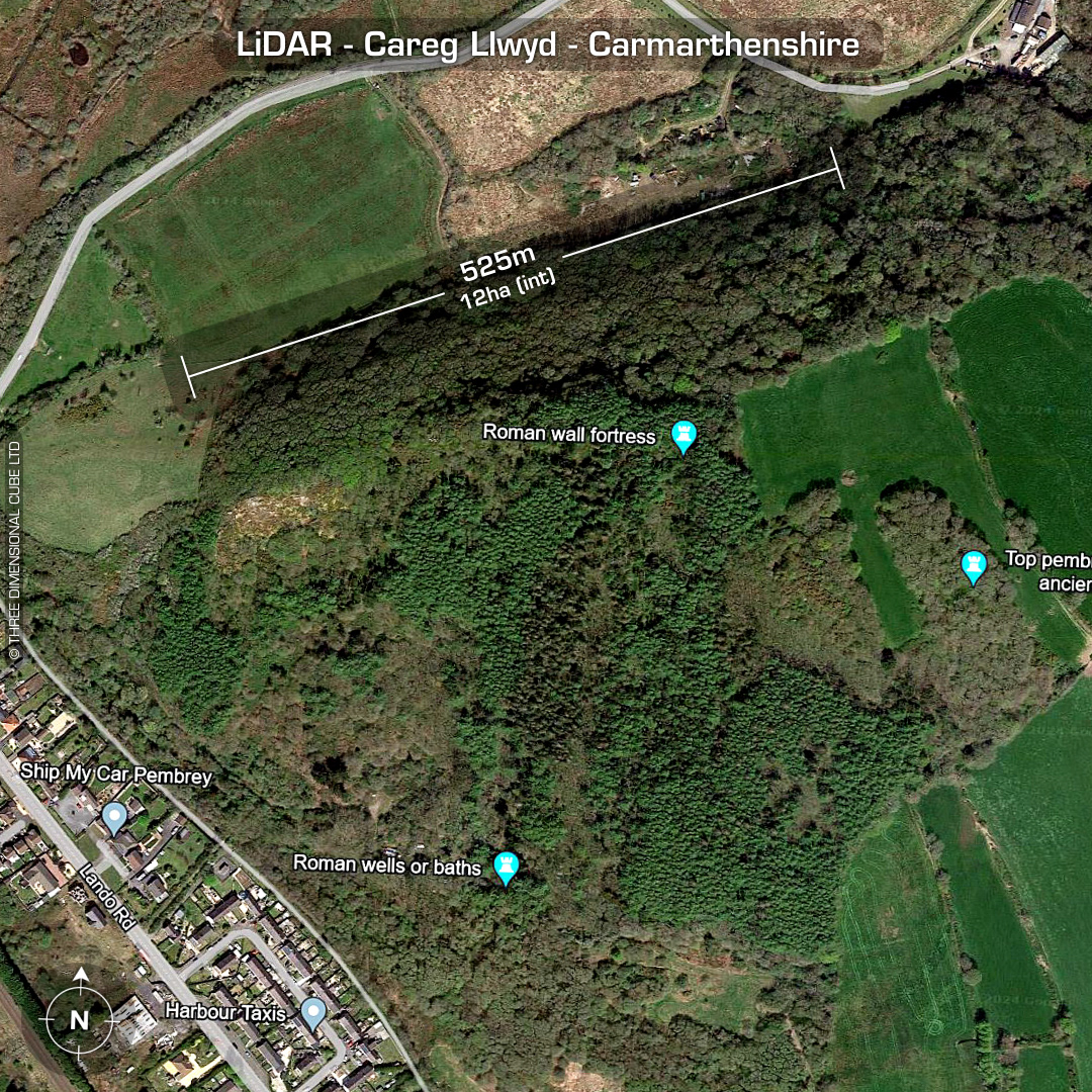
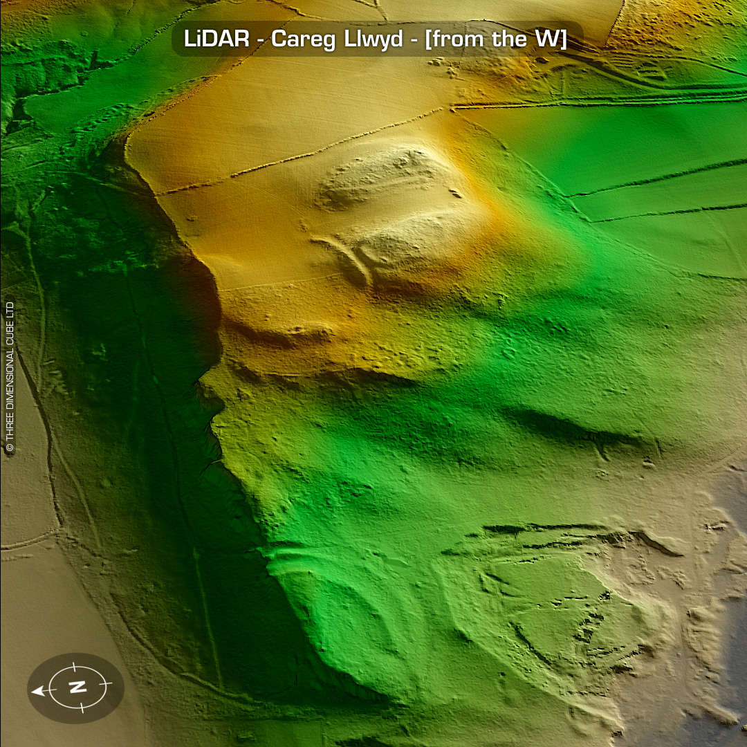

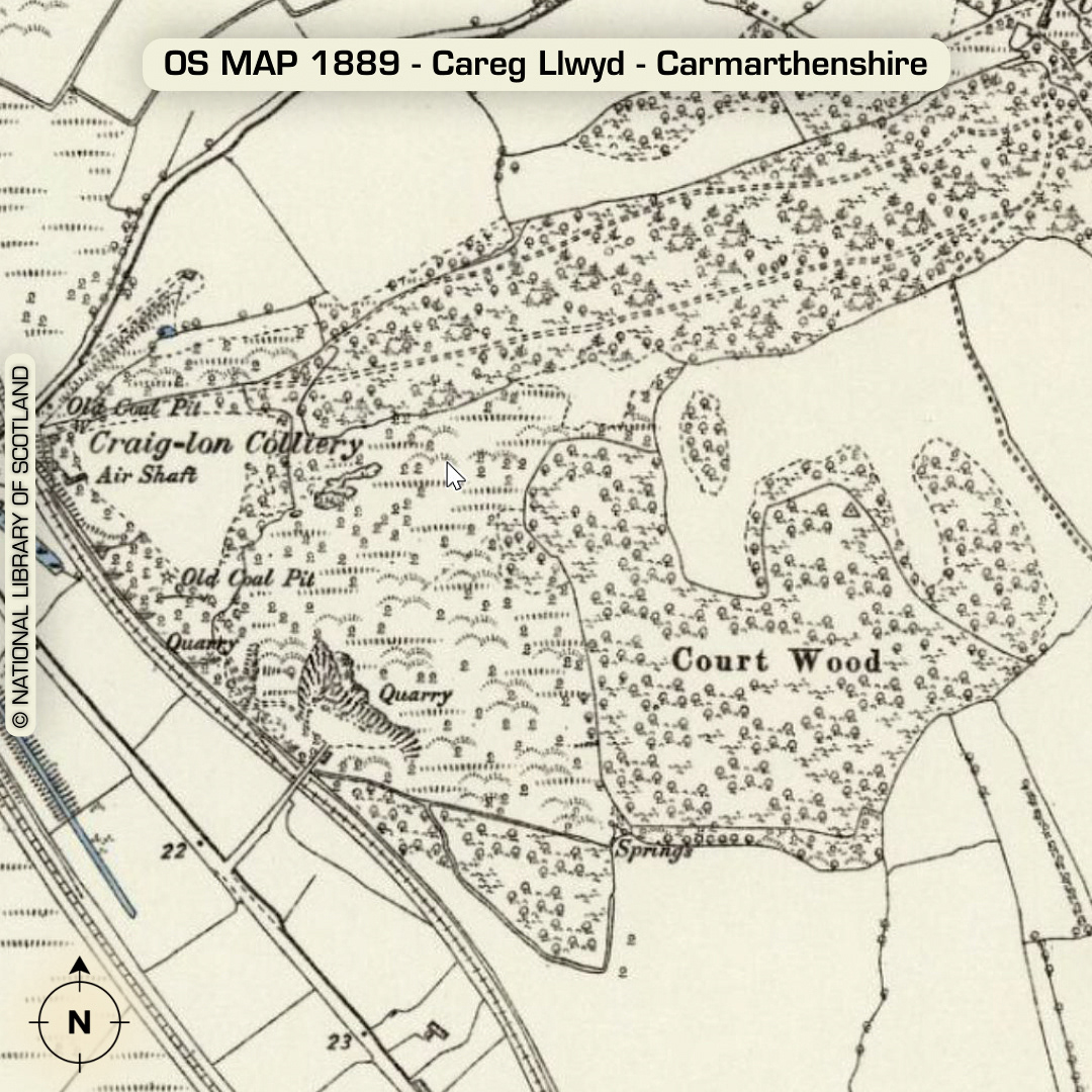
LiDAR – Careg Llwyd - Carmarthenshire DTM- (Digital Terrain Model, i.e. No buildings or foliage) Overlooking the village of Pembrey which is just west of Bury Port lies the very complex multi-phased site of Careg Llwyd (or Garreg Llwyd). The primary bivallate promontory hillfort lies on the west end or the spur. Probable SW entrance. Erosion from weather & heavy quarrying to the south has degraded the site. The quarry has slumped in the last 100 years, as you can see on the LiDAR. Nothing indicated on 1st Ed OS Map. Mind you, as it was a (coal) mining site at the time of mapping I’m sure the pits bosses would have frowned upon anyone pointing out the antiquity of the site they were digging into/around. West of the main site, going uphill lies a 2-part stepped curved rampart/enclosure whose east-side may have been degraded whose name is, Court Wood. DYFED Archaeological trust part-excavated Court Wood in 1977 and found the following: 3 Phase construction. Rectangular arrangement of post-holes with paving. Found below the bank was a sealed layer with occupation debris radiocarbon dated to circa 335BC. Additional square posthole arrangement to the rear of the bank. Possible Roman occupation buried feature. The twin elongated rock features SE of Court Wood indicate a rock-cut avenue with entrance to both sites above. This area is named, Coed Y Marchog. (Scheduled monument) Iron Age tribal association (conjecture based on location): Demetae Descriptions from Dyfed Archaeological Trust HER. Contains public sector information licensed under the Open Government Licence v3.0.