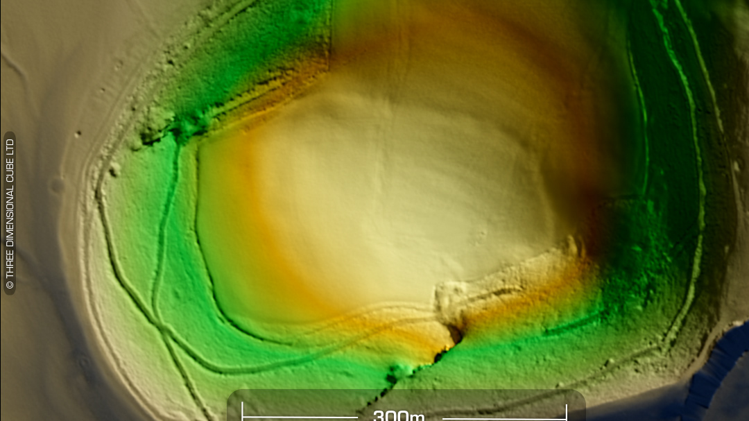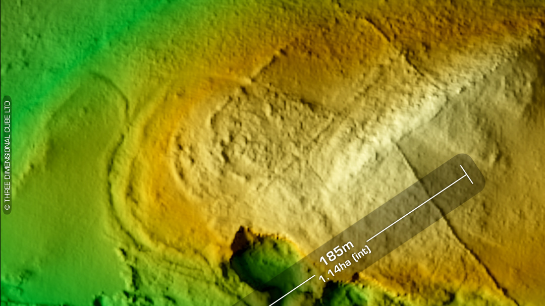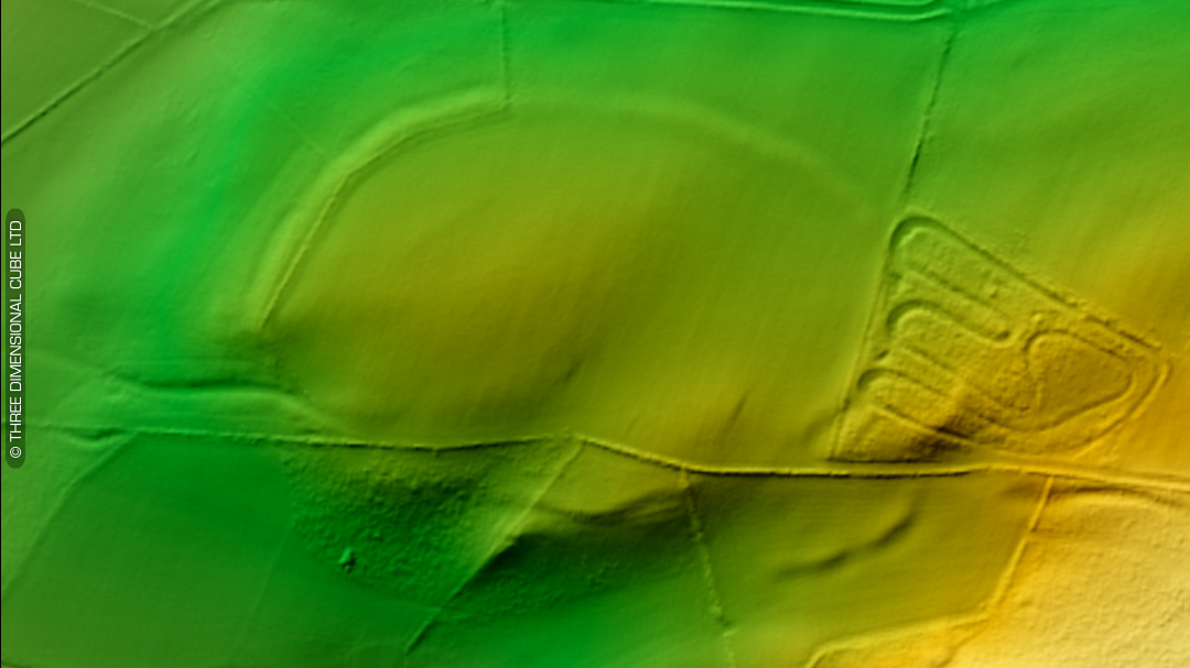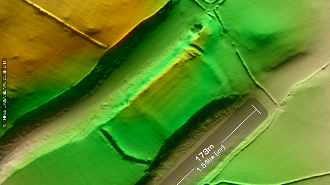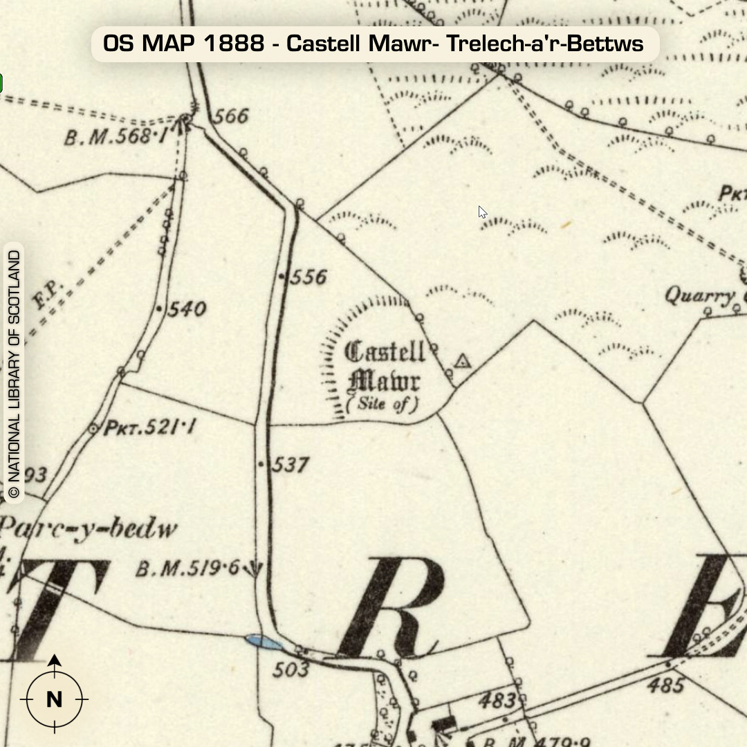
LiDAR – Castell Mawr- Trelech-a’r-Bettws - Carmarthenshire DTM- (Digital Terrain Model, i.e. No buildings or foliage) At the peak of a summit 1.5km NE of the village of Llanwinio lies the hexagonal univallate ‘defended enclosure’, Castell Mawr- (Trelech-a’r-Bettws). This site is almost identical to the one I discovered (and has since been verified) opposite the Dinosaur Park just to the northwest of Tenby last year. This site may have a possible outwork or annex running in an arc to its south. West side entrance. Heavily degraded by ploughing. Now to pasture. Last site visit in 2014 No recorded excavations or finds, hence undated. (Scheduled monument) Iron Age tribal association (conjecture based on location): Demetae Descriptions from Dyfed Archaeological Trust HER. Contains public sector information licensed under the Open Government Licence v3.0.