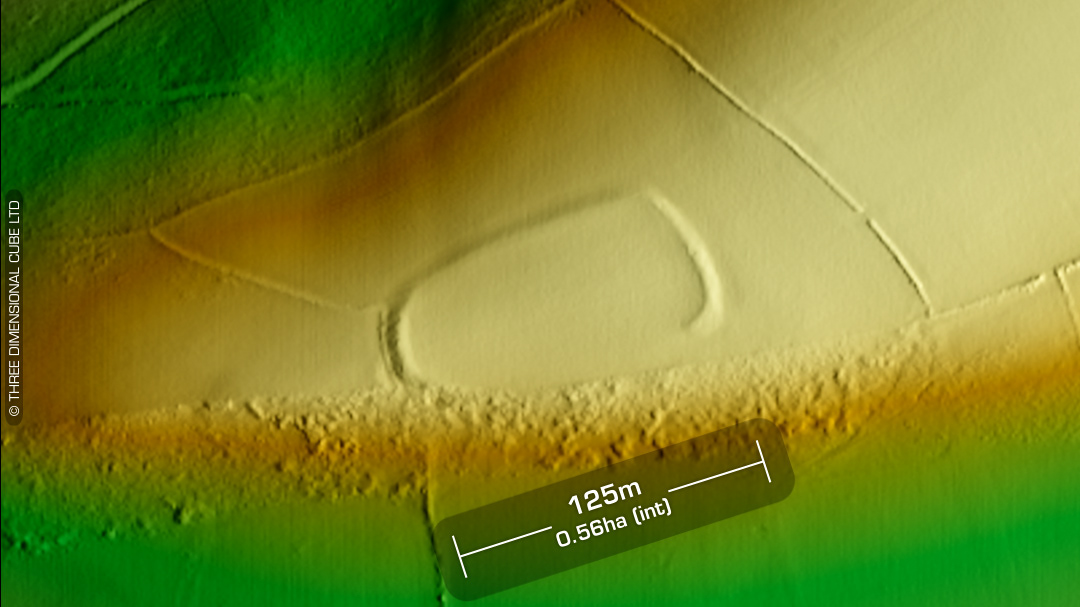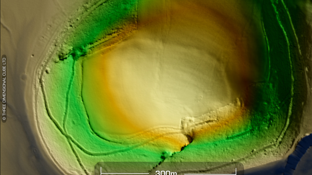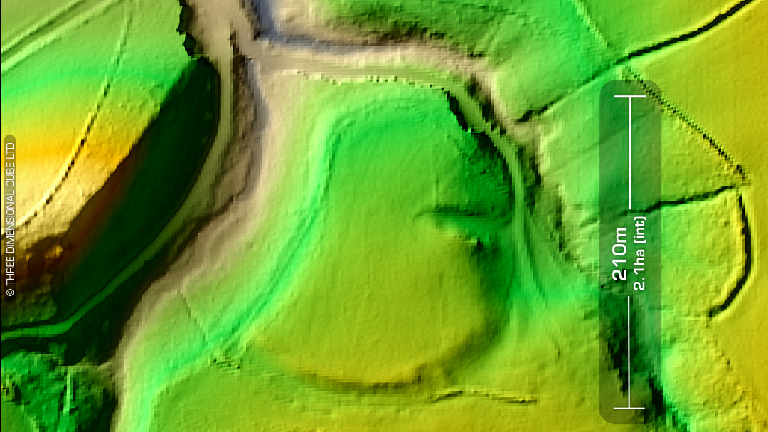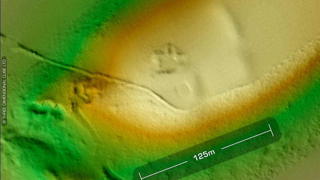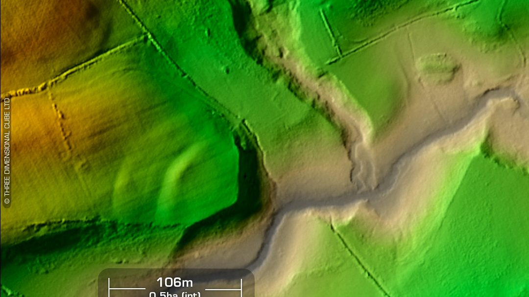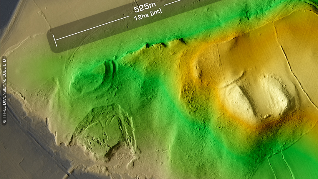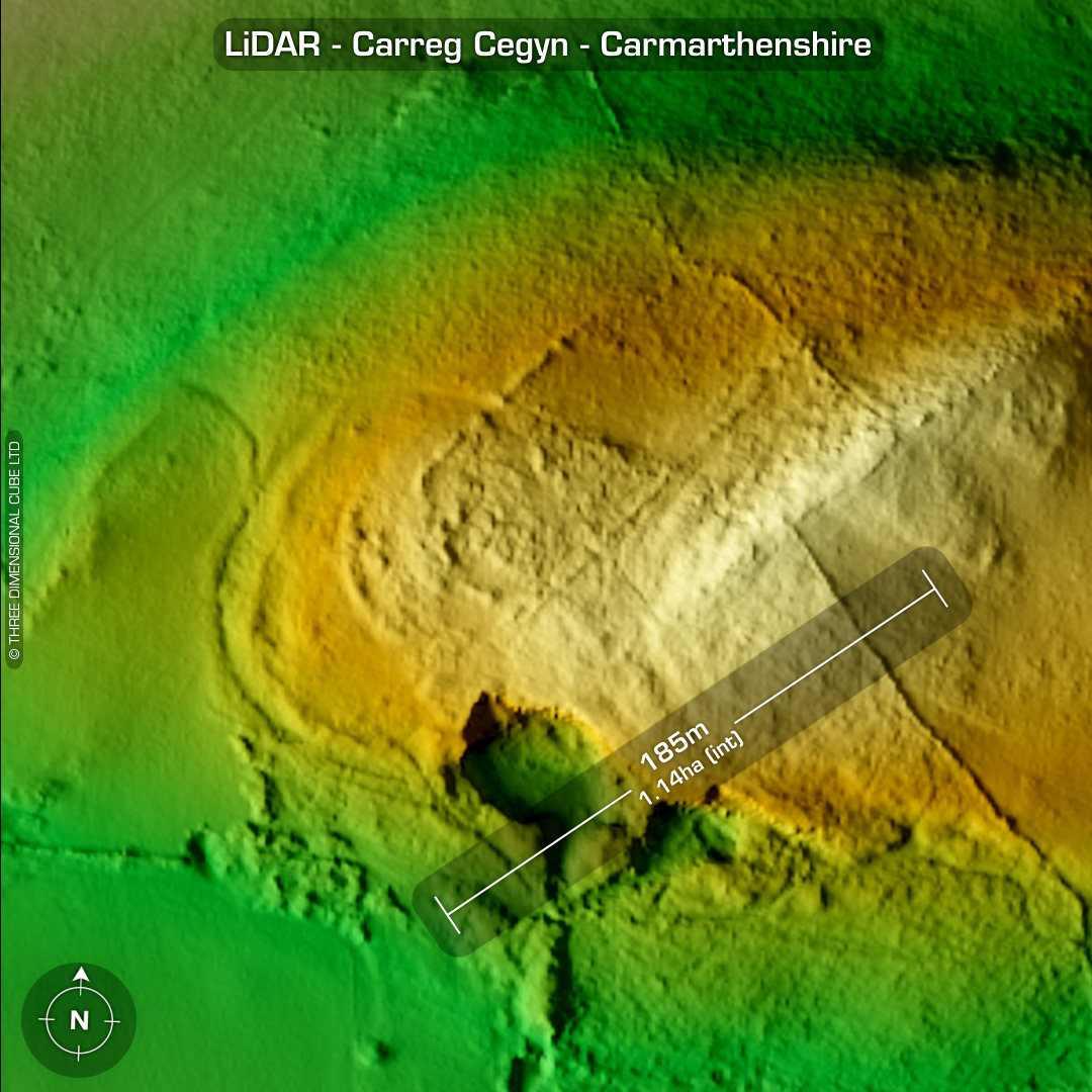
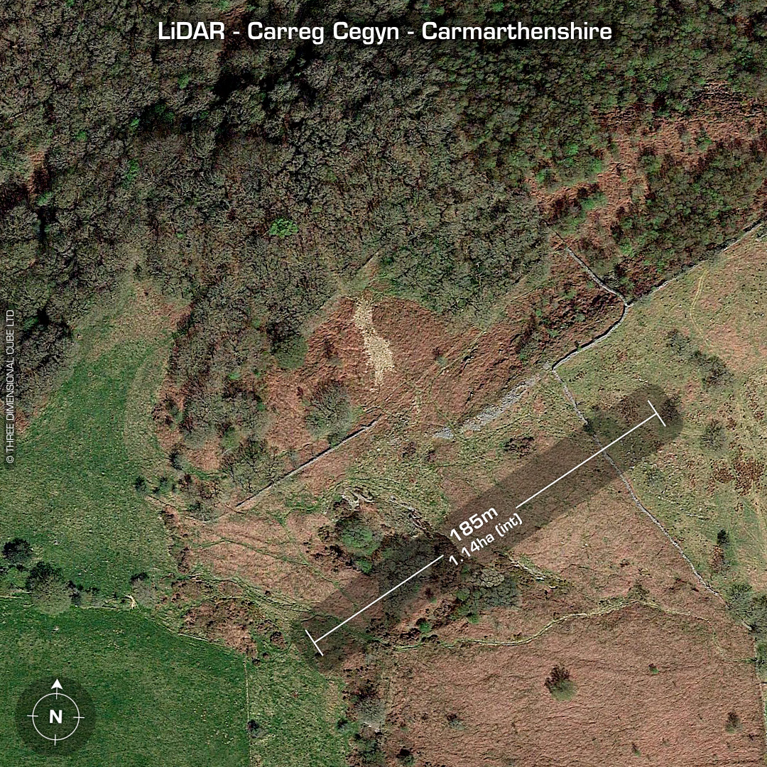
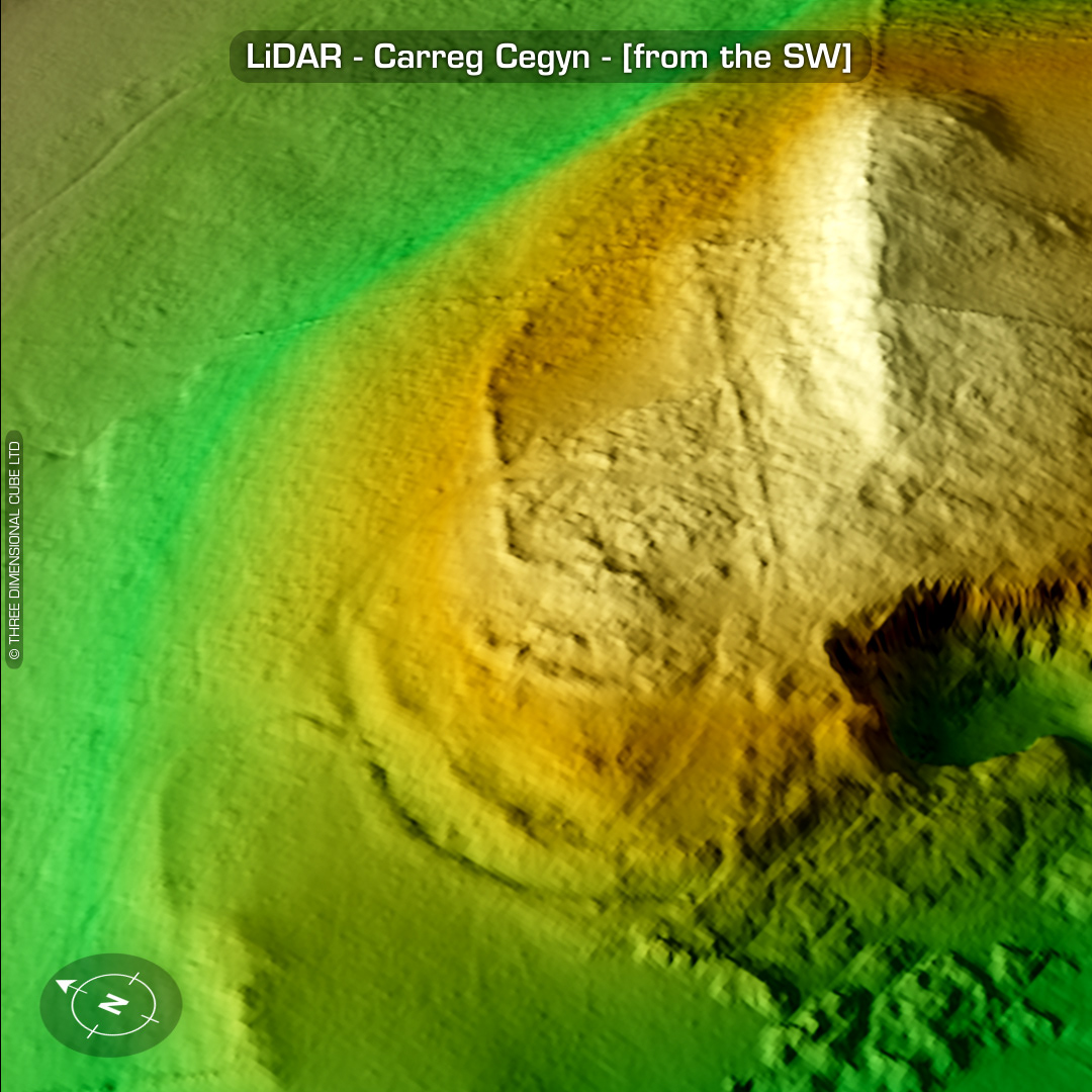
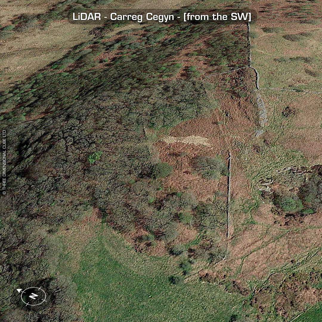
LiDAR – Carreg Cegyn - Carmarthenshire DTM- (Digital Terrain Model, i.e. No buildings or foliage) 2.3 Km SW of the village of Bethlehem sits the complex site of Carreg Cegyn. Site consists of a sub-circular heavily defended enclosure and an overlying rounded rectangular site. Site degraded by quarrying on the south-side. Guaranteed the field boundary walls were built from the ramparts/hut platforms! No recorded excavations or finds, hence undated. (Scheduled monument) Iron Age tribal association (conjecture based on location): Demetae Descriptions from Dyfed Archaeological Trust HER. Contains public sector information licensed under the Open Government Licence v3.0.