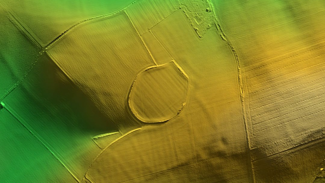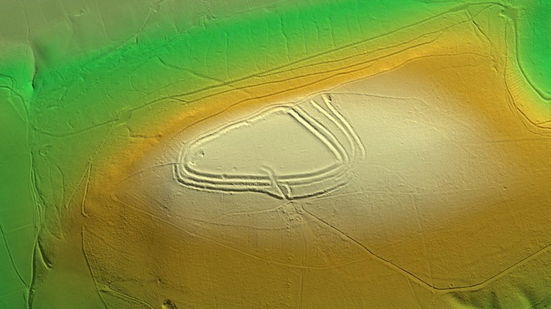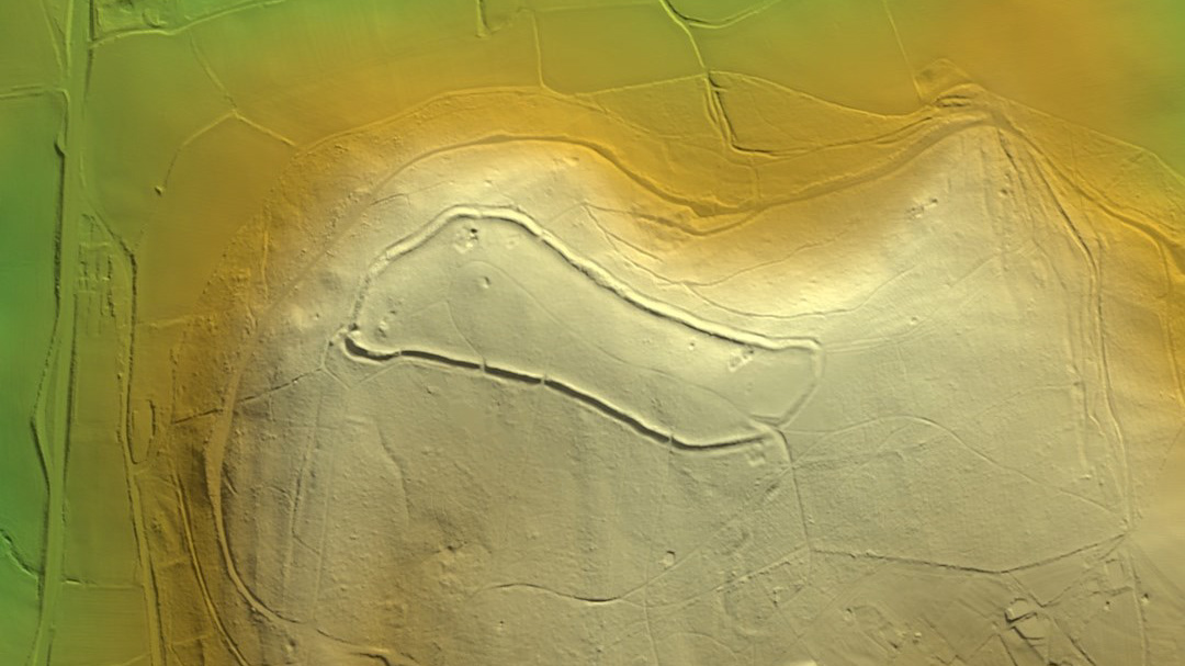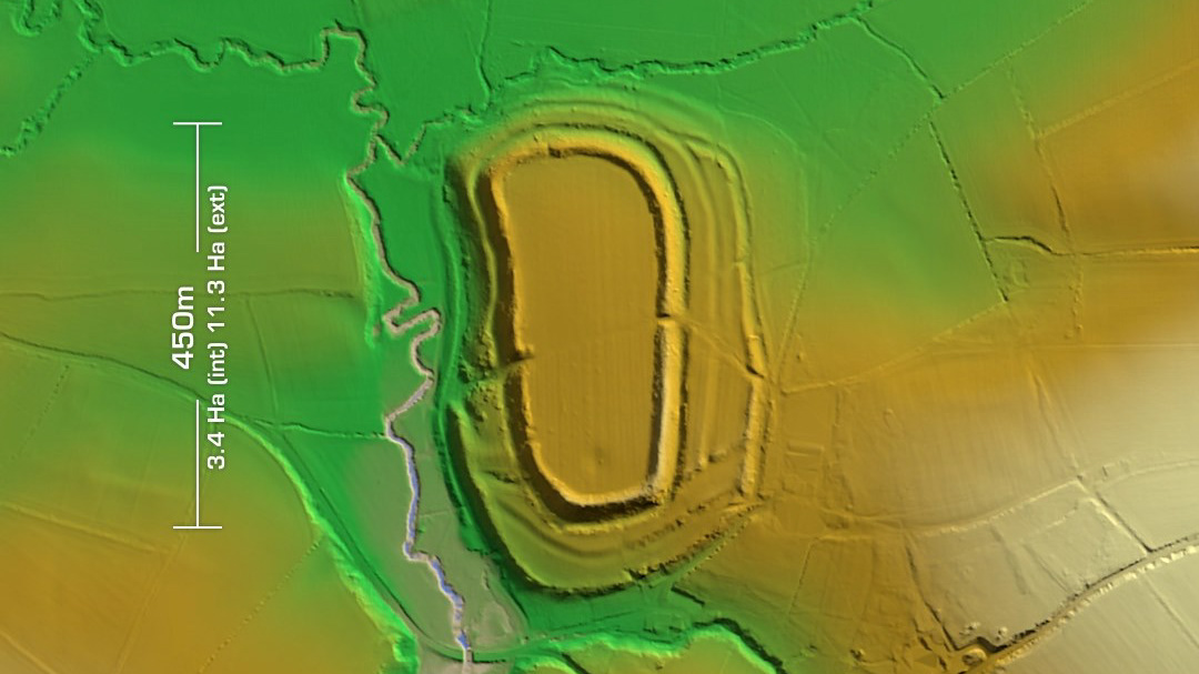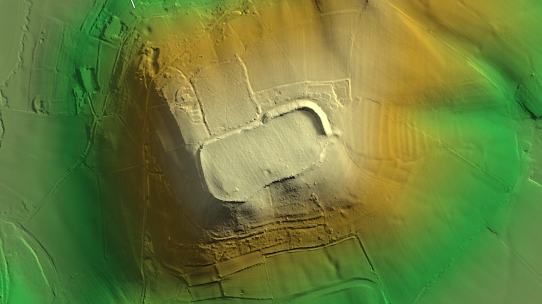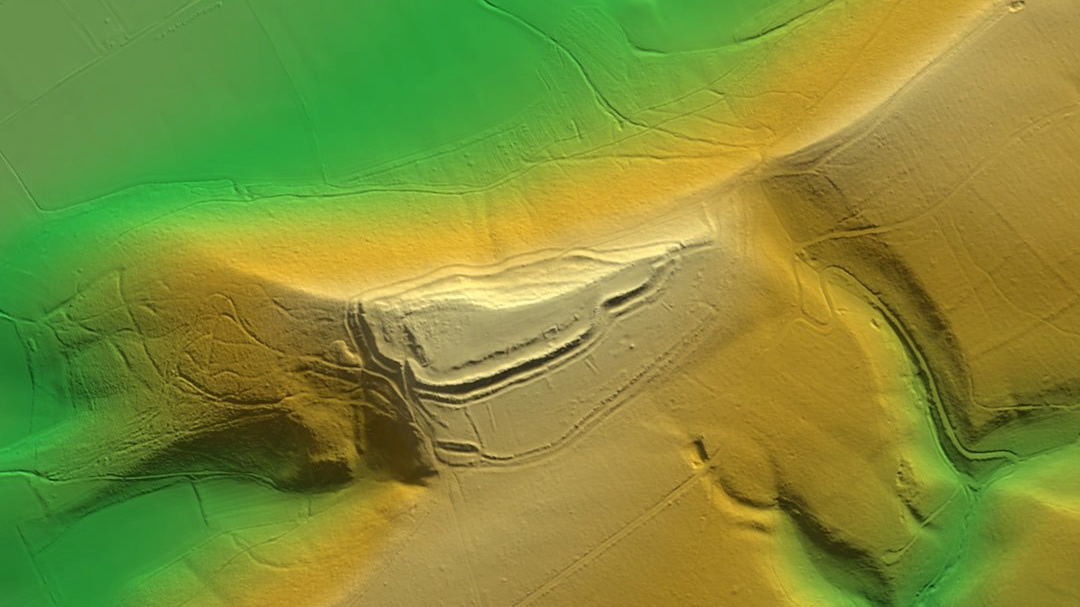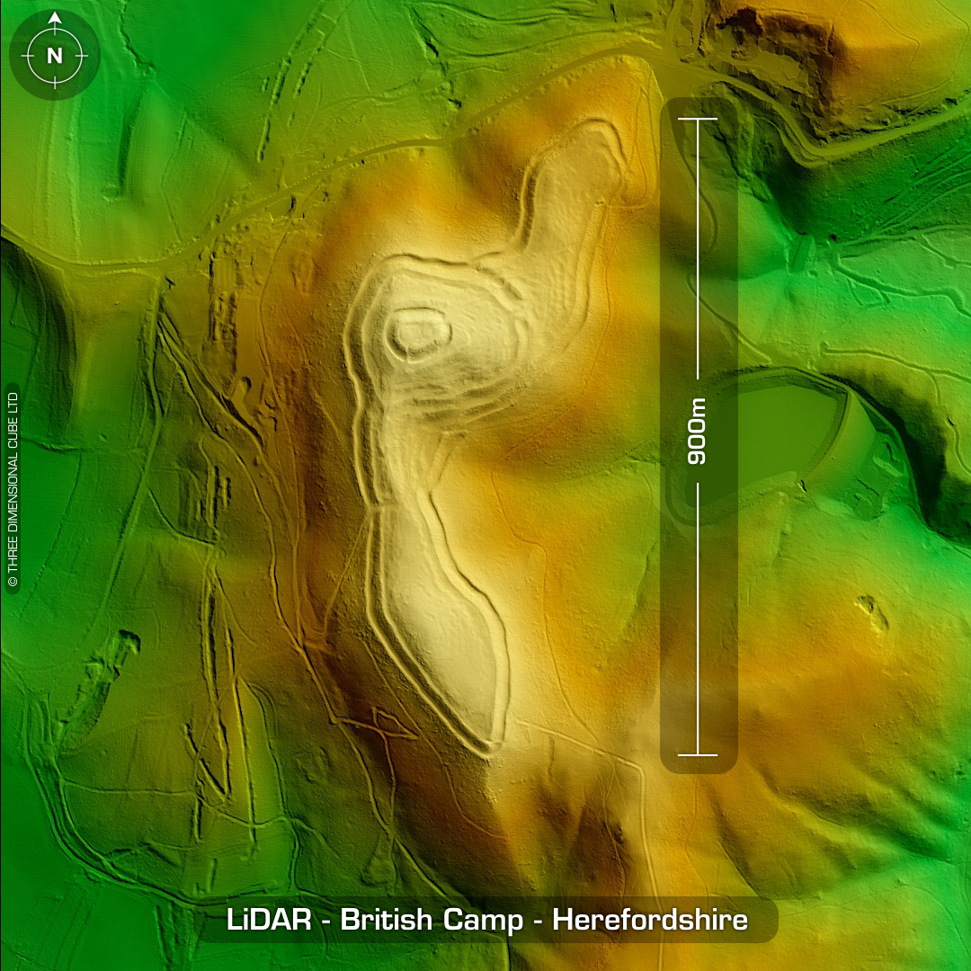
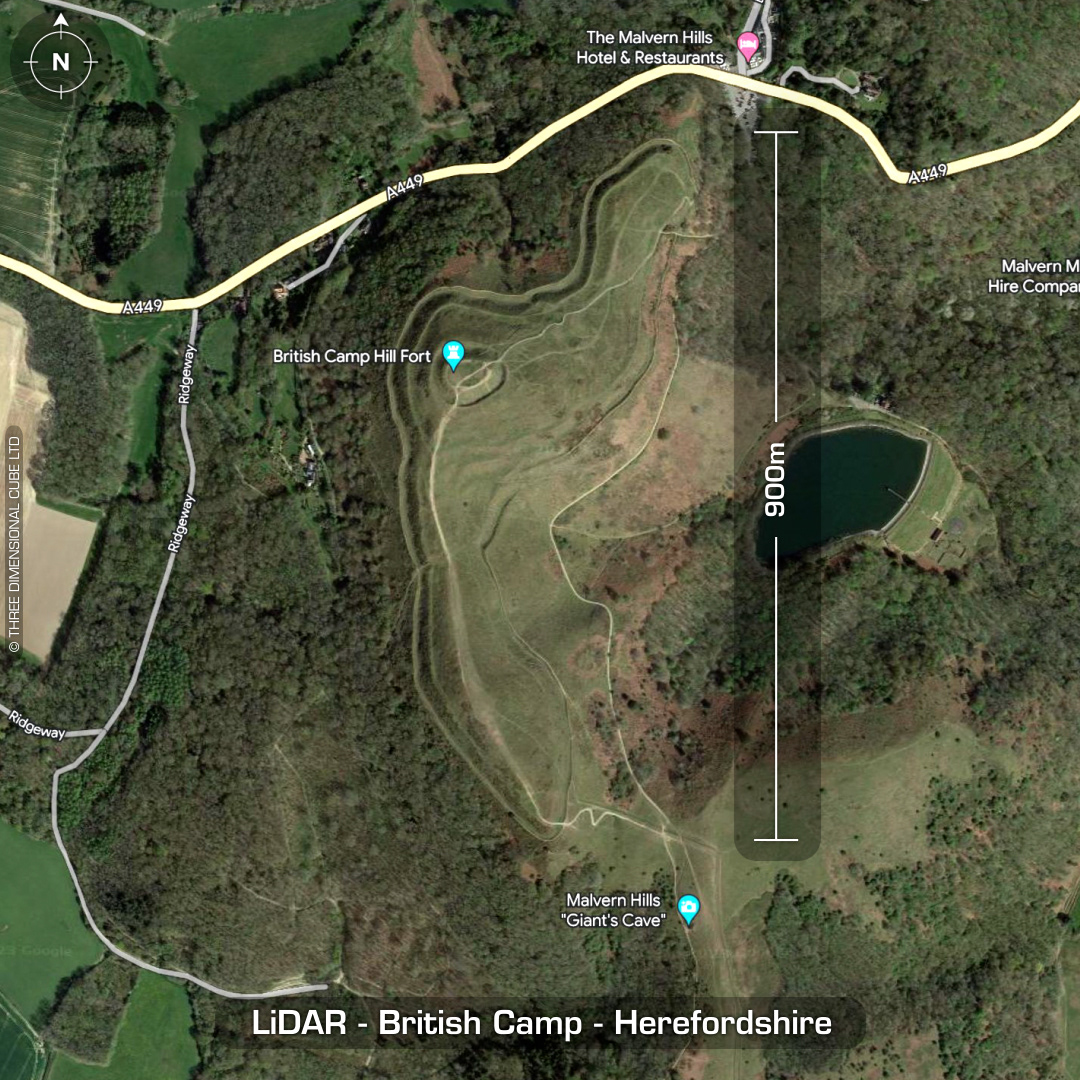
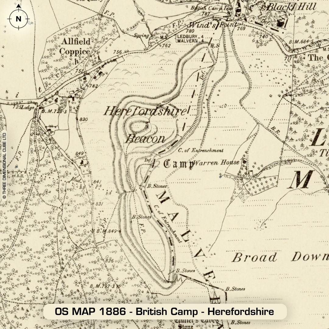
LiDAR – British Camp – Herefordshire DTM- (Digital Terrain Model, i.e. No buildings or foliage) Head east from the town of Ledbury along the A449 into the Malvern Hills and you will find one of the finest hillforts in the country, British Camp. Minimal excavation in 1879. 1999 survey found three phased construction. 118 hut platforms identified. Re-use post Roman from the Norman conquest to 14th century. Medieval ringwork denoted by the large circular feature. 1st written reference in Aubrey’s Monumenta Britannica in 1665. (Scheduled Monument)