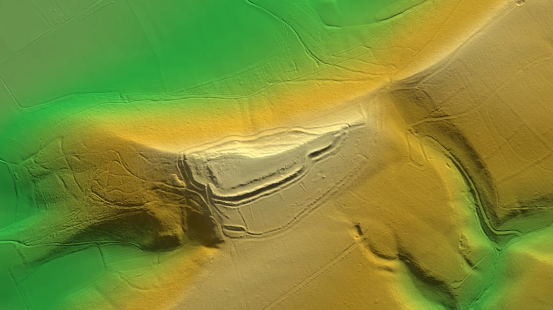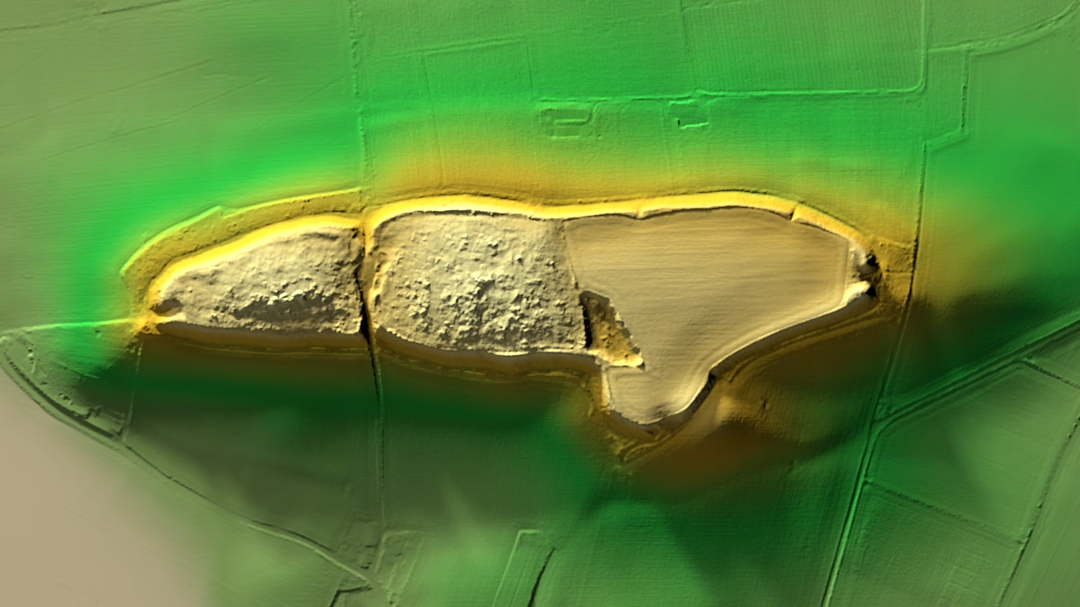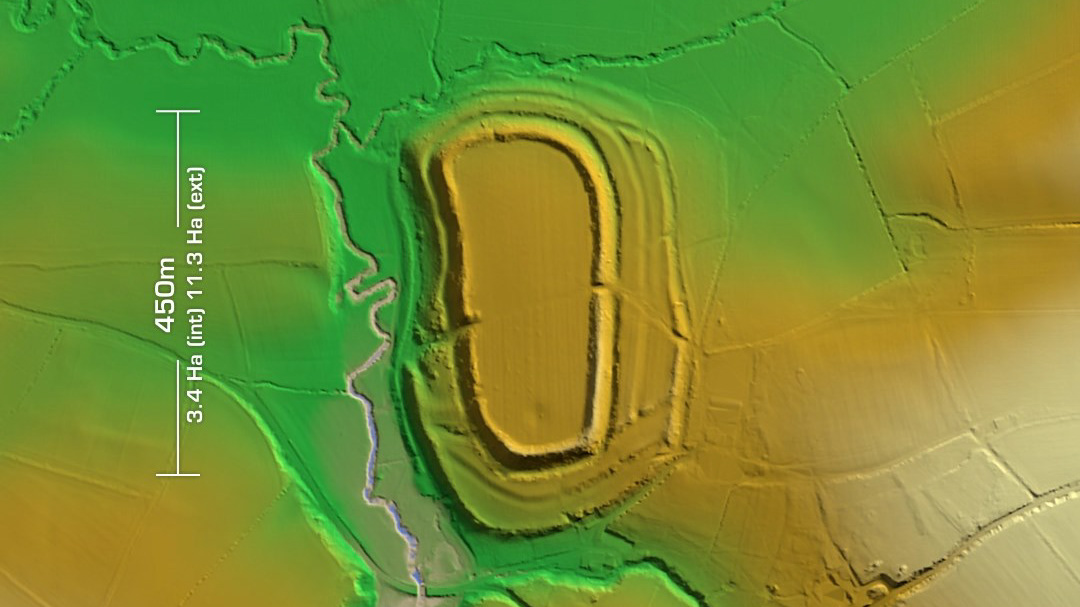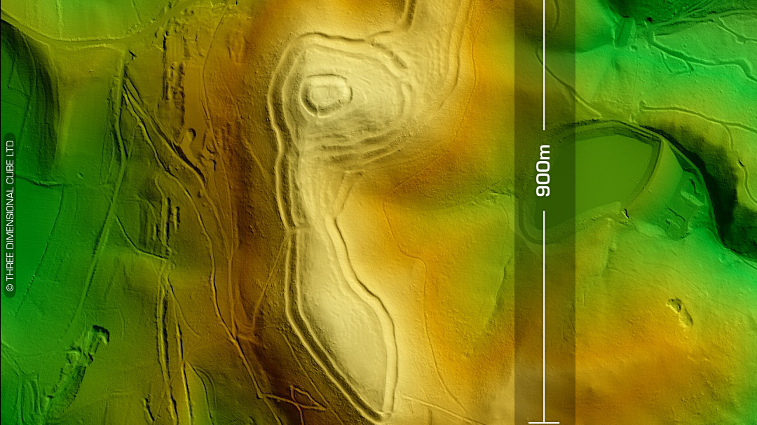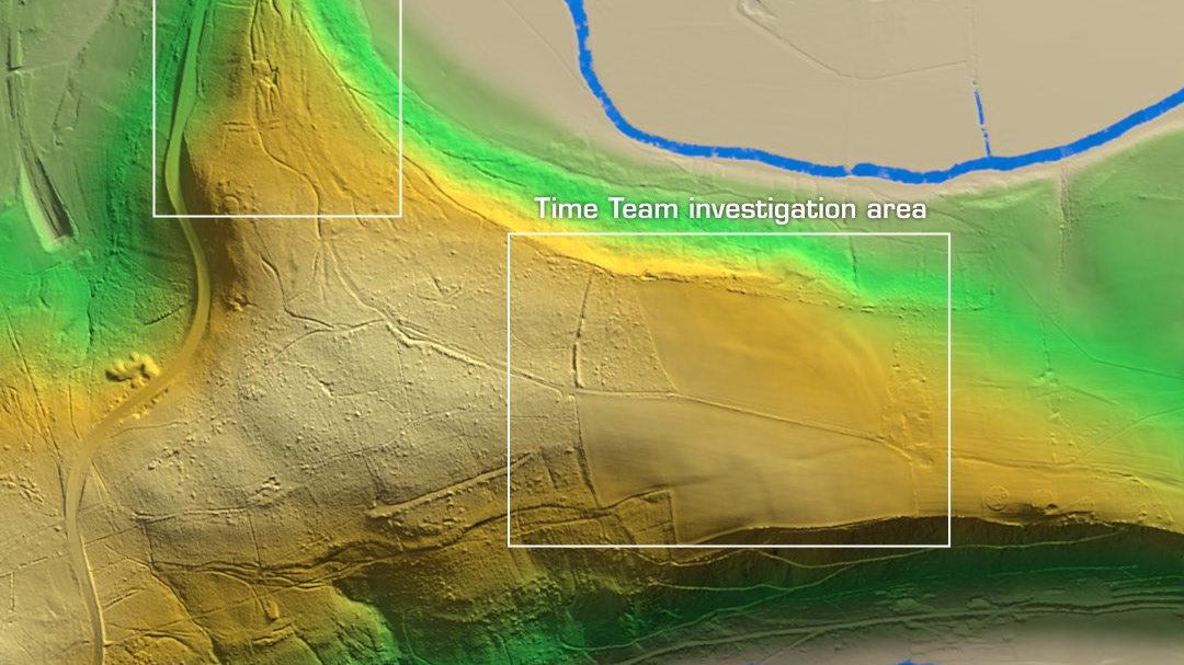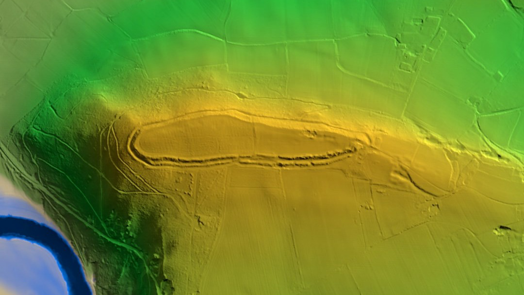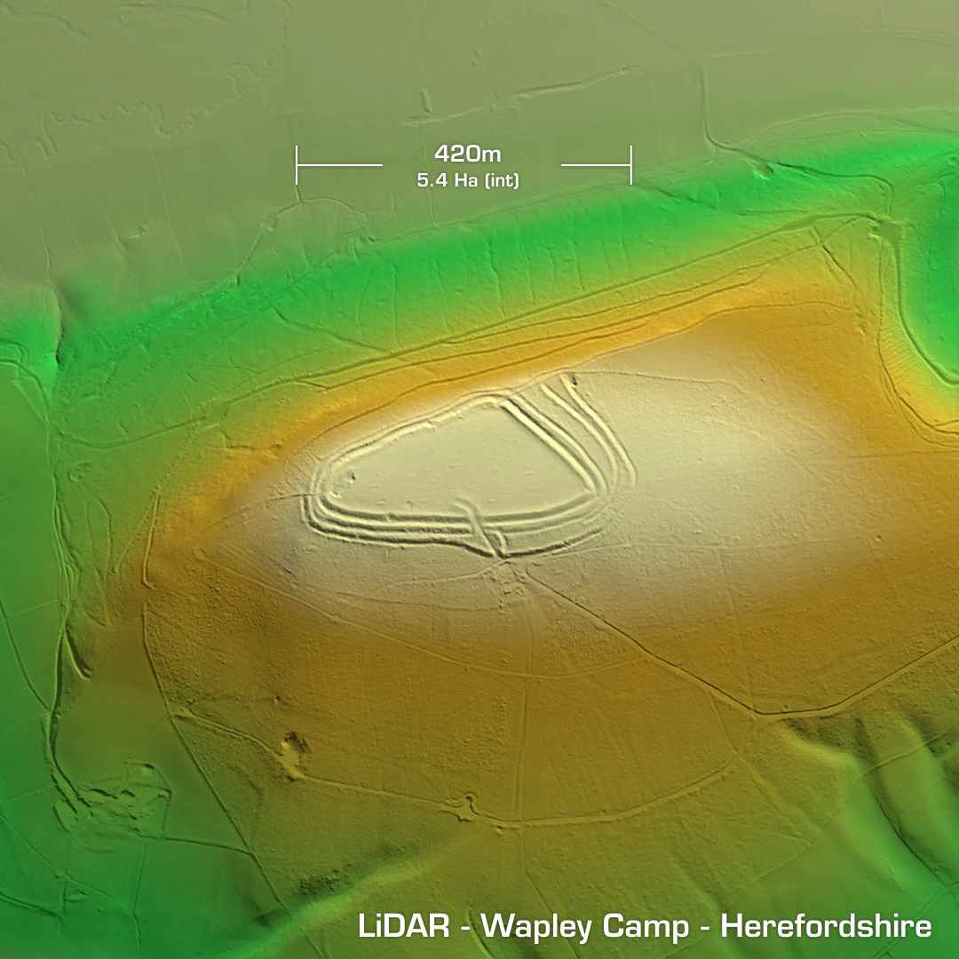
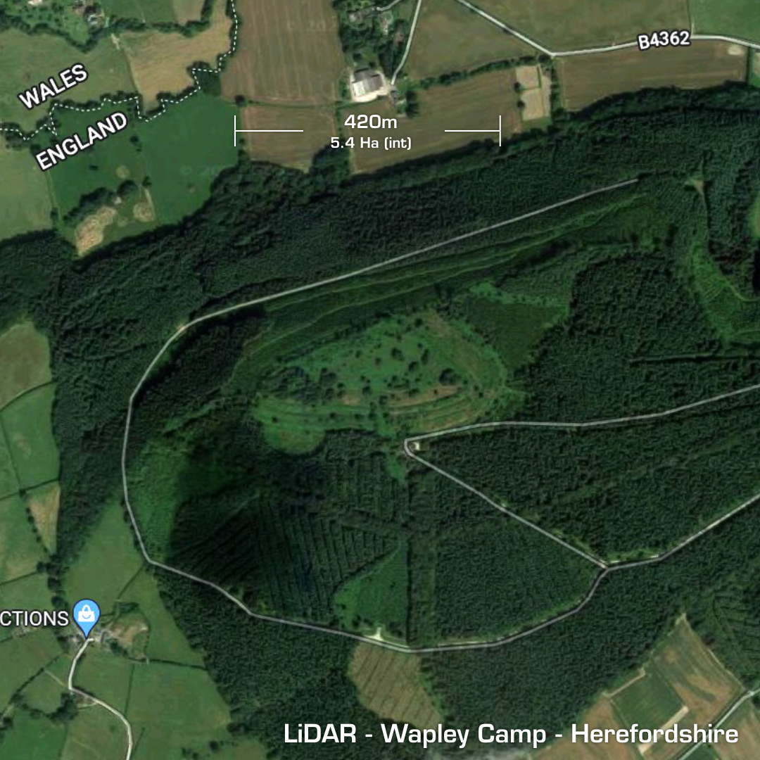
DTM- (Digital Terrain Model, i.e. No buildings or foliage) Just to the west of Shobdon, Herefordshire and adjacent to the border with Wales lies the triangular contour hillfort, Wapley Camp. The Forestry Commission owns the site, which is now cleared from trees. The online documentation says the site contains three ‘pillow mounds’; made in medieval times for the breeding of rabbits, but I count at least six on the LiDAR. Apparently, the people who oversaw these mounds for the rabbits fur & meat were called ‘Warreners’. There was also a recent quarry in the interior (west-end). No excavations but age attributed to the morphology of the site. Iron Age tribal association (conjecture based on location): Silures/Cornovii/Dobunni (un-scheduled monument)