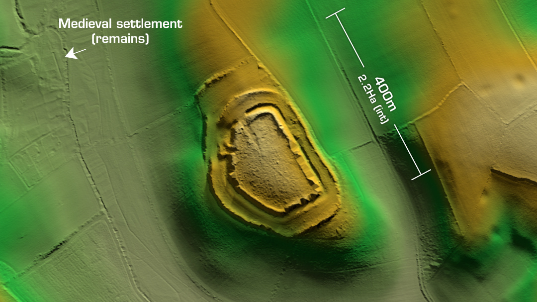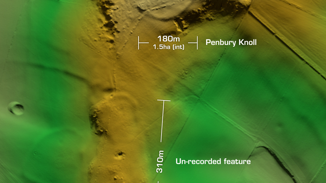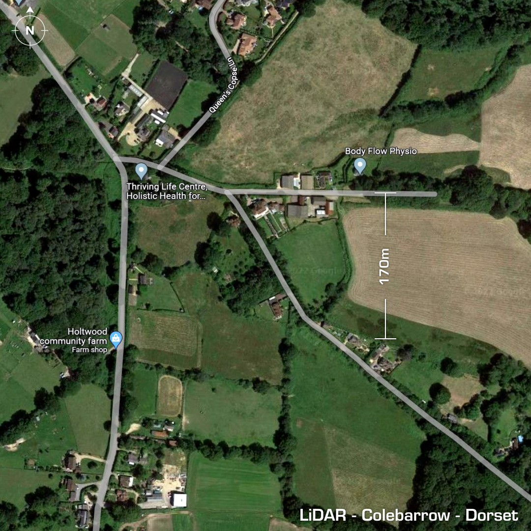
DTM- (Digital Terrain Model, i.e. No buildings or foliage) Just to the east of Holt Wood and straddling two roads and two fields lies the (possible) pentagonal hillslope fort, Colebarrow. The site has also been interpreted as a henge. First illustrated in 1600AD by Richard Hardinge on a map of Holt Forest. A subsequent map in 1774 by William Woodward illustrates an oval enclosure. Farm buildings and private residences now populate the site. No excavations hence no dating evidence. The name may denote a burial mound that once occupied the site. (Un-Scheduled Monument) Iron Age tribal association (conjecture based on location): Durotriges [Any descriptive text is attributed to the Atlas of Hillforts & Wikipedia websites and any associated archaeological descriptions online which will be credited accordingly.]