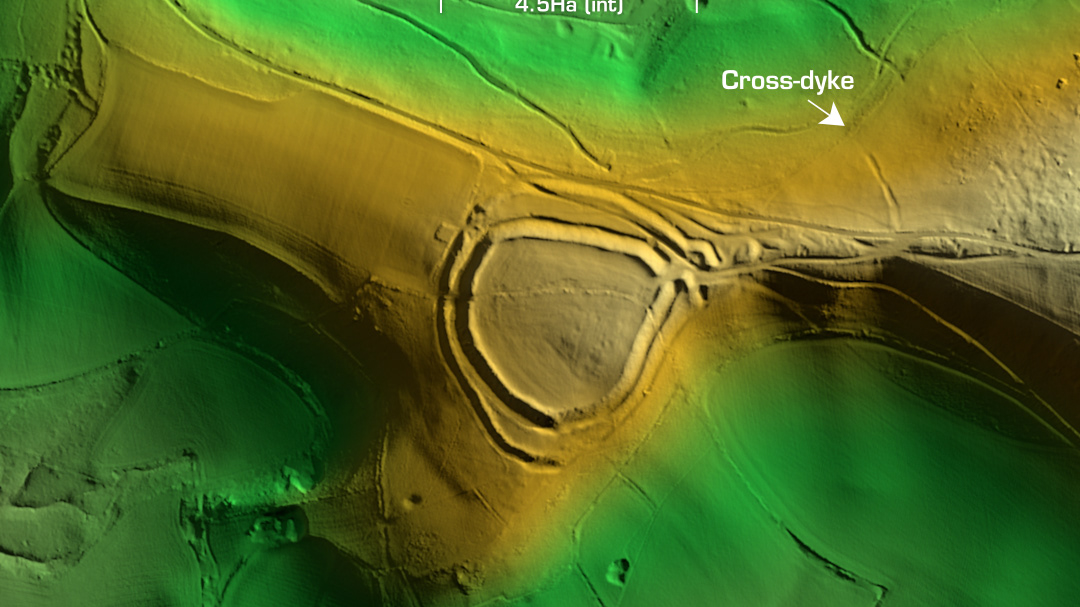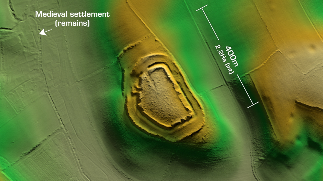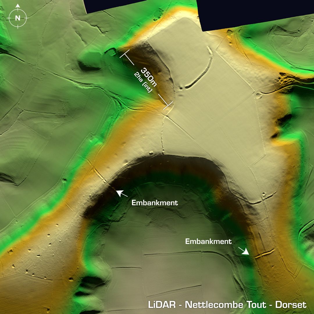
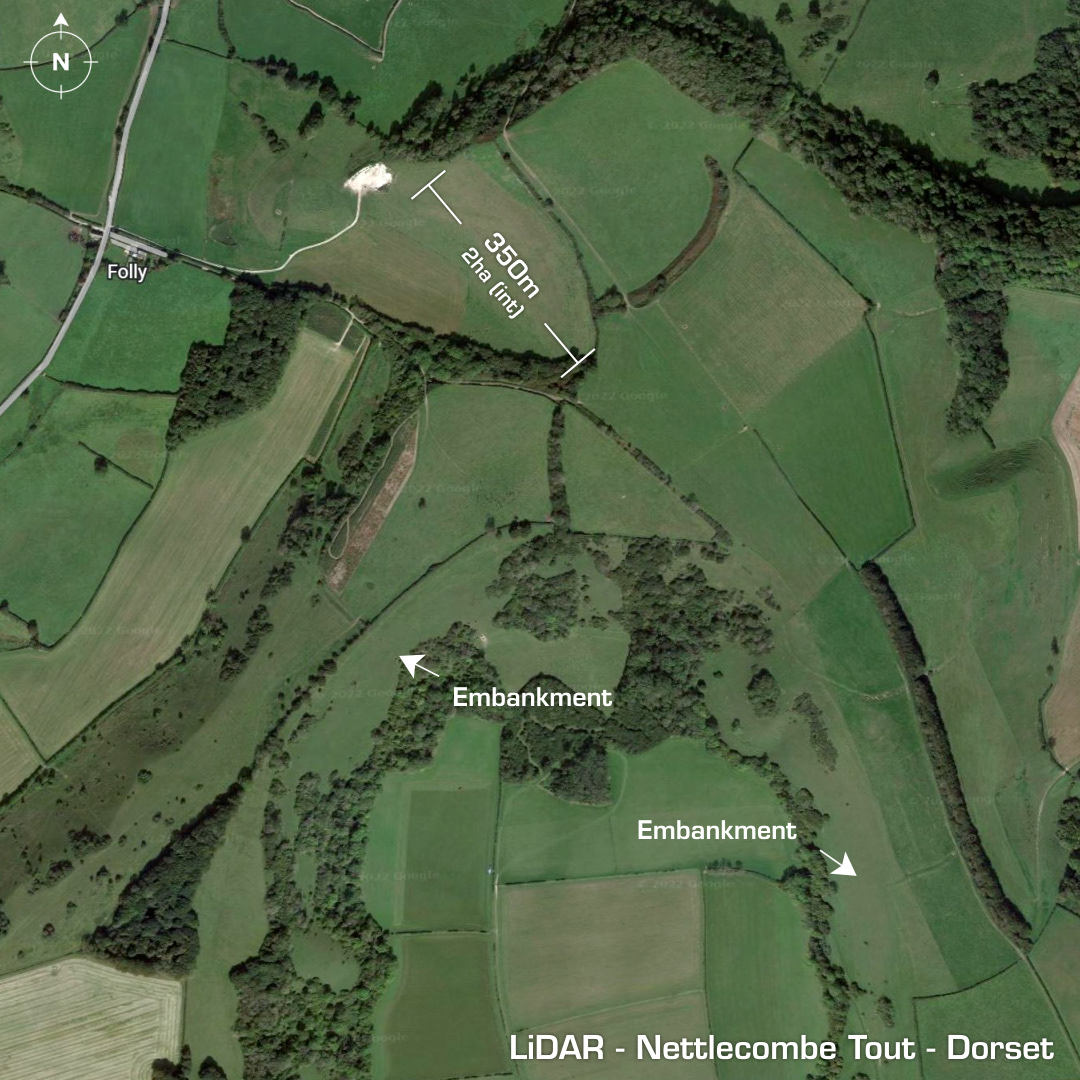
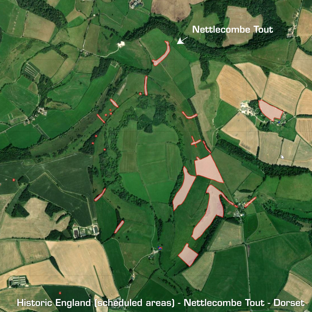
DTM- (Digital Terrain Model, i.e. No buildings or foliage) Less than a km to the northwest of Higher Melcombe lies the inland promontory fort, Nettlecombe Tout. A massive bank protects the main fort area but the approaches along each hill top are guarded by embankments. Site degraded by ploughing. If the whole horseshoe shaped hilltop site does lie within the guarding embankments that would mean at least a 6-hectare settlement. I’ve included a screengrab of Historic England site’s scheduling areas for the area. You can clearly make out the embankments all around the hill approaches as well as various barrows & ancient settlements. It looks like there will be plenty to discover here when funds become available for excavations and further investigations but as it stands, the site remains undated. (Scheduled Monument) Iron Age tribal association (conjecture based on location): Durotriges [Any descriptive text is attributed to the Atlas of Hillforts & Wikipedia websites and any associated archaeological descriptions online which will be credited accordingly.]