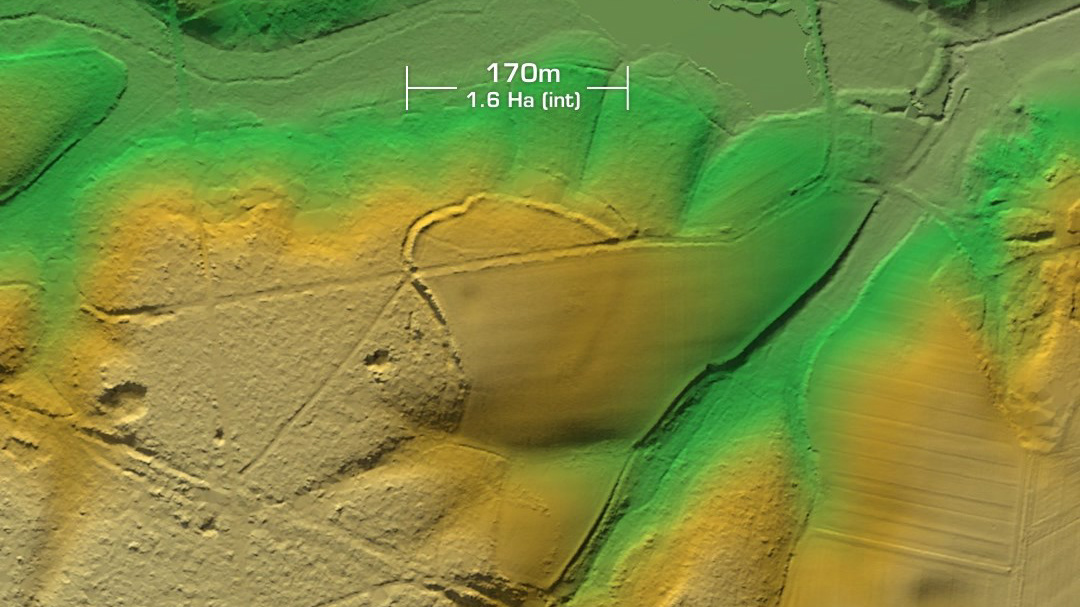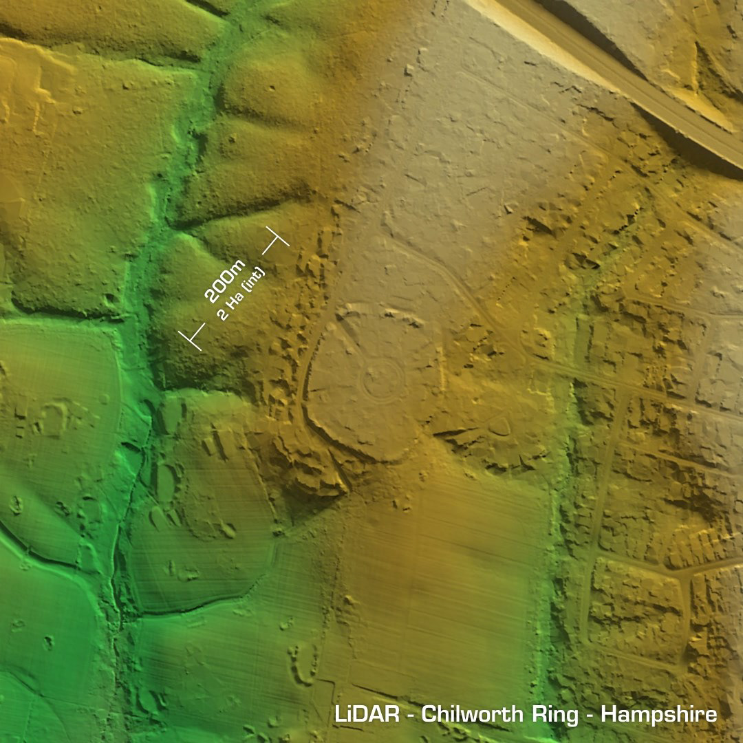
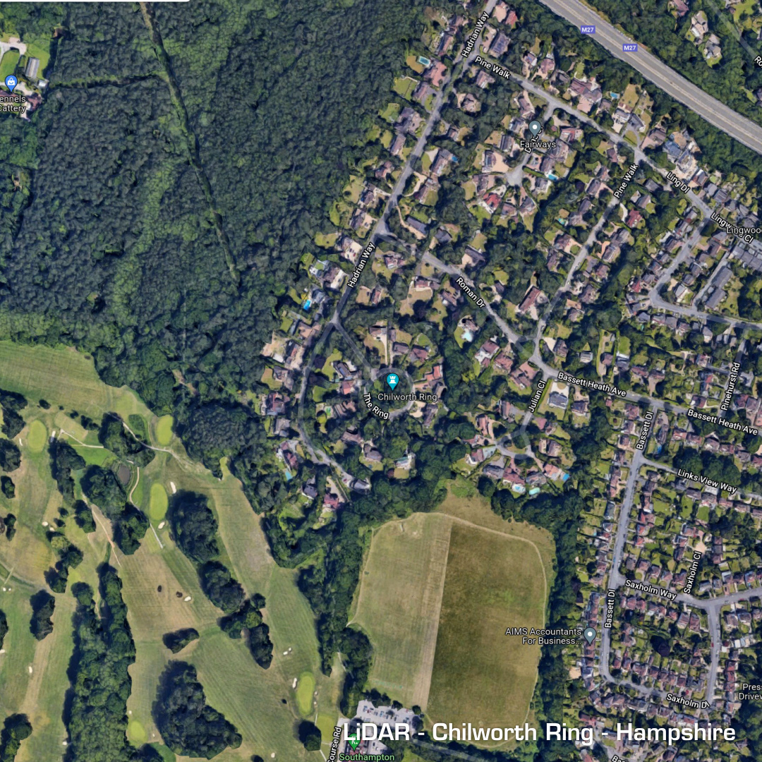
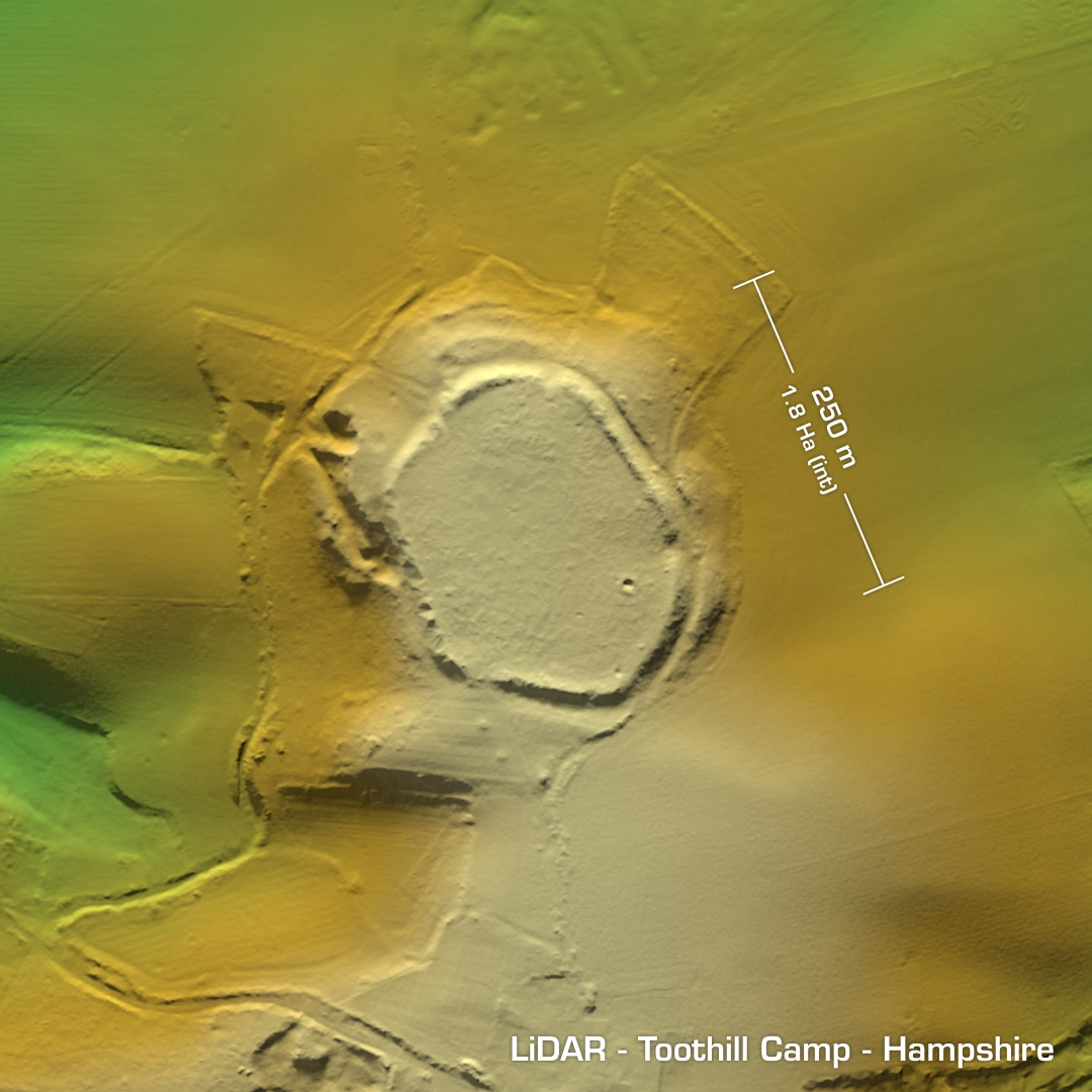
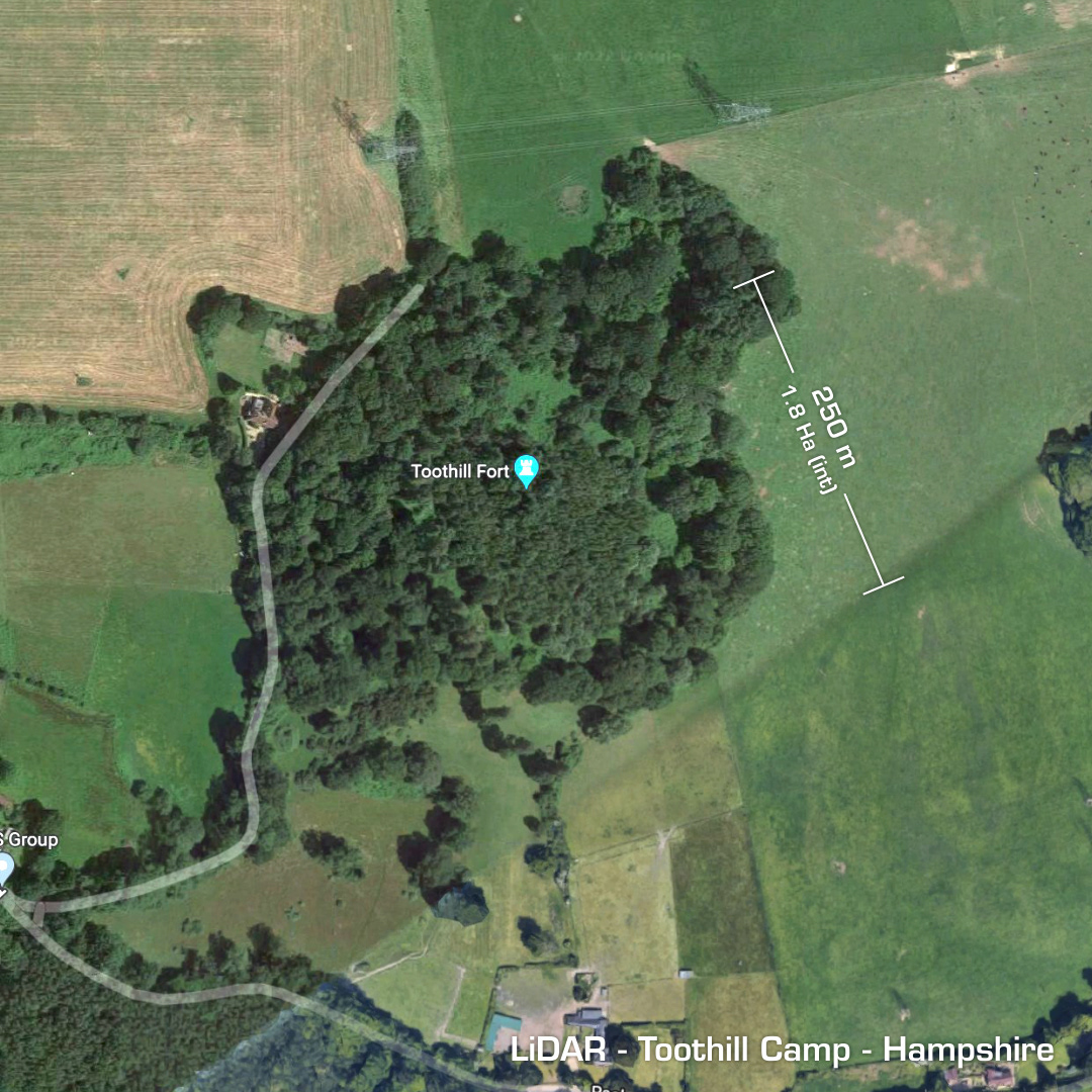
DTM- (Digital Terrain Model, i.e. No buildings or foliage) Just leaving Southampton to the north directly above Southampton’s golf course but before passing the M27 lies the destroyed univallate contour hillfort, Chilworth Ring. A ring of 1970’s-80’s houses within a housing estate now occupy the site. Some planning councillor is still the proud owner of a large swimming pool for signing that off… Minor excavation in 1928 found neolithic or early Iron age finds. Last investigation in 1983, probably before walking off-site shaking their heads while the diggers moved in. On the same LiDAR tile is the univallate contour hillfort, Toothill Camp. This site is located just to the northeast of Romsey Golf Club just above the M27 and a few miles east of Chilworth Ring. The Golf club paid for a survey in advance of proposing its inclusion to their range. Finds include Bronze Age spearheads and later old maps recorded the site as a Beacon (Totehill Beacon (sic)) which dates back to the medieval period. Iron Age tribal association (conjecture based on location): Belgae or Regni. (Scheduled monument but a bit late now for Chilworth Ring)