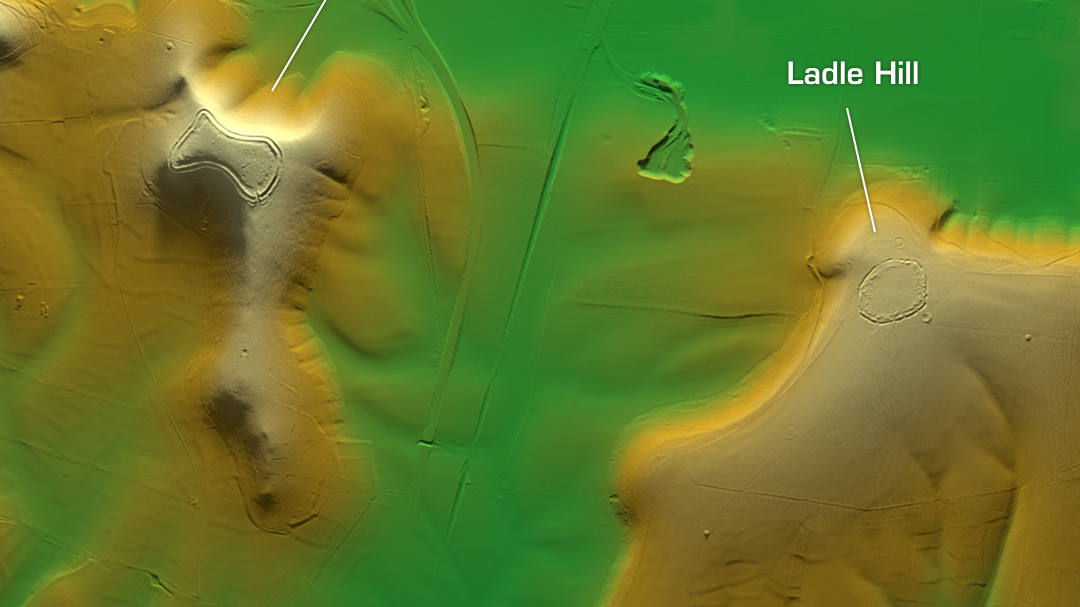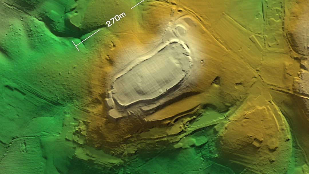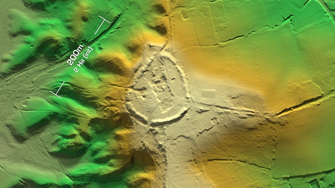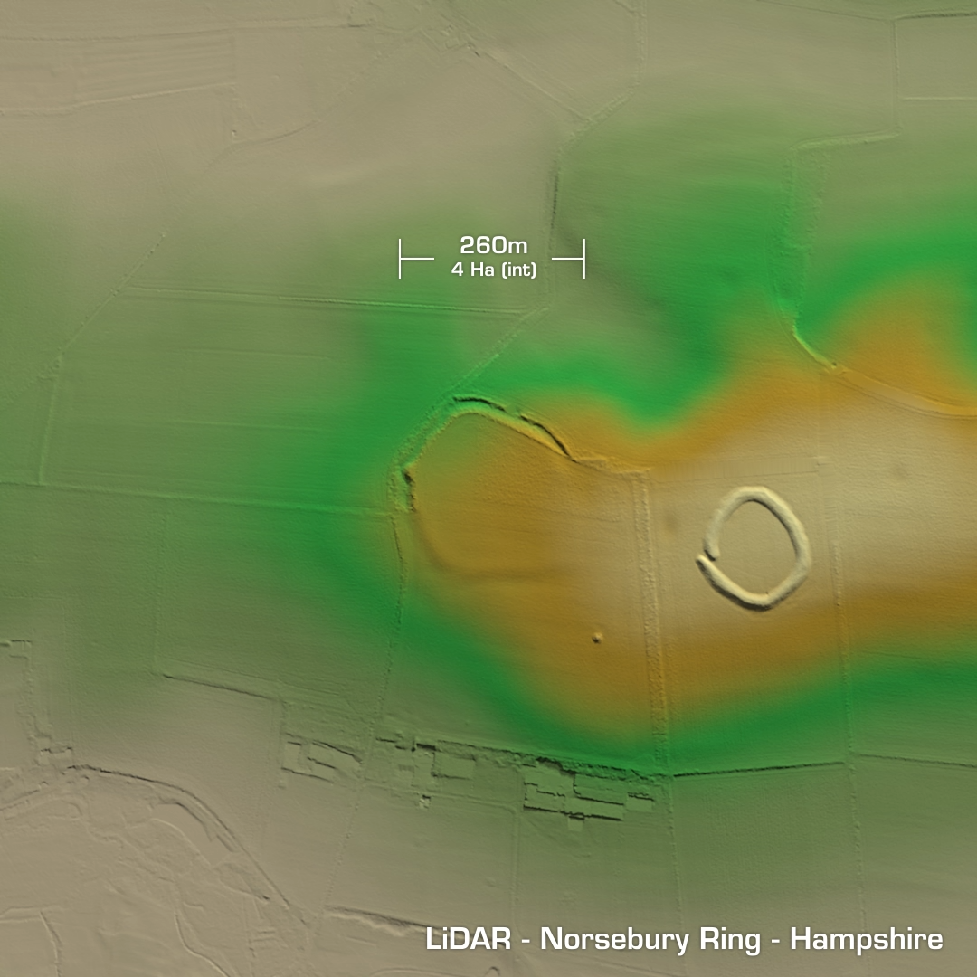


DTM- (Digital Terrain Model, i.e. No buildings or foliage) Just west of the A34 as it passes the A303 in Hampshire lies the univallate contour hillfort, Tidbury Ring. 1st test excavation in 1927 but the records were lost. In 1974 aerial investigations revealed two rectangular outlines, which could mean a Roman villa or temple. Two coins displaying Constantine, 306-337 AD were found. Site now ploughed-out and degraded. Just to the north of Stoke Charity, Hampshire is the heavily degraded univallate partial contour hillfort, Norsebury Ring. First documented in 901 AD as Naesan Byrig (Old Camp). Fieldwalks in 1979 found Bronze Age, Iron Age & Roman pottery. Post medieval pottery was also recovered. So essentially this site has been in use from the Bronze age to the present day. English Heritage did a geophys survey in 1997 and found various Iron Age pits, hearths and roundhouse features. Iron Age tribal association (conjecture based on location): Belgae (Scheduled monument)